Tiny Gadheim Will Be the New Center of the EU, Thanks to Brexit
EU flags will soon grace a German field.


Gadheim, population 89, is a quiet village surrounded by farms in central Germany’s wine country. It may be just a small dot on the map, but Gadheim is about to be a symbolically important dot. When Brexit is finalized in 2019, the town will be the new geographic center of the European Union.
The exact coordinates of the new center of Europe lead to a field of rapeseed owned by Karin Kessler. An EU flag will soon fly there to mark the spot, but Kessler has mixed feelings about the designation. “The fact that it’s only happening because of this Brexit is a bit of a shame for me,” she told German news site The Local.
The geographic center of the EU shifts each time a country joins or leaves. The current center is in Westerngrund, about 37 miles northwest of Gadheim, but it has only held the title since 2013, when Croatia joined the coalition. Before that, the inclusion of Bulgaria and Romania put the center in Meerholz, Germany. If Scotland votes to withdraw from the United Kingdom and independently rejoin the EU, the geographic center will move (slightly) once again, back toward Westerngrund.
There are several methods for geographers to pinpoint the geographic center of a country or landmass, and there has been much debate over the years of how it should be determined. One way is with an actual pinpoint. The geographic center of the contiguous United States, for example, was identified in 1918 when someone at the U.S. National Geodetic Survey (NGS) balanced a cardboard cutout of the lower 48 on a point to find its center of gravity. The coordinates were only 20 miles off the actual center, calculated through a later survey, near Lebanon, Kansas. The NGS puts the geographic center of the entire country—Alaska and Hawaii included—just a few miles from the point where the borders of South Dakota, Montana, and Wyoming meet.
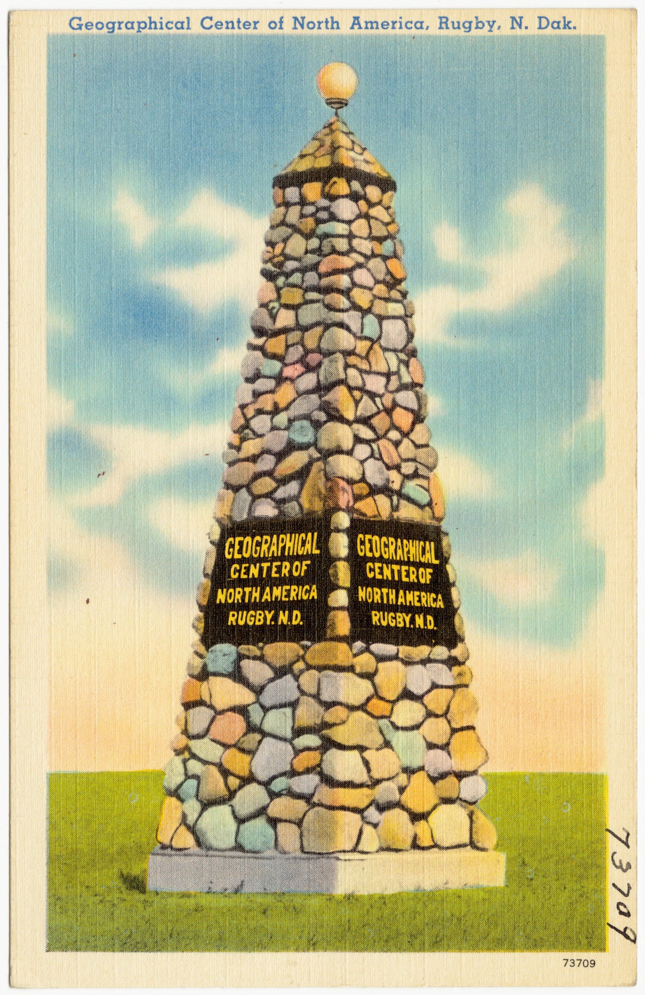
Modern methods have made the calculations of geographic centers much easier, but that doesn’t make them controversy-free. A geographer at the University of Buffalo, Peter Rogerson, developed a computer program that calculates the precise mathematical center of any state or country. The program deposed Rugby, North Dakota, as the center of the North American continent, a title the small town has prominently claimed since 1931. The new center of the continent is 145 miles southwest in the appropriately—and entirely coincidentally—named Center, North Dakota.
If there’s one thing Gadheim can learn from all of this, it’s that their new status is probably temporary.


Follow us on Twitter to get the latest on the world's hidden wonders.
Like us on Facebook to get the latest on the world's hidden wonders.
Follow us on Twitter Like us on Facebook