The Hidden Beauty That Only Satellites Can See
From space, Earth is living art.
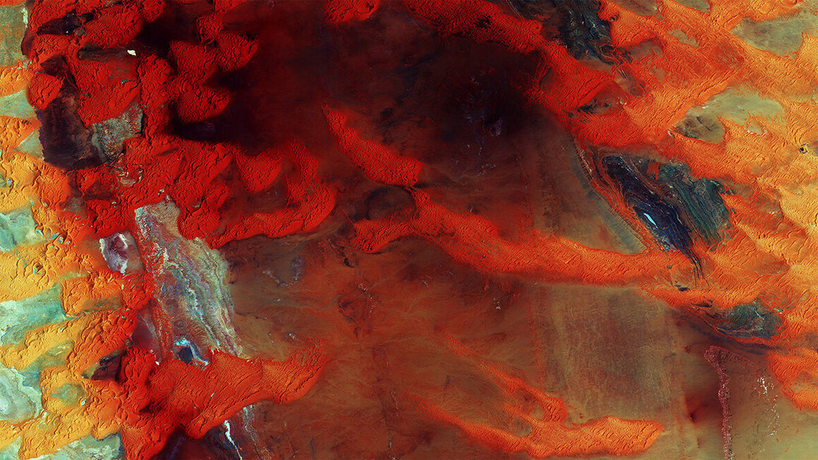
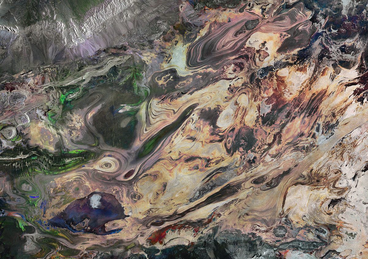
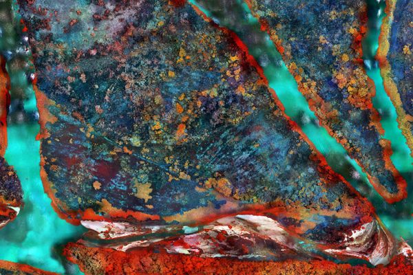
Extraordinary colors in Libya’s sand dunes, as captured by Sentinel-2A. (Photo: ESA)
Right now, high above us, are a suite of satellites called Sentinels. Operated by the European Space Agency, they are circling the earth with one mission: to monitor the earth’s environment. They can capture a precise picture of our planet, down to types of vegetation and sea surface temperatures.
The Sentinels do this through radar and multi-spectral imaging. For example, the Sentinel-2A uses infrared bands to assess types of vegetation and chlorophyll content. (This also gives some of its images unexpected areas of bright red).
The data that the Sentinels collect has a fundamental application for climate change. For example, in February, March and April 2016, Sentinel-1A captured three radar images of Greenland’s northeast coast. The recently-released composite is a vividly detailed, half monochrome, half rainbow image.
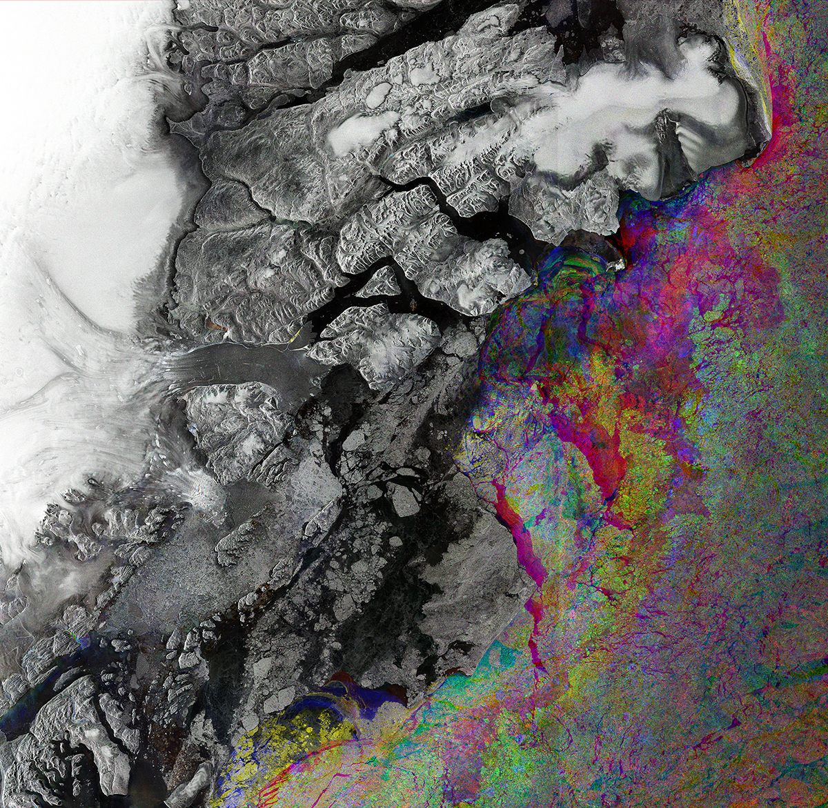
A composite image of the north-east of Greenland. (Photo: ESA)
But it tells a story beyond that as well. The rainbow colors indicate the changes in sea-ice during the three-month period. The same satellite is monitoring in near-real time Greenland’s Zachariae Isstrom glacier, in the image at center-left, such is the state of its erosion by warmer water.
To a scientist, the images provide essential information; to a regular person, they are strikingly beautiful, showing mosaics of irrigation, infrared farms and iridescent reefs. Here is a section of the startling satellite art:
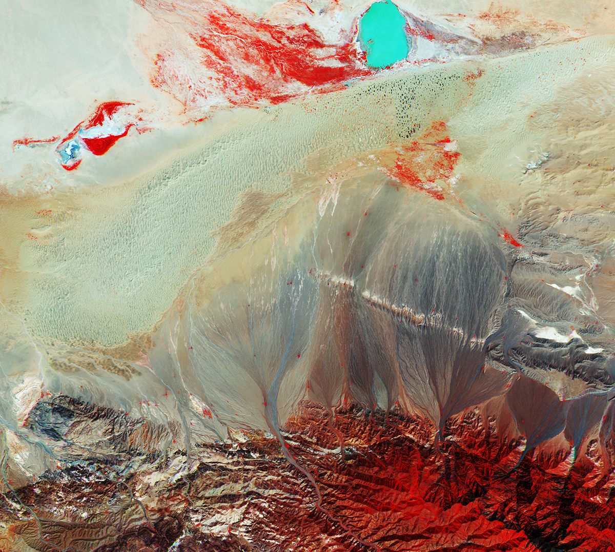
A false-color image from Sentinel-2A of southern Mongolia. The shades of red represent different types of vegetation. The turquoise circle at the top is a saline lake, Taatsiin Tsagaan Lake. (Photo: ESA)
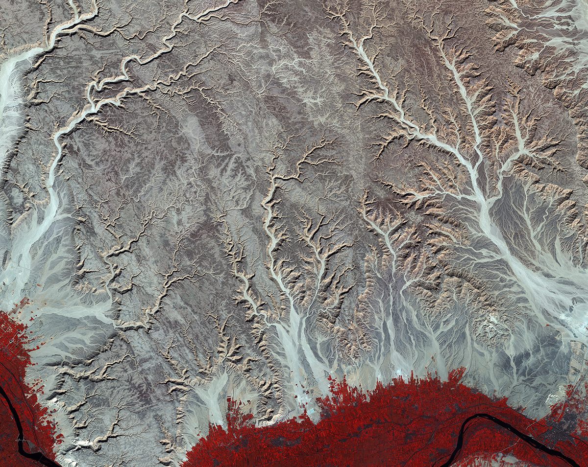
The desert in Egypt. The red at the bottom of the image indicates intensive farming along the Nile river. (Photo: ESA)
A image from the Sentinel-2A satellite, with infrared showing a central-pivot irrigation system in Saudi Arabia. (Photo: ESA)
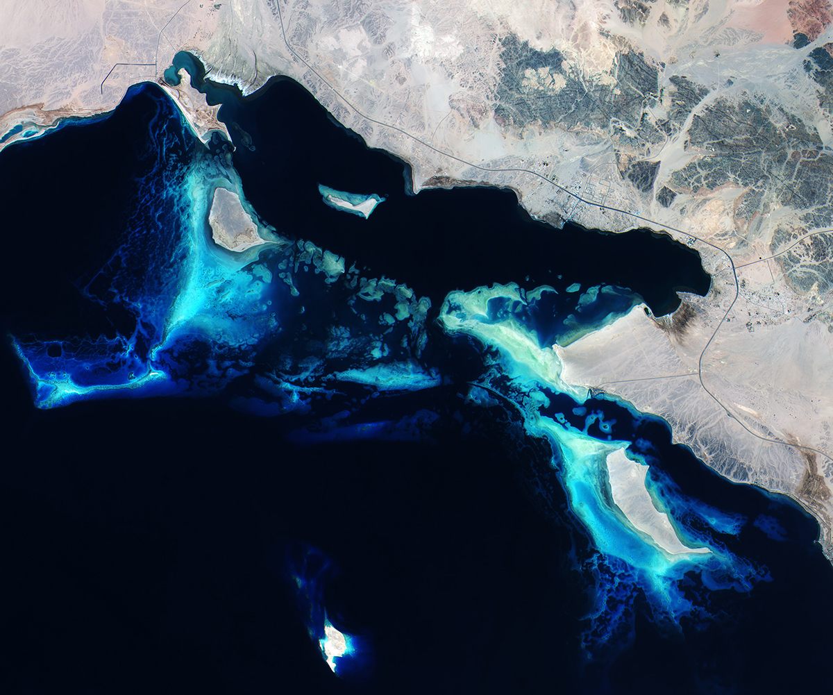
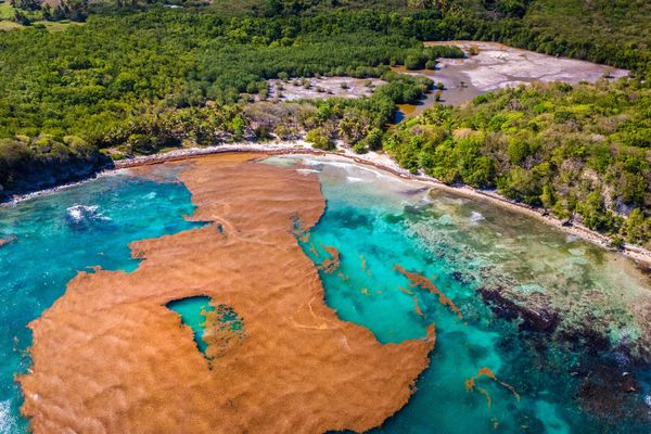
A true-color image of coral reefs in the Red Sea of Saudi Arabia. (Photo: ESA)
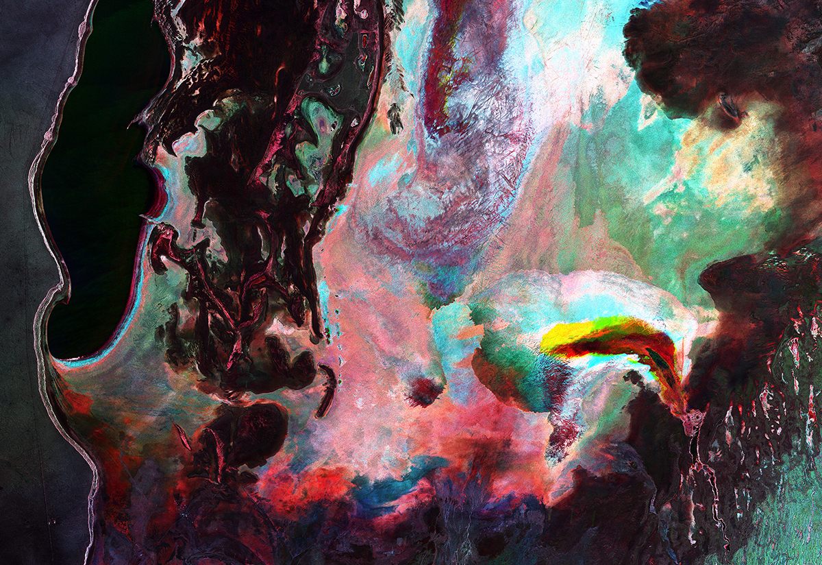
A multi-temporal radar image from Sentinel-1A of the Aral Sea in Central Asia. The name is something of a misnomer: the sea has largely dried up. (Photo: ESA)
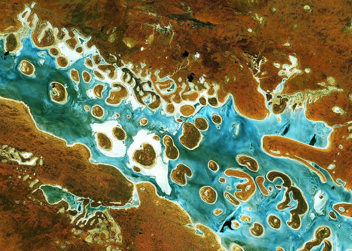
Lake Amadeus in Australia’s Northern Territory. (Photo: ESA)
Dasht-e Kavir, Iran’s salt desert, pictured with a combination of Sentinel-1A radar scans. (Photo: ESA)
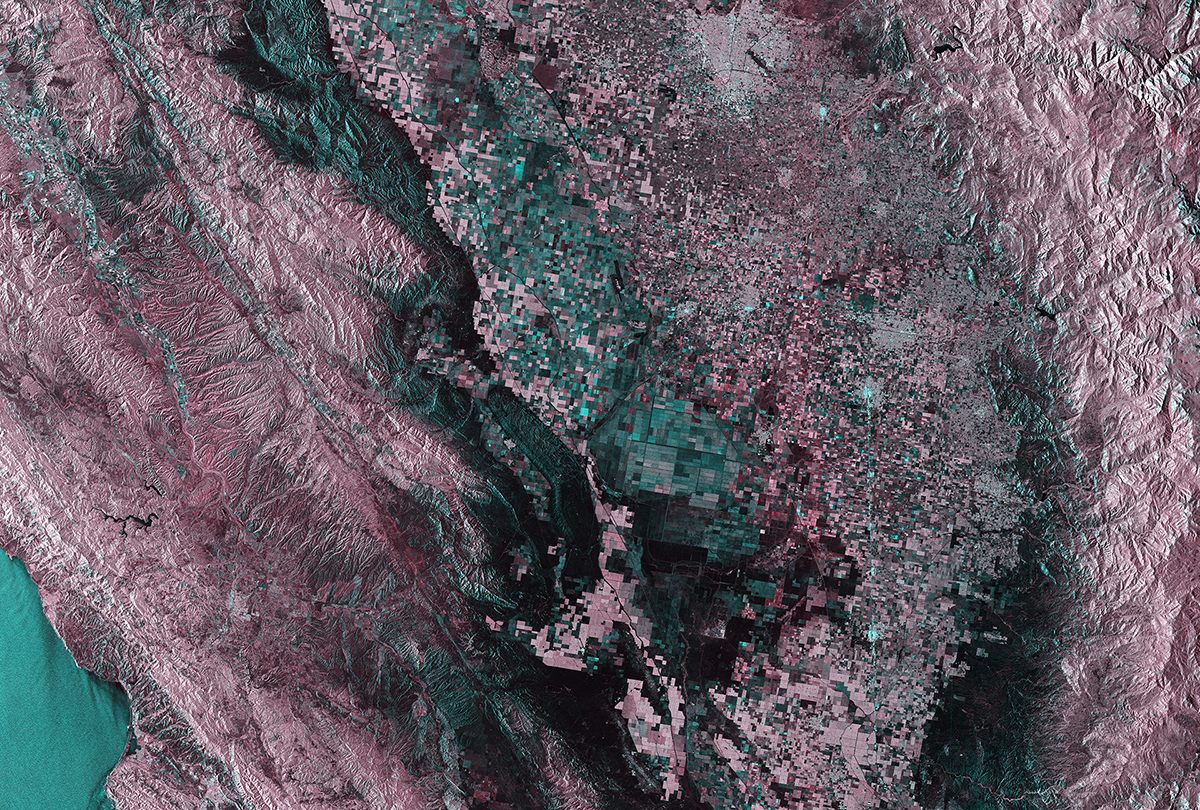
Central California seen through Sentinel-1A’s radar, with the San Andreas fault line running diagonally down from top left. (Photo: ESA)
A true-color image of Namibia’s Namib-Naukluft National Park, with orange-red sand dunes. (Photo: ESA)
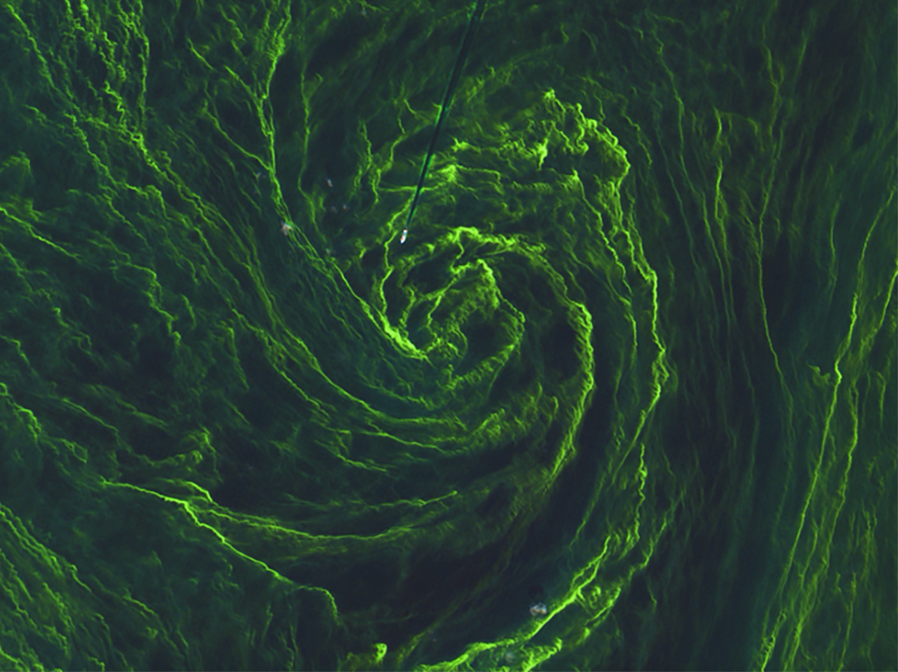
An algae bloom in the Baltic Sea, as pictured by Sentinel-2A. A boat cuts down from the top of the image. (Photo: ESA)
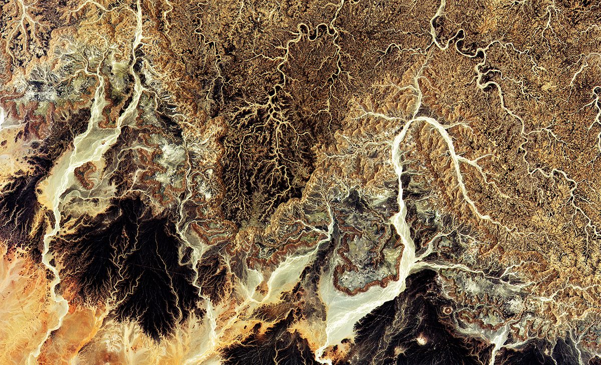
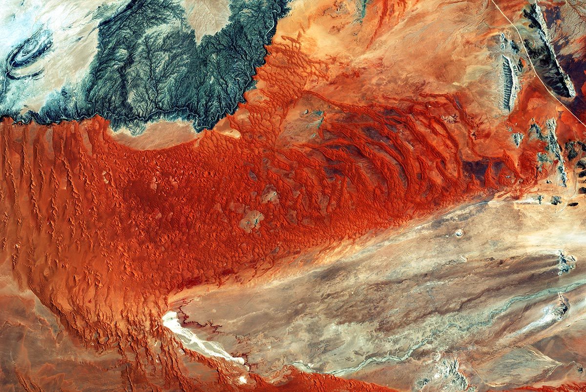
The dusty shades of the Sahara desert, in Algeria. (Photo: ESA)
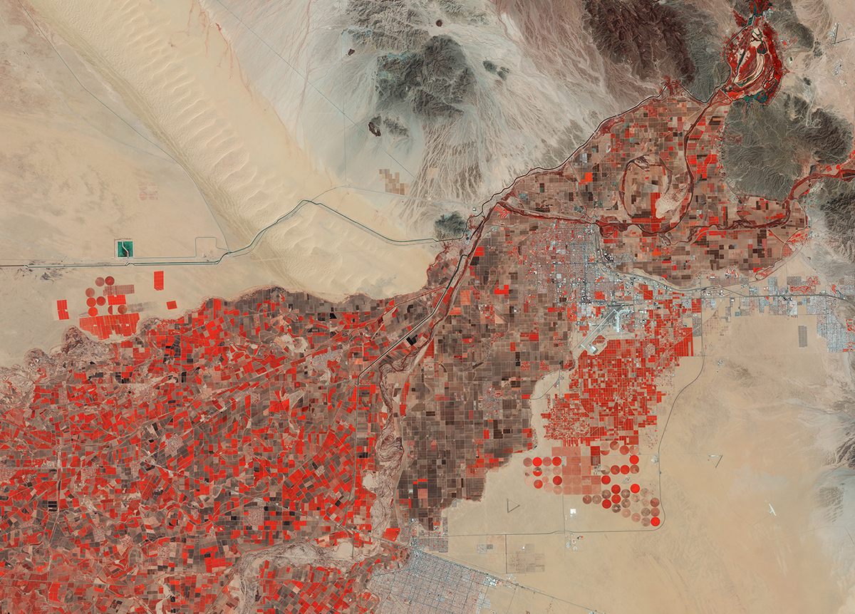
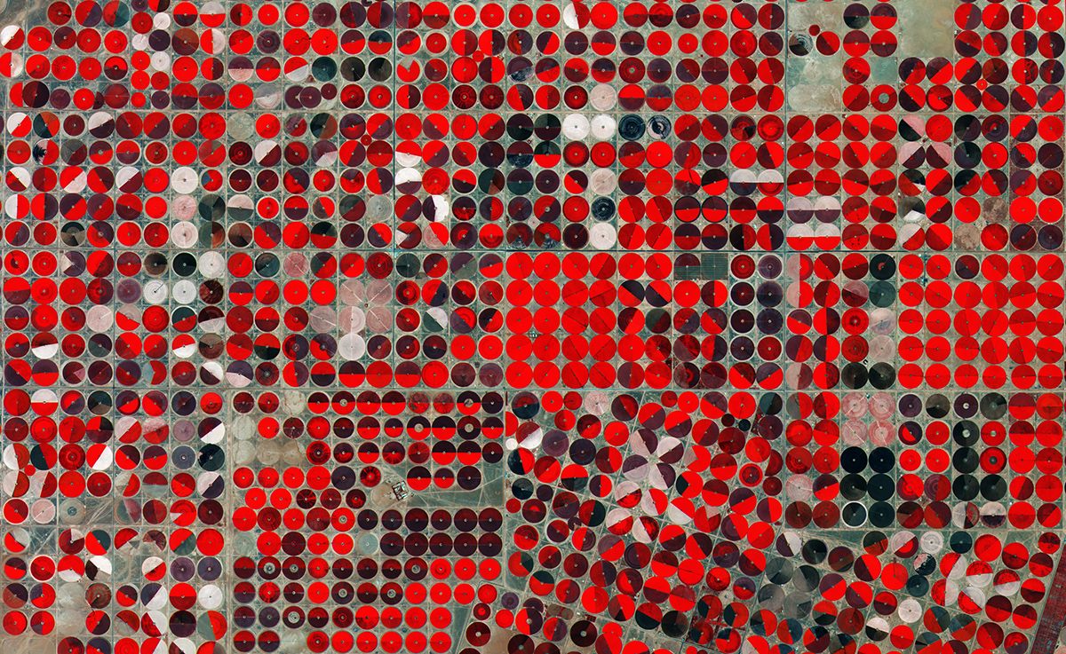
Yuma, Arizona, from Sentinel-2A. The different shades of red show the different chlorophyll content between the farms (the squares) and the irrigation system (the circles). (Photo: ESA)
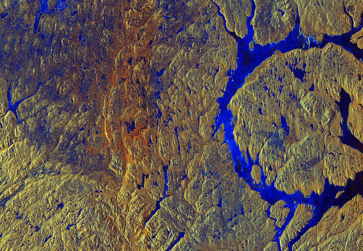
Canada’s Manicouagan Crater, which was created by an asteroid strike. In this false-color radar image, the blue is areas of ice and water and the yellows and oranges are vegetation. (Photo: ESA)


Follow us on Twitter to get the latest on the world's hidden wonders.
Like us on Facebook to get the latest on the world's hidden wonders.
Follow us on Twitter Like us on Facebook