See Aerial Reconnaissance Photos of WWI Battlefields

A Breguet 14, a bi-plane bomber and reconnaissance aircraft, is photographed over enemy territory in Kortekeer in 1918. (All photos: Courtesy Yale University Press/ Mercatorfonds)
Aerial photography was a relatively new technique at the outset of World War I, but over the next four years, it became an invaluable reconnaissance tool. But the process was complex; as the book The Great War Seen From the Air recounts: “They took photographs from an open cockpit. The exposure had to be set manually and after every shot the glass negative had to be replaced and stored away. Meanwhile, the observer photographer combed the skies for enemy planes looking for observation planes to shoot down.”
By 1918, the entire front was being photographed twice a day by both sides. More than a century after the beginning of World War I, these photographs show a unique perspective on the conflict and the scale of the devastation to the landscape. The following photographs are from The Great War Seen From The Air, which drew from the extensive archives at the Imperial War Museum in London, the In Flanders Museum in Ypres, and the Royal Army Museum in Brussels.

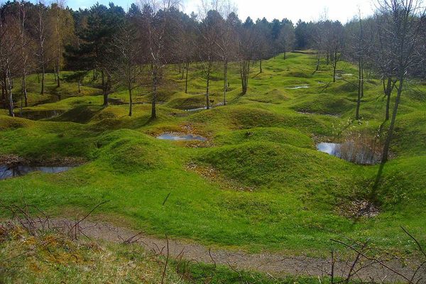
Trench patterns in Hooge, part of the Ypres Salient. For much of the war, the front line of the Salient ran through Hooge. The village was destroyed by sustained fighting, and the casualty rates for British and Commonwealth forces were around 300 per day. The massive crater at the top of the photo was caused by a British mine on July 19, 1915. It has since been filled in and today is next to a WW1 burial site, the Hooge Crater Cemetery.
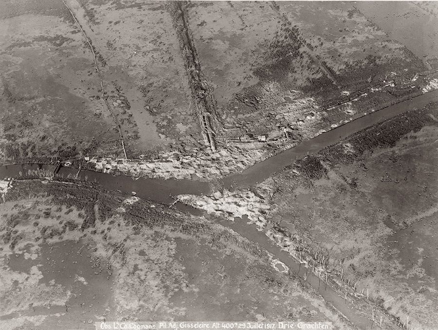
An aerial photograph of Drie Grachten, the ‘three canals’, taken on July 29, 1917, before the Third Battle of Ypres. Trenches and bunkers are visible on the western bank.
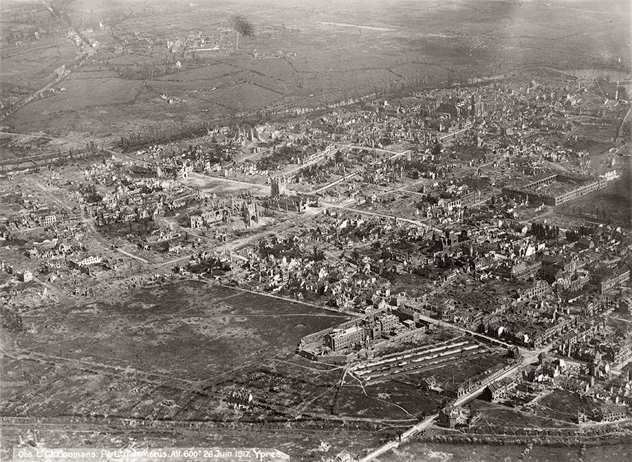
Ypres town center, September 1917. The Third Battle of Ypres, also called the Battle of Passchendaele, took place around Ypres between July and November of 1917 and resulted in nearly half a million casualties on both sides. The town was largely destroyed and rebuilt after the war, and is now home to the In Flanders Fields Museum and the Menin Gate Memorial to the Missing.
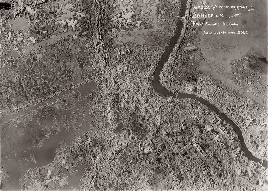
The town of Dikmuide, Belgium, was first attacked on October 16, 1914. By the end of the war, it had been completely destroyed. The German bunkers are visible in the landscape.
The cover of The Great War Seen From The Air: In Flanders Fields, 1914-1918.


Follow us on Twitter to get the latest on the world's hidden wonders.
Like us on Facebook to get the latest on the world's hidden wonders.
Follow us on Twitter Like us on Facebook