The Perfect 22-Foot Map for Your Ancient Roman Road Trip
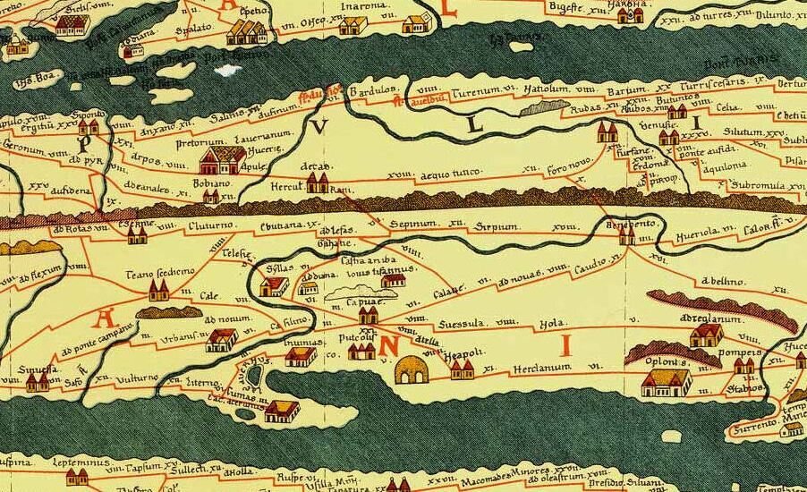
A close-up of the Tabula Peutingeriana. (Photo: Public Domain/WikiCommons)
If you’re planning a road trip in ancient Rome, you’ll need two things: a time machine, and the Tabula Peutingeriana.
Also known as the “Peutinger Map,” the Tabula illustrates the complex road networks of the Roman Empire. The surviving version, a 22-foot parchment scroll stored at the Austrian National Library in Vienna, is from the 13th century, but the original that this replica was based on goes all the way back to the fourth or fifth century. The name Peutinger comes from German Konrad Peutinger, who came into possession of the map in 1508 before it found its way to its current home in 1737.
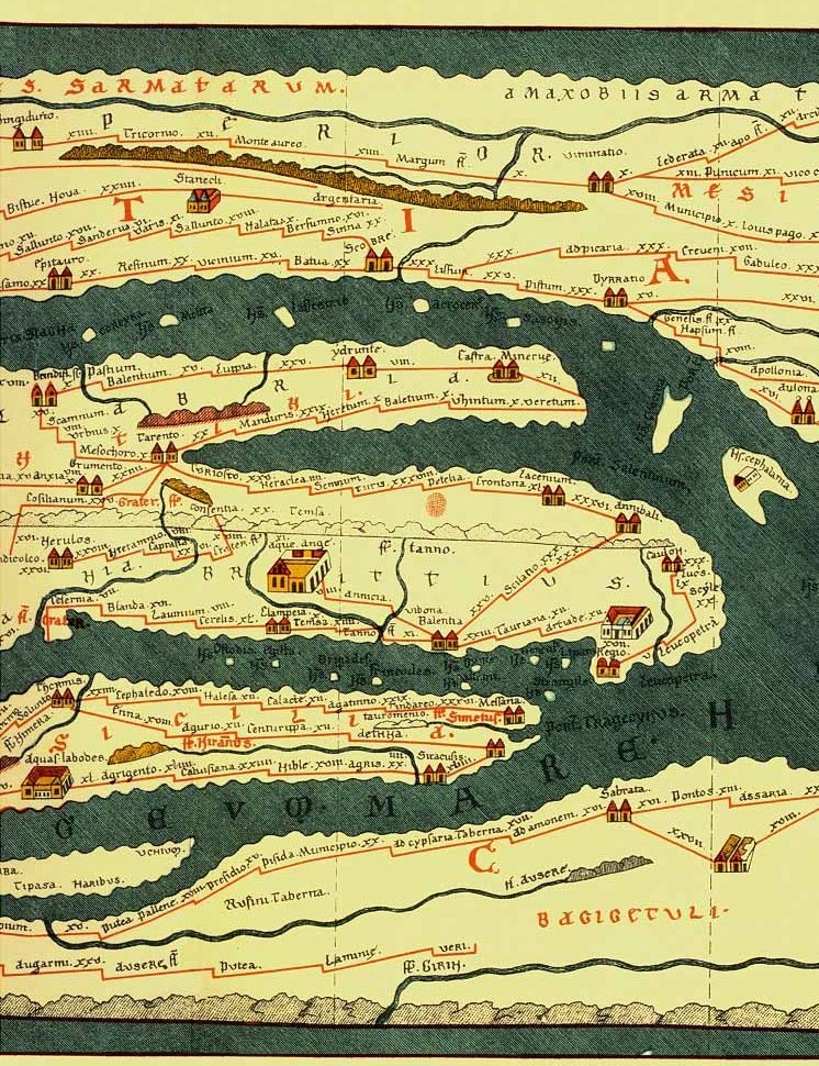
This segment includes the boot of Italy, the Mediterranean Sea, and what’s now southern Tunisia and Tripolitania. Reminder: not geographically accurate. (Photo: Public Domain/WikiCommons)
Given the size of the Roman Empire at its height, your ancient road trip could start in Europe and have stops in North Africa, the Middle East, and parts of Asia. The map extends all the way from the Atlantic to Sri Lanka, though it is not geographically accurate or to scale. Some top destinations to consider include Constantinople, Rome, and Antioch.
If Atlas Obscura existed in ancient Rome, we’d probably recommend that you check out the mountain views by the Tarento resupply station or the excellent foot courier treatment along the Coriello coast. Looking closely at the map, you’ll count 555 cities and 3500 other place names which include settlements and rivers, mountains and islands, all meticulously colored and labeled. Roads are in red, with each hook in the road representing a day’s travel, estimated to be between 30 and 67 miles.
 The full expanse of map, all 6.75 meters of it. (Photo: Public Domain/WikiCommons)
The public roads, or cursus publicus, marked on the Tabula Peutingeriana were built in the first century under Emperor Augustus to improve imperial communication. There were stations throughout the empire, located at 12 mile or so increments, where foot couriers could hand off messages. Later, horses and carriages sped things up and removed the middlemen. Building public thoroughfares, of course, is not cheap, as President Eisenhower would know, and the cursus publicus was no exception. Way station operators were expected to provide food and board to travelers, and only travelers with a government certificate could get the full treatment.
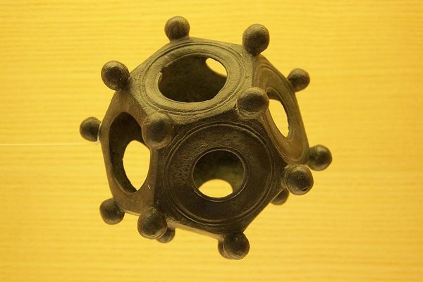
This tool could have come in handy for those foot couriers, eh? (Photo: Screen shot)
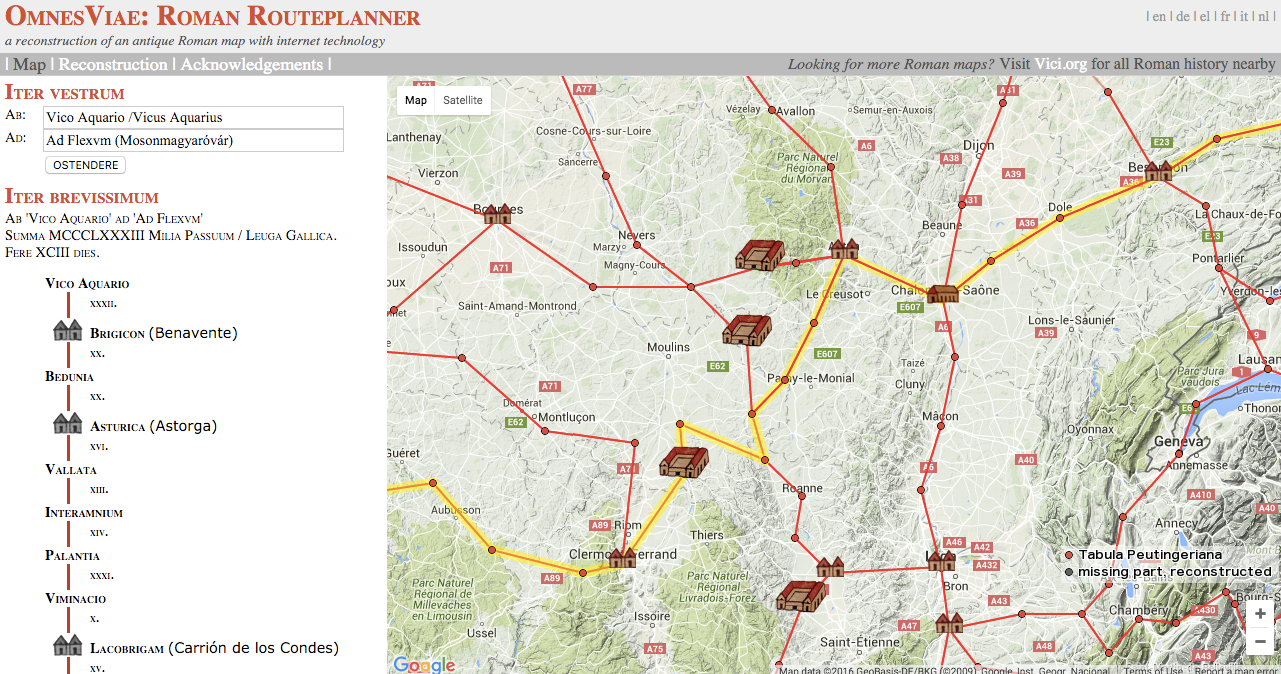
For a closer look, this interactive map allows you to zoom in on any section of the map and also lets you highlight specific routes, symbols, or landmarks. If you’d like to see a close-up of the 12 individual segments, check out Bibliotheca Augustana. Even cooler is this Roman Route Planner, OmnesViae, which allows you to toggle with the Tabula as you would with Google Maps. For example, going from Vico Aquaria to Ad Flexvm will take you through 99 rest stations, over eight rivers, and include stops in Burdegalo (Bordeaux), Aqvis Caladis (Vichy), and Samvlocenis (Rottenburg am Neckar). If you can somehow get your iPhone, a solar-powered charger, and unlimited data for your ancient Roman road trip, then OmnesViae is indispensable.
Map Monday highlights interesting and unusual cartographic pursuits from around the world and through time. Read more Map Monday posts.


Follow us on Twitter to get the latest on the world's hidden wonders.
Like us on Facebook to get the latest on the world's hidden wonders.
Follow us on Twitter Like us on Facebook