Cheltenham Badlands
These strikingly barren, rolling red hills were caused by bad farming practices.
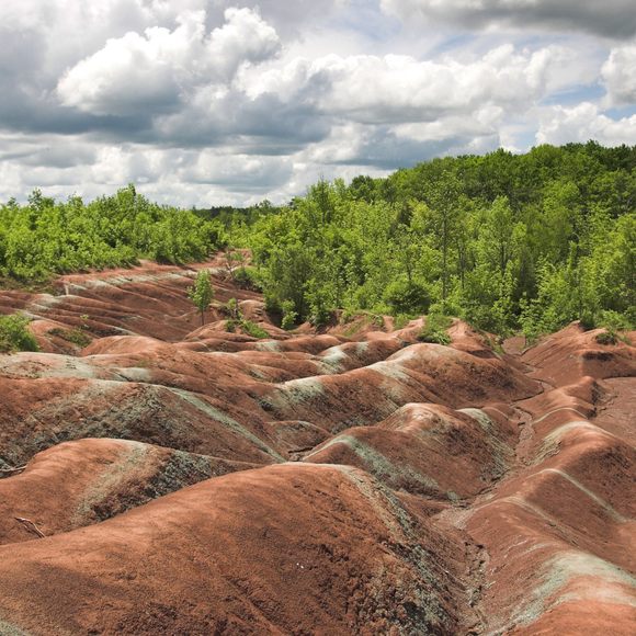
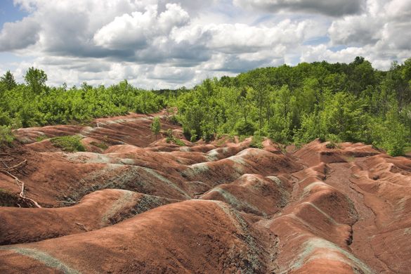
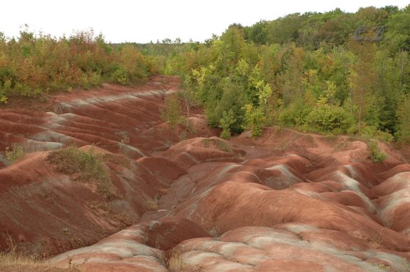
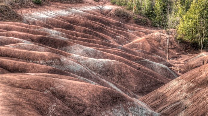
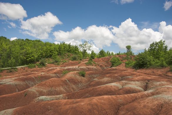

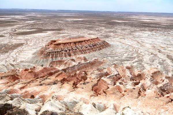
The Cheltenham Badlands are a series of bare, windswept red hills and gullies in southern Ontario that formed as a result of overgrazing. In the 1930s, the area was still productive farmlands, but poor farming practices resulted in the creation of the rolling martian landscape.
As dirt and vegetation were worn away by the elements, the Queenston shale below the surface farmland was exposed. Unfortunately, the shale supports little or no vegetation, and has left the area as barren badlands. The reddish hue of the Badlands is caused by iron oxide, while narrow greenish bands show where groundwater has transformed the rock from red to green iron oxide.
Care should be taken while visiting, as this area is very fragile. Visitors should not climb on the hills after a rainfall or when the ground appears soft. Violation of this unwritten rule will also result in a nasty reddish dirt stain that most travelers work to avoid while on vacation.
As of August 2019, you can visit most of the Cheltenham Badlands in Ontario, however, check their website beforehand, as conservation projects are ongoing. You can no longer walk on the rocks, as they are fenced off, but there is a lookout platform to take in the view.
Know Before You Go
From Toronto take Hwy 427 to Hwy 401-W then 410 towards Brampton. Exit onto Hurontario-N and continue 9.6km. Turn left on Old Baseline Road and go 3.8km until you see the Badlands on your left. Physical access to walk on the badlands is no longer available, instead there is now a viewing platform and boardwalk. There are parking spaces adjacent to the boardwalk and a sidewalk that leads directly to a parking lot on Olde Base Line Road.
Community Contributors


Plan Your Trip
The Atlas Obscura Podcast is Back!


Follow us on Twitter to get the latest on the world's hidden wonders.
Like us on Facebook to get the latest on the world's hidden wonders.
Follow us on Twitter Like us on Facebook