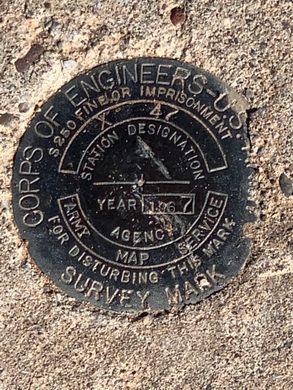
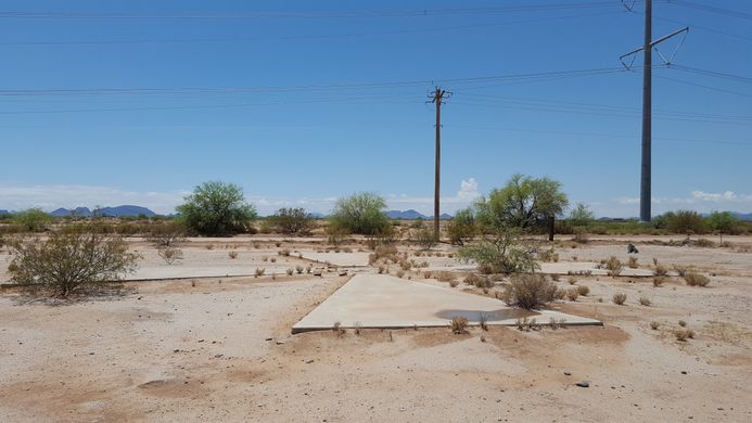
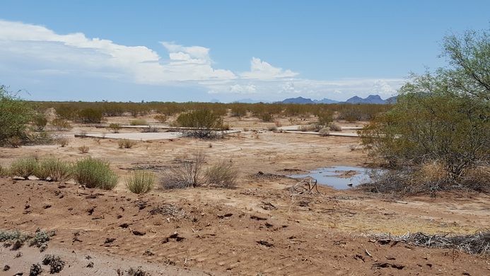
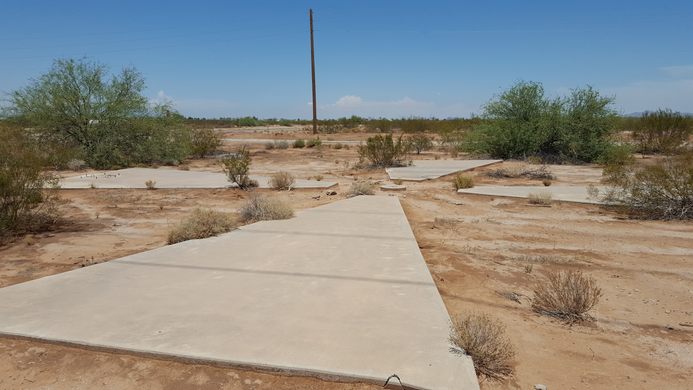
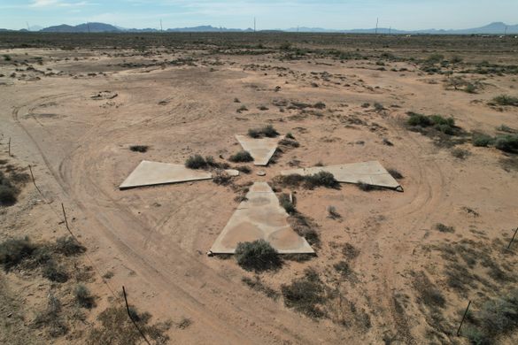
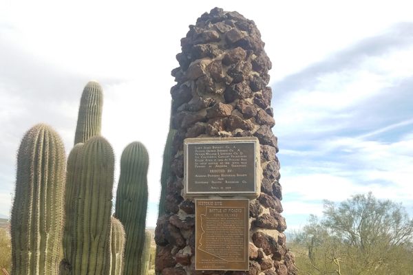
Corona Satellite Calibration Targets
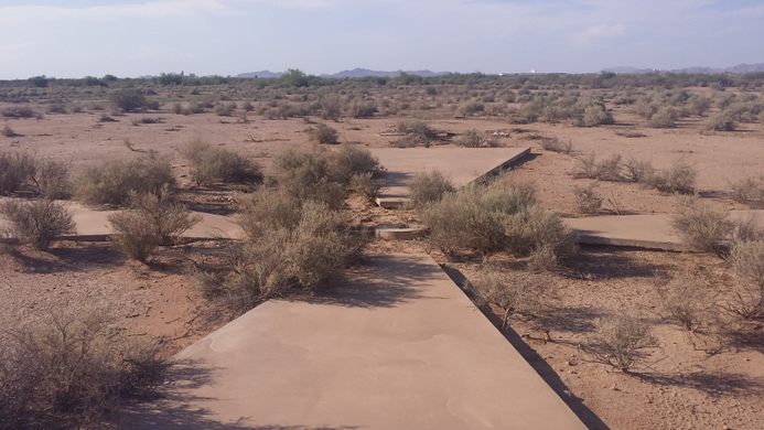
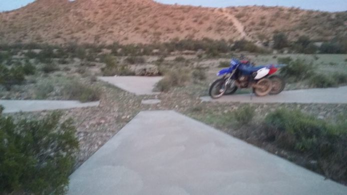
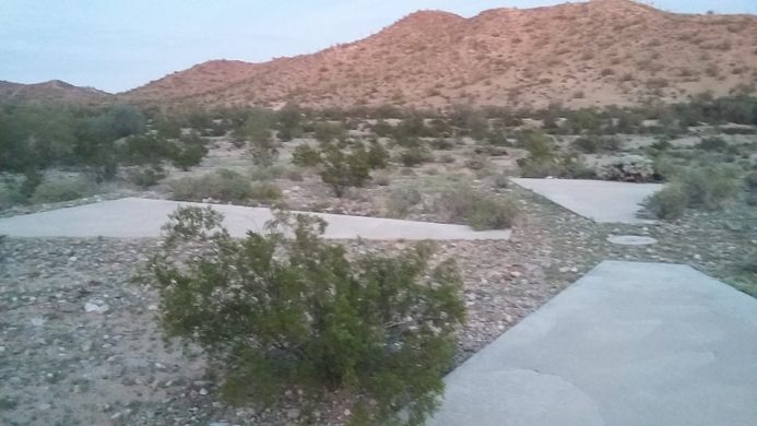
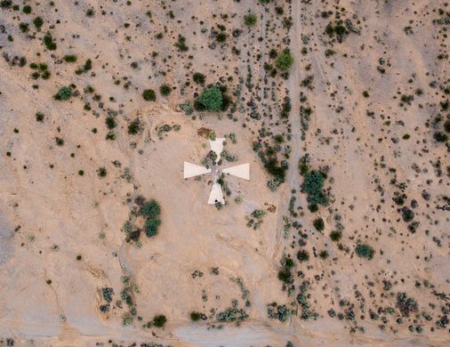
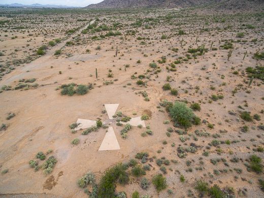
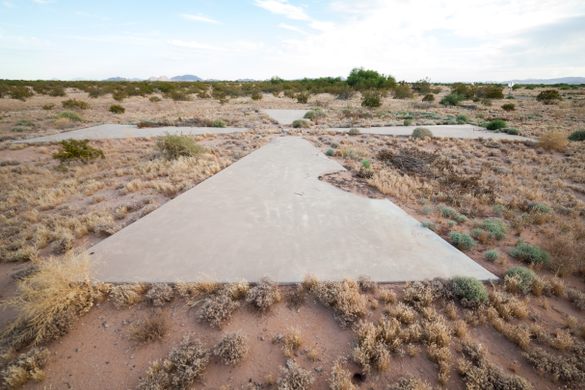
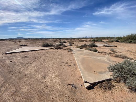
Concrete crosses scattered across the Arizona scrubland which were used to align spy satellites.


It is a common myth that the concrete crosses surrounding the city of Casa Grande AZ were used for the CORONA intelligence satellite program. This unfortunately is not the case. While this target network is interesting, its purpose was not to calibrate the cameras for the CORONA spacecraft, or any spacecraft for that mater.
These crosses were however constructed for the calibration of aerial photogrammetry cameras to validate maps. While the US Air Force did use the Casa Grande Range for aerial (aircraft) camera calibration for certain mapping cameras, it was not used for space based intelligence camera systems.
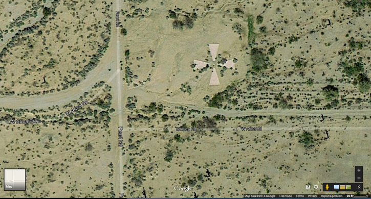
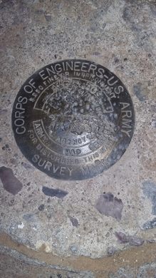
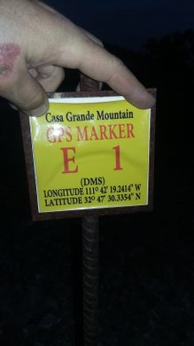
The Casa Grande targets were part of what was officially called the Casa Grande Photogrammetric Test Range which, consisted of a 16 x 16 mile grid of 60’ targets. Each target was roughly spaced 1 mile apart. These targets provided a fixed spatial grid for photogrammetric calculations for mapping camera calibration/validation.
REGARDING CORONA: First and foremost; the CORONA program was a most highly classified program and as such all technical information was very well controlled and would never have had calibration tools in a public setting. The classification controls were so restrictive that most people working in the program were not privy to the name CORONA until after its declassification in 1995.
The calibration of the CORONA cameras was conducted in a lab setting (not on the space craft while in flight-as commonly misunderstood). Thus, the accuracy and focal length of the cameras would render the Casa Grande Targets useless for focus calibration.
The CORONA cameras were in fact calibrated in lab by raising the film plane by mere fractions of a millimeter based on information gathered from the Controlled Range Network (CORN). These high resolution grid type targets were located in controlled areas (military bases) to prevent outside agencies from having direct access to the process. The CORN program also incorporated mobile targets that could be deployed based on specific mission flight profiles. They [CORN] used varying grayscale and specific color patterns to calculate the edge focus of visible and infrared light exposed film.
Know Before You Go
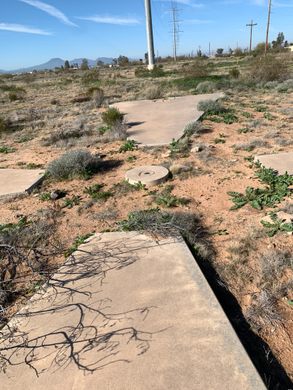
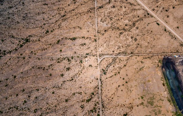
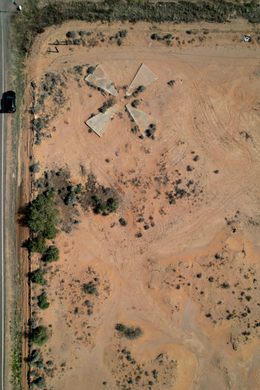
Correct coordinates for the marker in the aerial photo: 32º42'17.12"N - 111º45'25.77"W. The other photos show the crosses at the intersection of South Montgomery and West Cornman Roads, and at the intersection of Cornman Road and Carmel Blvd., in Casa Grande, Az.A map of extant locations as well as missing ones can be found here: https://www.google.com/maps/d/u/0/edit?mid=1CkeC8CvojF3V_89o9_C9DL9OFfY
Community Contributors


The Atlas Obscura Podcast is Back!


Follow us on Twitter to get the latest on the world's hidden wonders.
Like us on Facebook to get the latest on the world's hidden wonders.
Follow us on Twitter Like us on Facebook