Mount Carleton
New Brunswick's tallest mountain is the highest point in all the Maritimes.

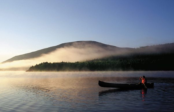
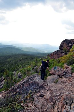
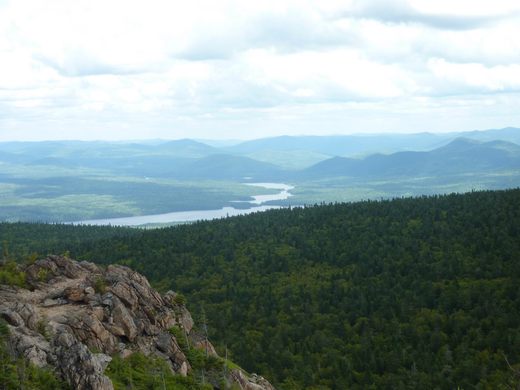

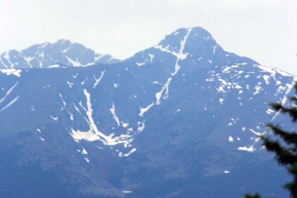
Towering 817 meters (2,680 feet) over the surrounding New Brunswick wilderness, the summit of Mount Carleton looks out over a sweeping vista that stretches from Maine to Quebec’s Gaspé Peninsula.
Mount Carleton is a peak within the Notre Dame Mountains, a range within the Appalachian Mountains that runs from Vermont’s Green Mountains (itself a subset of the Appalachian Mountains) to the mighty Chic-Chocs of Quebec (ditto). Like the rest of the Appalachians, Mount Carleton is an ancient mountain made of 400-million-year-old volcanic rock relentlessly weathered into its current softened form. It is the tallest mountain in Canada’s (largely non-mountainous) Maritime provinces, which consist of New Brunswick, Nova Scotia, and Prince Edward Island.
The peak was named in 1899 after New Brunswick’s first lieutenant governor, Thomas Carleton. Carleton was a British military officer who served with distinction during the American Revolutionary War, helping lift the siege of Quebec City. After being appointed lieutenant governor of New Brunswick in 1786, he helped to re-settle the many Loyalists leaving the newly non-British territories “down south.”
If you’re wondering why the mountain was named after the province’s first lieutenant governor — as opposed to, say, the first governor — then you’re probably not Canadian, as “lieutenant governors” in Canada are provincial royal representatives carrying out the monarchs constitutional and ceremonial duties, rather than figureheads who have little to do until the governor dies or is hounded out of office by some sordid scandal.
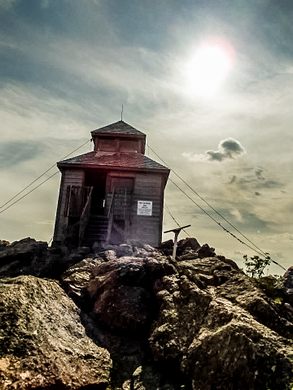
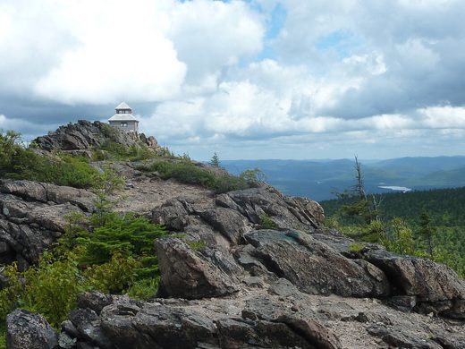
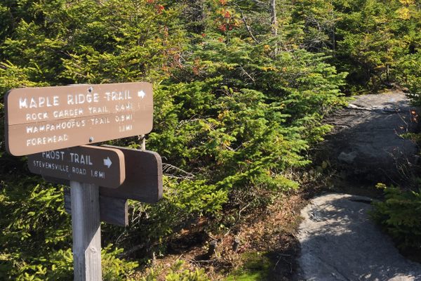
Mount Carleton is located within Mount Carleton Provincial Park, which is easily accessible by road, despite the dearth of nearby towns or villages. Two reasonably demanding hiking trails provide visitors access to the summit, which takes 1.5-2.5 hours to reach (depending on your speed, and whether you take the shorter, direct trail or the longer, old fire road route). A fire tower still stands at the top of the mountain, which was used by forest fire spotters from 1923 to 1968.
Know Before You Go
From Route 180 in north-central New Brunswick, turn south on Route 385. Enter the park and follow the signs to the end of Bald Mountain Brook Road. Hike either the Mount Carleton Trail or the old fire road up to 4.4 km to the summit, following the signs and green blazes.
Community Contributors


The Atlas Obscura Podcast is Back!


Follow us on Twitter to get the latest on the world's hidden wonders.
Like us on Facebook to get the latest on the world's hidden wonders.
Follow us on Twitter Like us on Facebook