AO Edited
Ricker Basin
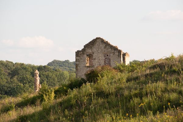
The remains of a deserted 1800s farming community can be found in Little River State Park.

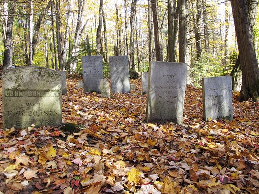
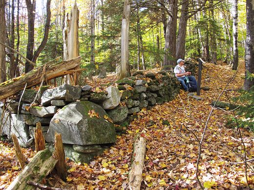
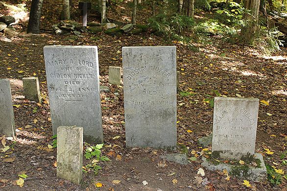
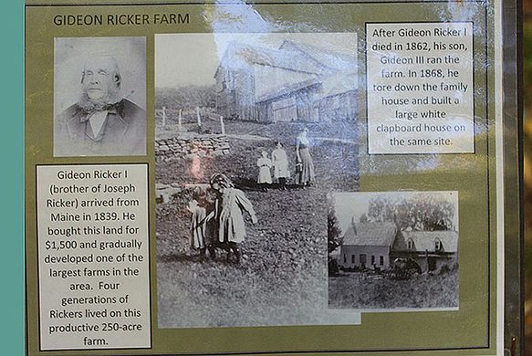

On Ricker Mountain in Vermont’s Little River State Park you’ll find an abandoned farming community. The mountain is covered with stone walls, cellar holes, the remnants of a sawmill, and a cemetery.
The community was established in 1816 by Joseph Ricker, but didn’t pick up until the railroad came through the area. Once it did, some 50 families settled in Ricker’s basin. They thrived for a little while, building a school house, trading post, and several sawmills, but soil issues proved unsurmountable. By the end of the 1800s most families had picked up and left.
The timber industry continued in Ricker Basin, but they too eventually closed. A disastrous flood in 1934 sealed the fate of the few families still residing on the mountain. The waters forced many residents onto their roofs, and nearly 50 people drowned. When a dam was built the next year, some of the now deserted Ricker community was submerged.
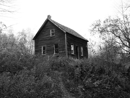
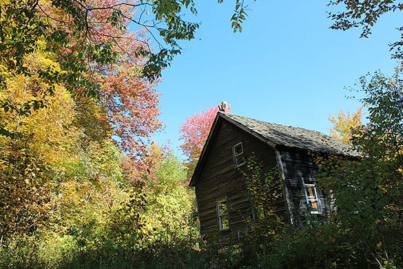
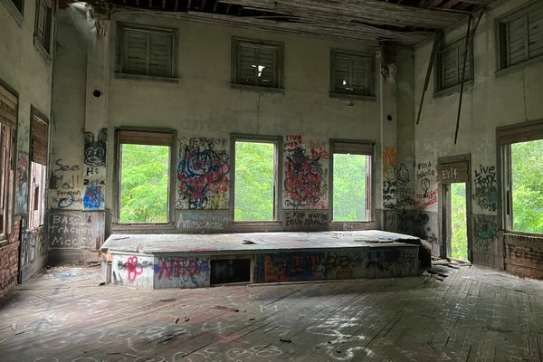
The remains of the community are few, but worth exploring. The foundations of houses and stone walls still stand. Only one full house is still standing, Almeron Goodell’s farmhouse, which is in good enough shape to this day that hikers are allowed entry. It is, however, quickly deteriorating, and its rotting wood is covered in graffiti.
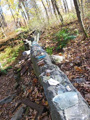
There are lots of artifacts to be found among the leaves, such as glass bottles and farming tools dating back to the area’s first settlement. There is a tradition amongst hikers of arraying the items along the tops of cellar holes or propped up against trees near the trail for the benefit of others to come.
Know Before You Go
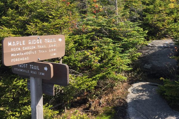
Pick up a map for The History Hike upon entry to Little River State Park. It is a moderate hike up the mountain primarily on the Dalley Loop Trail. Wear well-treaded footwear.
Community Contributors


The Atlas Obscura Podcast is Back!


Follow us on Twitter to get the latest on the world's hidden wonders.
Like us on Facebook to get the latest on the world's hidden wonders.
Follow us on Twitter Like us on Facebook