AO Edited
St. Thomas Ghost Town
This former Mormon settlement is reemerging from the receding waters of Lake Mead.

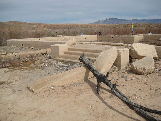

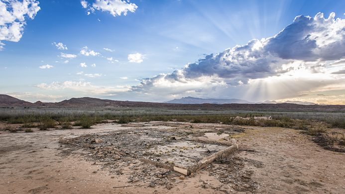


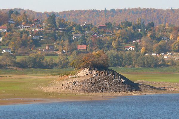
Originally founded in 1865 by Mormon settlers, the tiny town of St. Thomas, Nevada was eventually drowned after the building of the Hoover Dam, but now the dramatically disappearing waters of Lake Mead have lowered and the town’s ruins have reappeared.
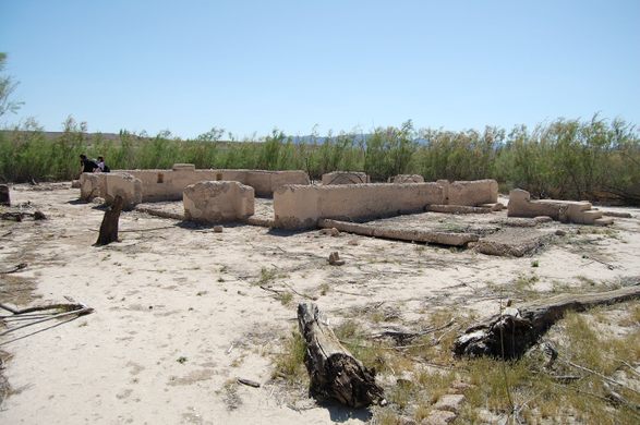
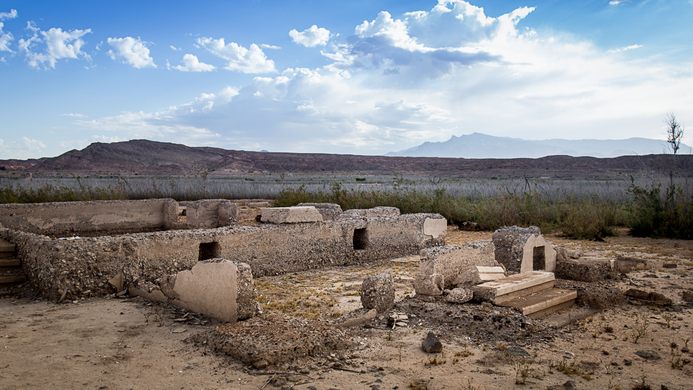
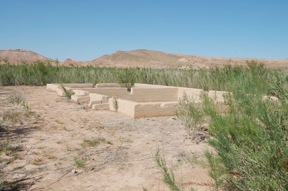
Consisting of farms and businesses put in place by pioneers looking to tame the West, the town reached a population of 500 citizens at its peak. When the Mormon settlers established the settlement, they thought that they were building their town in Utah, but within a few years, a survey placed their town in Nevada. Now that a new town had appeared in its borders, the state of Nevada decided to levy taxes against the residents, including owed taxes from previous years. Unable to fork over the gold the state was demanding, the town was abandoned in 1871.
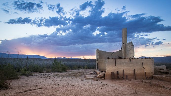
Others moved into the abandoned properties after the Mormon settlers moved to Utah. However once the Hoover Dam was built, the nearby Colorado River began to swell and soon the town had to be abandoned once again as the waters overtook it. By 1938, the town was no longer habitable and soon, it was completely submerged beneath the newly created Lake Mead. In June of 1938, the final remaining resident of St. Thomas set fire to his home before getting into his boat and rowing away.
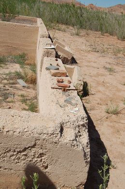
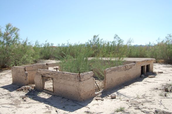
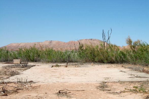
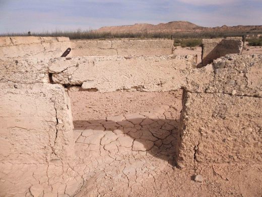
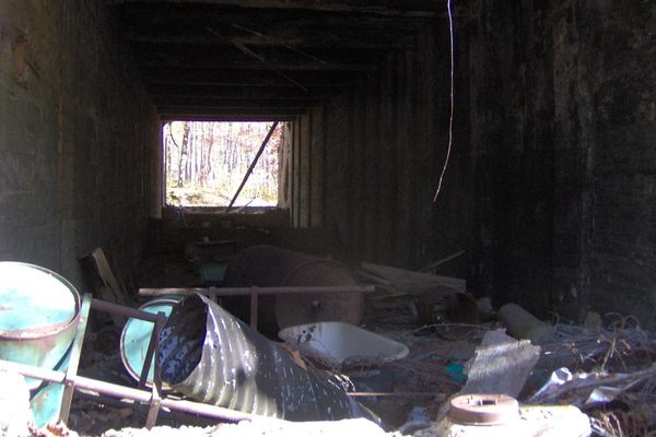
After rampant water consumption has drastically lowered the level of the lake, the remains of St. Thomas are beginning to surface. Building foundations and chimneys are beginning to rise above the water, reminding visitors of the town that once was. Should the drought in the area ever abate the town may once again disappear, but for now the old settlement is once again ready for pioneers.
Know Before You Go
The hike begins with an 85 foot descent to a flat loop that follows the old roads of the original settlements of St. Thomas. Take Northshore road just past mile marker 46 and turn onto Old St. Thomas access road, which is dirt and sometimes bumpy, 4×4 vehicle is recommended. The trailhead is located at the end of the 3.5 mile access road. There is a dirt trail leading to the town site from the parking area. Distance: 2.04 mile loop (3.28 km) loop Elevation Change: 85 feet Difficulty: Moderate
Community Contributors


Plan Your Trip
The Atlas Obscura Podcast is Back!


Follow us on Twitter to get the latest on the world's hidden wonders.
Like us on Facebook to get the latest on the world's hidden wonders.
Follow us on Twitter Like us on Facebook