AO Edited
The Mississippi River Basin Model
Built by prisoners of war, the largest small-scale model ever built includes eight miles of tiny streams that now sit abandoned.


In the 1940s, before computers were up to the task, when engineers needed to model a complex system, they would do just that, literally “modeling it,” by building amazingly elaborate scale models.
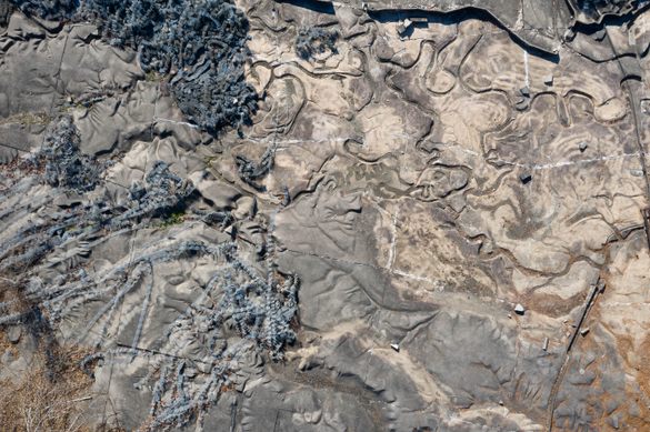
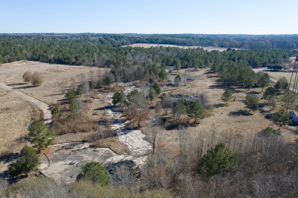
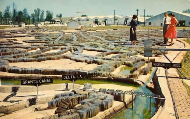
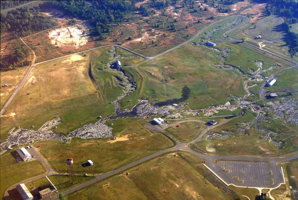
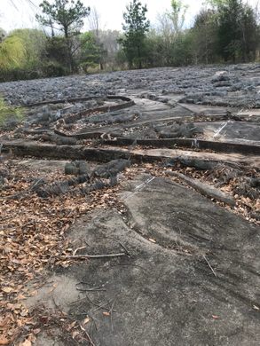
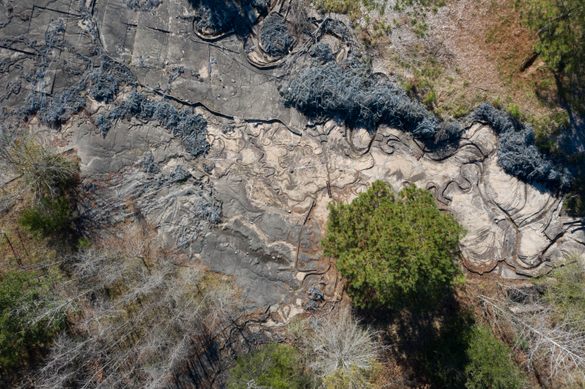
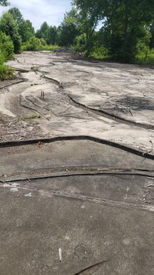
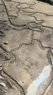
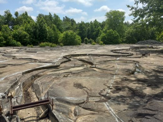
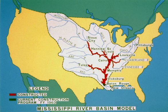
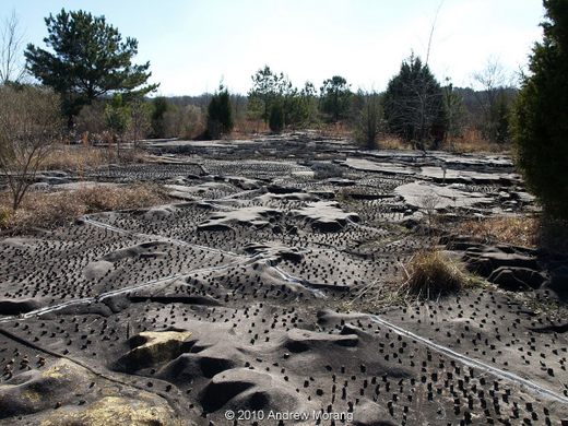
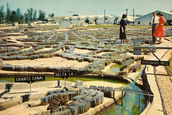
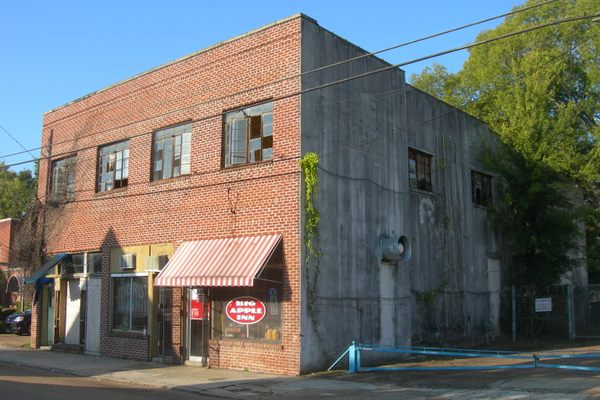
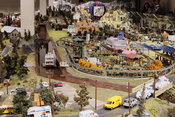
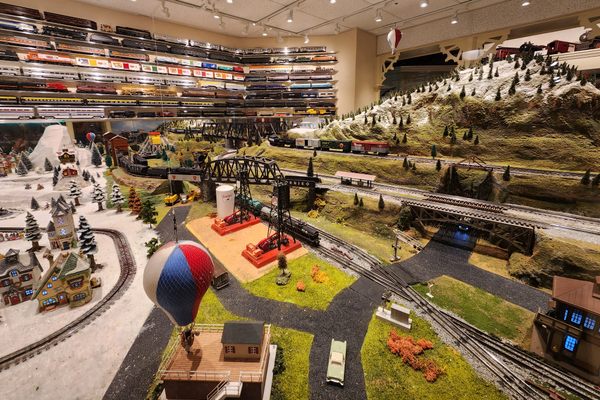
While the Army Corps of Engineers built many such models over the last century, none were on the scale of the Mississippi River Basin Model. It is the largest small-scale model ever built, representing 41% of the US in miniature, and the more than 15,000 miles of rivers that make up the Mississippi river basin laid out in eight miles worth of tiny, winding streams on 200 acres of park land. Today it sits abandoned and overgrown.
In 1927, half-a-million people had been displaced, thousands of homes were destroyed, multiple levees had failed, and millions of acres across seven states had flooded. The financial damage caused by the great Mississippi flood of 1927 was equivalent to a third of the entire federal budget at the time, some 1.3 trillion dollars in modern currency, and Herbert Hoover called it “the greatest peace-time calamity in the history of the country.” The outcry was enormous and Congress and the Army Corps of Engineers sprung into action. Levees were built, laws were passed, and the great Mississippi was tamed. All the same, ten years later it happened again.
Clearly there was a problem. What measures had succeeded in one place simply created a new flood in another. The problem was that the complexity of the Mississippi river was huge and the problem was being approached place-by-place in individual localities, but never looked at as a whole. What was needed was a way to see what would happen to the Mississippi given a certain set of inputs, to have some way to model the entire river system in total. That is exactly what the Army Corps built.
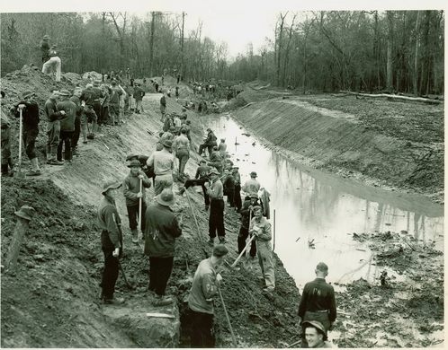
Begun in 1943 during World War II, the US was understandably short on manpower, so the Army Corps used the manpower that was available, and which happened to be free - captured Italian and German prisoners of war. Many of the laborers were German engineers handpicked for the project, among them the “Afrika Korps,” the German soldiers sent to fight in northern Africa.
The Army Corps began building the most ambitious research project they had ever undertaken. Aimed to be completed by 1948, the model took a bit longer to be finished. Though elements of the model were in use as early as 1949, the model wasn’t truly finished until 1966, a full 26 years after it was started. Six years later it was used for the last time.
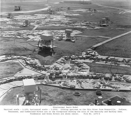
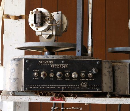
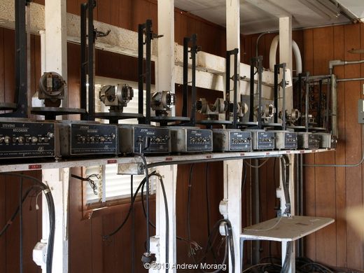
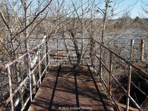
The model, built at a skewed ratio, with a horizontal scale of 1:2000, but vertical scale of 1:100 (meaning the Rocky Mountains would be a towering 50-feet tall) did get good usage over its operating years. It saw 79 simulations run, with each simulation taking anywhere from weeks to months. In 1952, information gathered using the model prevented major flooding in Omaha, avoiding as much as 65 million in flood damages. The site also became a tourist destination for a time, drawing over 5,000 people a year to stride like giants along walkways above the banks of the tiny Mississippi.
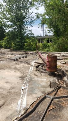
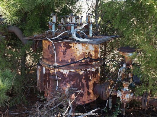
However by the early 1970s the push towards computer modeling had begun, and by the 1980s, the model simply became a burden for the Army Corps. In 1990, they left. The site was transferred to the city of Jackson, but was too expensive for them to maintain, so the city simply abandoned it.
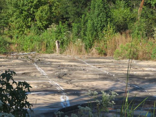
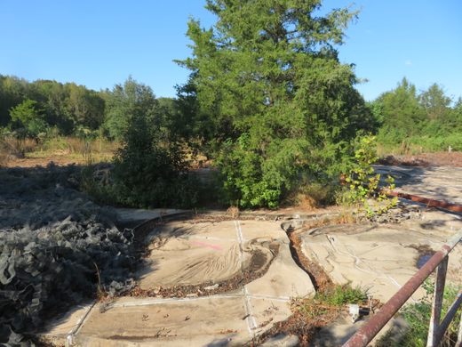
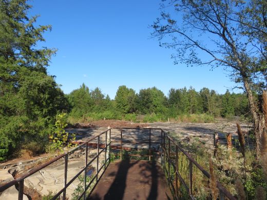
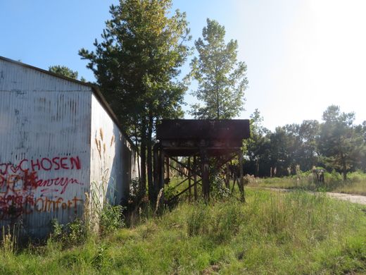
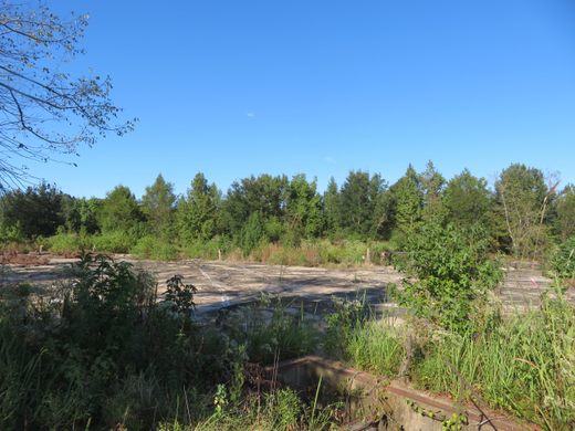
Listed on the Mississippi Heritage Trusts’ 10 Most Endangered List in 2000, today the model sits surrounded and hidden by overgrown woods in the Buddy Butts Park. It is open to the public to visit, but the tiny concrete banks of the rivers are now overgrown with life-size foliage.
Update May 2020: The area has become very overgrown and fencing may obscure views of the model. The gate was also locked. The remains of the model might be able to be seen from a concrete area nearby.
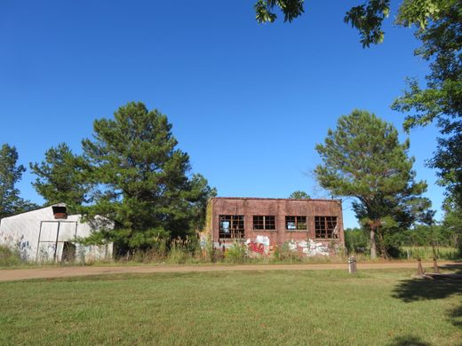
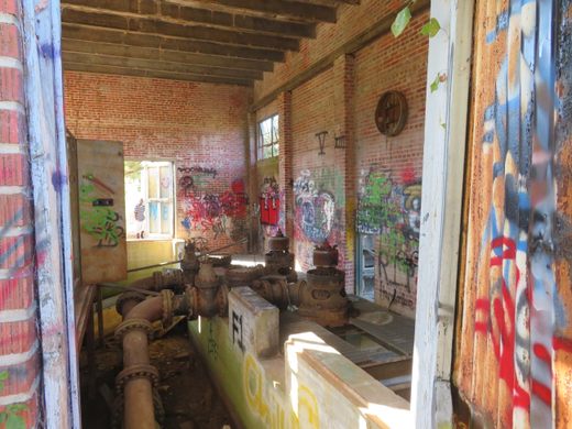
Update June 2022: You can drive and park within several hundred yards of the model. An open gate to walk through. There is a sign and an overgrown road past several abandoned, vandalized structures. There is a small historic overviewing area built. It’s all there, spooky and wondrous.
Community Contributors


Plan Your Trip
The Atlas Obscura Podcast is Back!


Follow us on Twitter to get the latest on the world's hidden wonders.
Like us on Facebook to get the latest on the world's hidden wonders.
Follow us on Twitter Like us on Facebook