160-Year-Old Ganges Canal Super-Passages Are An Engineering Marvel
The Ranipur super-passage passes over the Ganges Canal (Photo: Anthony Acciavatti/Ganges Water Machine)
When the Ganges Canal first opened in 1854 it was the largest and costliest man-made waterway in the world. Built to provide irrigation between the Ganges and Yamuna rivers in northern India, it stretches more than 898 miles south from Haridwar, one of Hinduism’s holiest places.
In its upper reaches, the canal crosses paths with other rivers and streams. During the monsoon season, these waterways swell to threatening volumes and speeds. This is why, as Anthony Acciavatti writes in his book Ganges Water Machine, a full fourth of the money spent on the canal went to building, at these watery intersections, passages that carry one massive body of water over the other. These marvels of engineering were unparalleled anywhere in the world.
More than a decade ago, Acciavatti, a designer and historian, set out to create a dynamic atlas of the Ganges basin, that would show how the area changes over time and with the season—and how people adjust to those shifts. After he arrived in India, he found that there was little bookish knowledge to support his endeavor: when he asked about existing maps of the Ganges basin, he’d be told that, if they did exist, he wouldn’t be allowed to see them, as a foreigner, and that, anyway, they didn’t exist. The last time the basin had been comprehensively mapped was in the 1960s and early ‘70s.
The Ranipur super-passage, towards the north (Photo: Anthony Acciavatti/Ganges Water Machine)
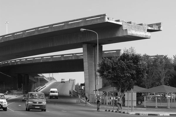
Accavatti ended up spending 10 years traveling, surveying and photographing the river and the cities and lands surrounding it. He had not originally intended to work on the Ganges Canal, but in March 2006 he decided he would visit the canal’s headwaters, where it splits from the Ganges River. Traveling there, on roads that often parallel the canal, he caught his first sight of the “super-passages,” which in monsoon season carry torrents roaring down from the mountains over and across the canal.
Photos and an aerial shot of the super-passage, and a map of the Ganges basin (Photo: Anthony Acciavatti/Ganges Water Machine)
“They were out of control, crazy structures,” he says. “I was going up just as the monsoon was starting to strike. You could see the change happening, and all of the debris and all of the silt pouring down with the water from the mountain. I was awestruck.”
To take the photos seen here, Acciavatti, as he often did, asked his driver to stop so he could snap a series of shots. As he was wrapping up, a man in a uniform—some sort of government official—came up to him: he wasn’t supposed to take pictures here, he was told.
The canal goes under the passage, as the free-flowing water goes over (Photo: Anthony Acciavatti/Ganges Water Machine)
In the 19th century, though, these structures had many admirers like Acciavatti. As he writes in his book, engineers came from around the world to see the places where the canal crossed rivers. These outdid any canals and aqueducts that had been built before. (The British designer of the crossing had gone to Italy to study the canals that carried mountain torrents across canals, but he had not been impressed.) The super-passages were some of the first man-made wonders of infrastructure, in an area that Acciavatti calls ”one of the most engineered spaces on the planet.”
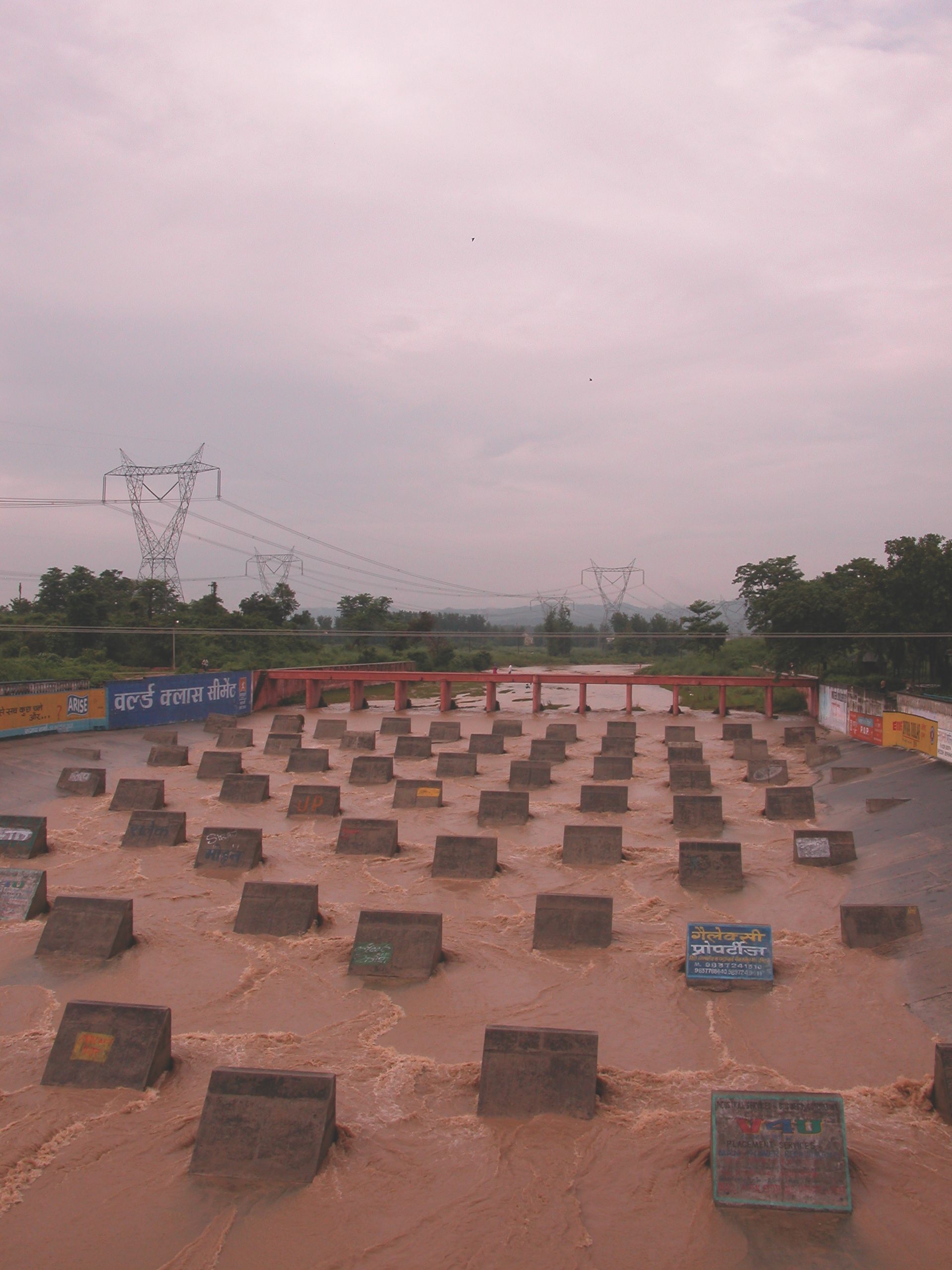
Concrete stops to break up debris (Photo: Anthony Acciavatti/Ganges Water Machine)
In the first 20 miles of the canal, there are four major intersections with bodies of water. Two are crossed by these super-passages, one 200 feet wide, 14-feet deep and 450 feet long, the other even wider, at 300 feet. In the first, the Rainpur super-passage, a neat army of concrete stops lines its bed, to slow the boulders coming down from the Himalayas, which could otherwise break through the wall of the bridge. The stops need to be replaced every two or three years.
In another spot, the river was channeled through tunnels under the canal during the dry season; during the rainy season, it intersected a canal at a “level-crossing,” where the two channels of water mixed. At one point, it took a staff of dozens of people to maintain the crossing, which would sustain damage each year, until in the 1980s, the World Bank helped finance the creations of a third bridge-like structure.
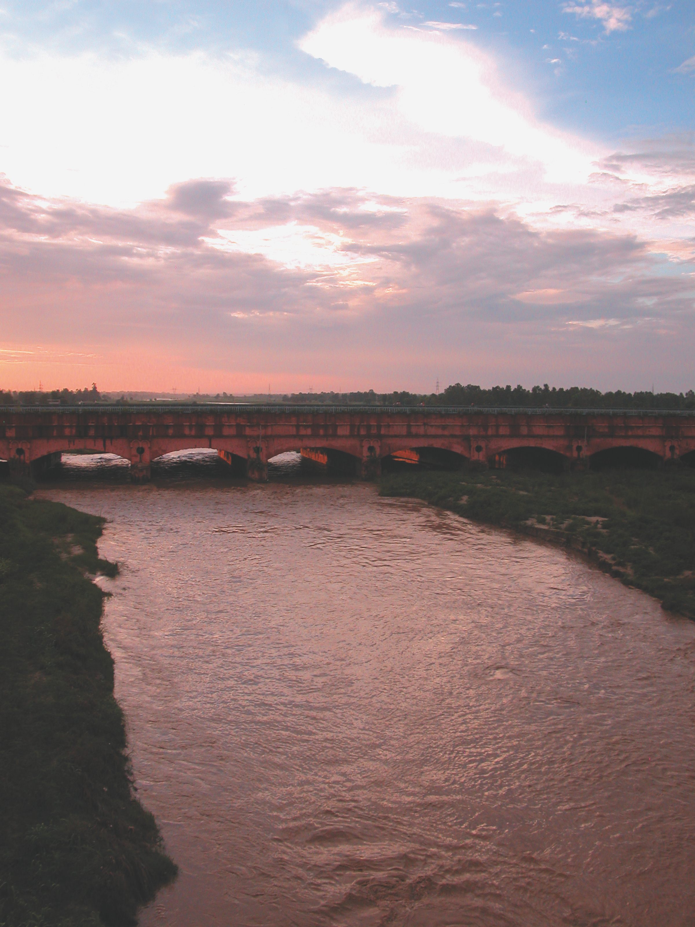
The Solani Aqueduct (Photo: Anthony Acciavatti/Ganges Water Machine)
In the 19th century, though, the British were most proud of the Ganges Canal’s Solani aqueduct in Roorkee, where the canal runs above the land and the seasonal Solani River for 2.25 miles. The water bridge is 172 wide and 24 feet tall, and once two lions sat at one end to mark the beginning of the canal’s irrigation area. It was, one observer wrote in 1887, “the most stupendous monument of that kind yet constructed.”
“They are quite exceptional structures,” says Acciavatti, “and to think they were built in the middle of the 19th century … they’ve been repaired and updated. But the bones are still there.”


Follow us on Twitter to get the latest on the world's hidden wonders.
Like us on Facebook to get the latest on the world's hidden wonders.
Follow us on Twitter Like us on Facebook