How Many Liquor Bottles Can You Find in This 1931 Map of Chicago?
The “Gangland Map” features drunken fish and goofy jokes alongside descriptions of brutal murders.
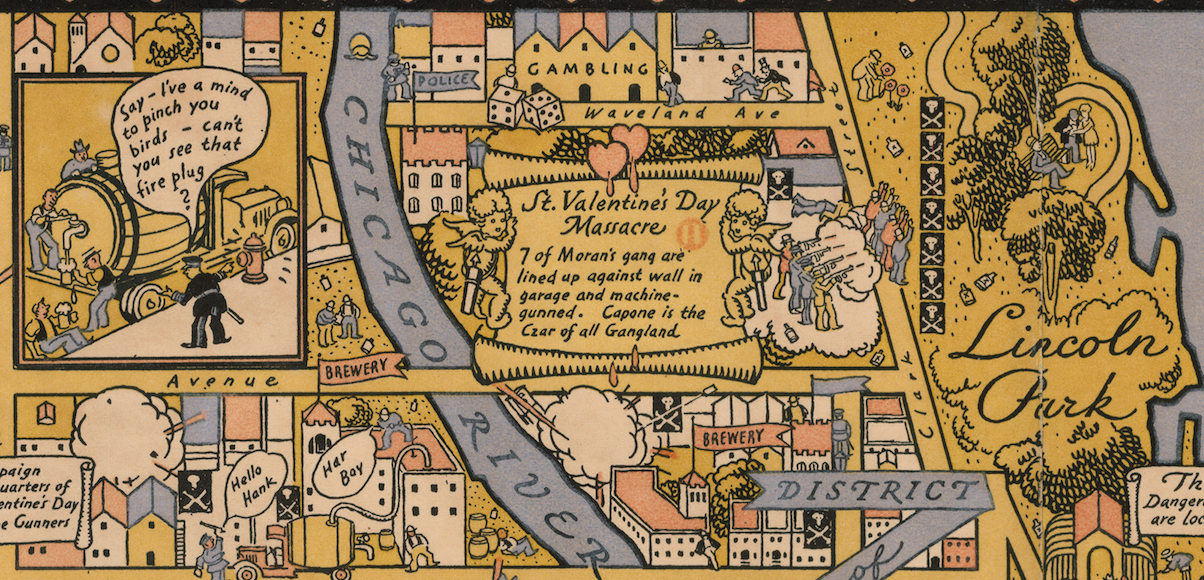
On February 14, 1929, around 10:30 a.m., Clark Street in Chicago was rattled by gunfire. The city’s most powerful gang leader, Al “Scarface” Capone, had finally sent some hit men after a rival gang. When the shots subsided, seven people were dead. It was, the Chicago Tribune later put it, “the most infamous of all gangland slayings in America.”
In the years since, the killing—now known as the “St. Valentine’s Day Massacre”—has been recreated in films, plays, and television shows. But in 1931, a Chicago cartographer gave it an unconventional treatment. In the northeast corner of a map of the city, in between carefully labeled streets, is a tiny cartoon version of the massacre: four gunmen, two disguised in policeman blue, wearing wide-brimmed hats, shooting at their victims. Next to it, an account of the slaying is written neatly on a scroll held aloft by two cherubs.
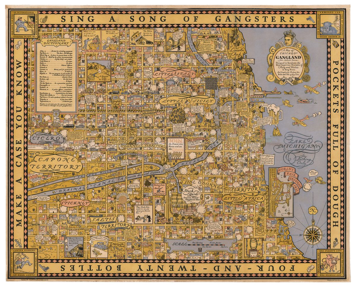
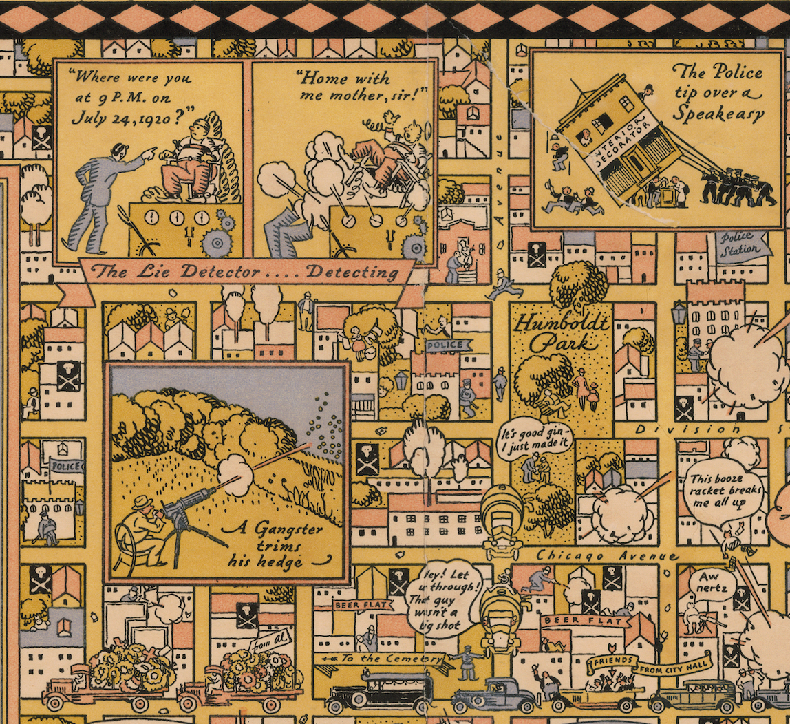
This is just one of the many events depicted in A Map of Chicago’s Gangland—a cynical, hyper-detailed portrayal of a city gripped by chaos. Sometimes hilarious and always gruesome, the 1931 map shows a Chicago riddled with corrupt police, incompetent detectives, and hiccuping bootleggers.
Rumors swirl around the map like gin in a decanter. For one thing, it’s unclear exactly who drew it. “We don’t know who the artist was,” says Lucy Garrett, a gallery assistant at Daniel Crouch Rare Books. (The dealership is currently selling a copy of the map, and will be displaying it at the London Map Fair on June 9 and 10.) It was published by a Chicago-based company called Bruce Roberts, which, she adds, is similarly shrouded in mystery: “We haven’t been able to find any more information about them except for a few other books they published,” which include a bridge strategy manual and a guide to marital sex. “It seems that they had a very wide remit.”
We do know that whoever made it was well-versed in map history. “It’s riffing on earlier, older maps,” says Garrett. Even the title, A Map of Chicago’s Gangland from Authentic Sources, is a throwback to a practice of centuries before. “On older maps—16th to 18th-century maps—it would say, “A map of wherever, from the best sources,” explains Garrett. “That’s because the people who were drawing those maps had not actually been there.”
In this case, it seems safe to assume that the cartographer was familiar with the city. The map’s title—along with its statement of purpose, “Designed to Inculcate the Most Important Principles of Piety and Virtue in Young Persons And Graphically Portray the Evils and Sin of Large Cities”—seem somewhat tongue-in-cheek, in keeping with the rest of its aesthetic.
Stylistically, the map also has a clear precedent: The Wonderground Map, a whimsical take on London by the graphic designer Leslie MacDonald Gill. That map was published in 1915, and quickly spawned imitators as far afield as Mexico and Australia. The Map of Chicago’s Gangland “is very much in this style—pictorial, cartoonish, with little snippets of information integrated into it,” says Garrett. It’s even got a similar color scheme, and a border with a poem running around it.
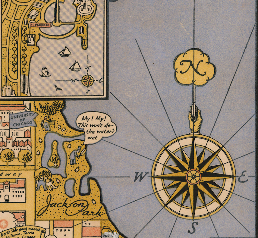
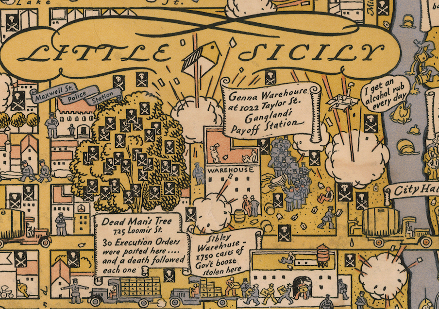
The subject matter, though, is quite different. In the Wonderground Map, a cartoon fish swimming in the Thames says “I’m a beggar for sardines.” In the Gangland map, its cousin from the Chicago River brags “I get an alcohol rub every day.” London’s miniature populace discusses polo and being late for tea, while Chicago’s chats about gin and weapons. And where the corners of the Wonderground Map are decorated with coats of arms, Gangland’s depict scenes of infamy, like “Armored car used by gangsters in making social and business calls,” and “Lawyer running to ‘spring’ his client with an habeas corpus writ.”
This juxtaposition of strife and silliness makes reading the map somewhat dizzying; these crimes, of course, had real victims. One intersection near the river, nicknamed “Death Corner,” was the site of a number of gang-related executions. On the map, the spot boasts a stack of skulls and crossbones, and is captioned almost gleefully: “50 Murders—count ‘em.” Throughout, other deaths get similarly flippant illustrations and descriptions.
Even the scale bar is a morbid parody, ranging from “One Shooting” all the way to “Massacre.” This vertiginous tone might help to explain another rumor attached to the map: That authorities, upset at the image of the city it portrayed, destroyed most copies of it before the 1933 World’s Fair.
In certain cases, the japery also comes at the expense of accuracy. As organized-crime expert John Binder recently told the Chicago Tribune, the map contains some crucial mixups. “They’re showing the West Side O’Donnell gang as being around Douglas Park,” Binder said. “That was controlled by the Valley gang.” And despite the description of the drainage canal as “a favorite disposal station”—and the two tiny thugs shoving someone into the water—Binder says people didn’t often dump bodies there.
If you want something that will tell you where that era’s criminals actually did their business, you might be better off with Chicago’s Gangland, a more precise (if less lively) rendering of the area’s hangouts and hideaways, made in 1927 by the sociologist Frederic Thrasher. If you want another view of a strange time, though—one complete with drunken fish and tire-stealing bootleggers—this map is worth a look.


Follow us on Twitter to get the latest on the world's hidden wonders.
Like us on Facebook to get the latest on the world's hidden wonders.
Follow us on Twitter Like us on Facebook