Ireland’s Coast Has Giant, Hidden Signs Telling Pilots Where They Are
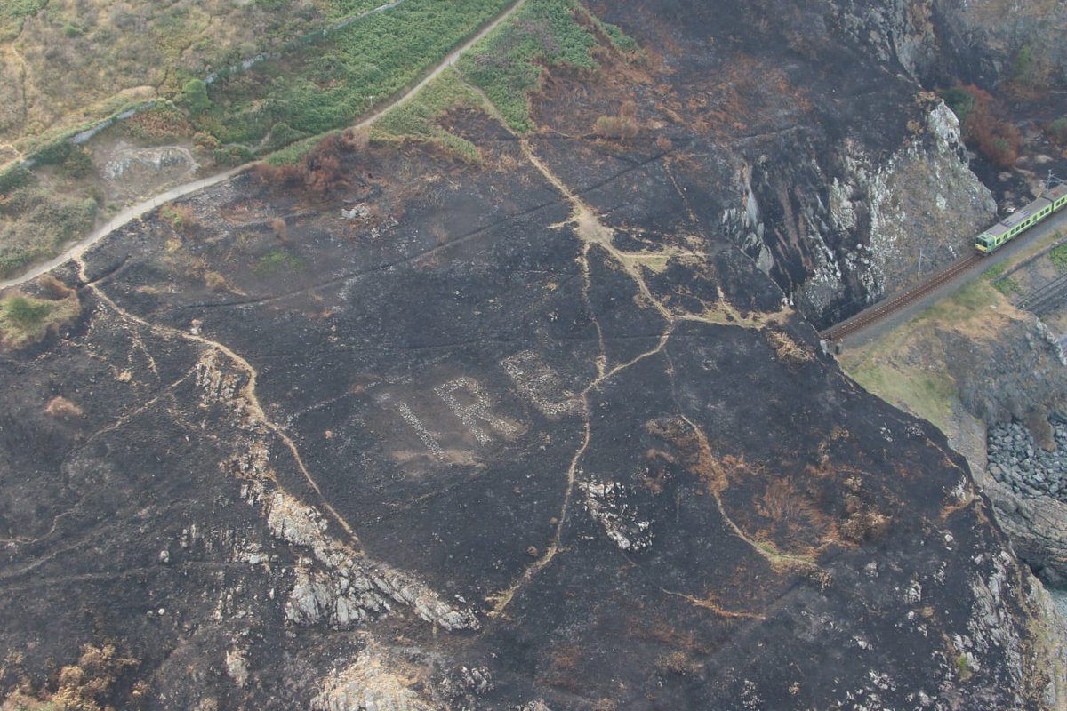
A wildfire has just uncovered one of these “Éire” signs from World War II.

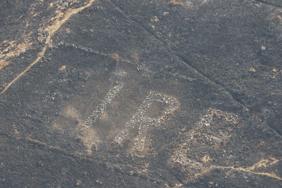
In County Wicklow, Ireland, a wildfire is blackening parts of the coast, and airborne crews have released around 40,000 gallons of water to try to stop it. High above the coast, an air support crew of An Garda Síochána, Ireland’s National Police Service, spotted a relic of World War II—a white stone sign spelling out “Éire,” which was meant to guide wartime pilots passing over this neutral territory.
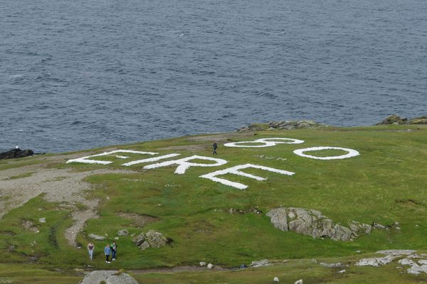
In 1939, Ireland declared itself a neutral party in the war and began setting up Coastal Watch stations to guard against invaders. A few years later, from 1942 to 1943, each of these 80-some stations constructed at least one sign that could be seen from the air.
The signs were meant to identify the land for pilots crossing above it—Éire is the name of the country in the Irish language. Each one was numbered, too, and they became navigational aids for British pilots. (Though officially neutral, in practice, Ireland favored the Allies.)

Over time, these signs have fallen into neglect, although in some places locals have restored them. Still, only about a quarter can still be found today. There’s a map with the locations of many of the extant signs.
This one—Éire 8—had been hidden beneath overgrown gorse, a spiny evergreen shrub. But when the fire burned the gorse away, the letters emerged, a reminder of the country’s past.


Follow us on Twitter to get the latest on the world's hidden wonders.
Like us on Facebook to get the latest on the world's hidden wonders.
Follow us on Twitter Like us on Facebook