Inside a Victorian Photo Shoot at Stonehenge
Early images of people enjoying and surveying the monument were recently released to the public for the first time.
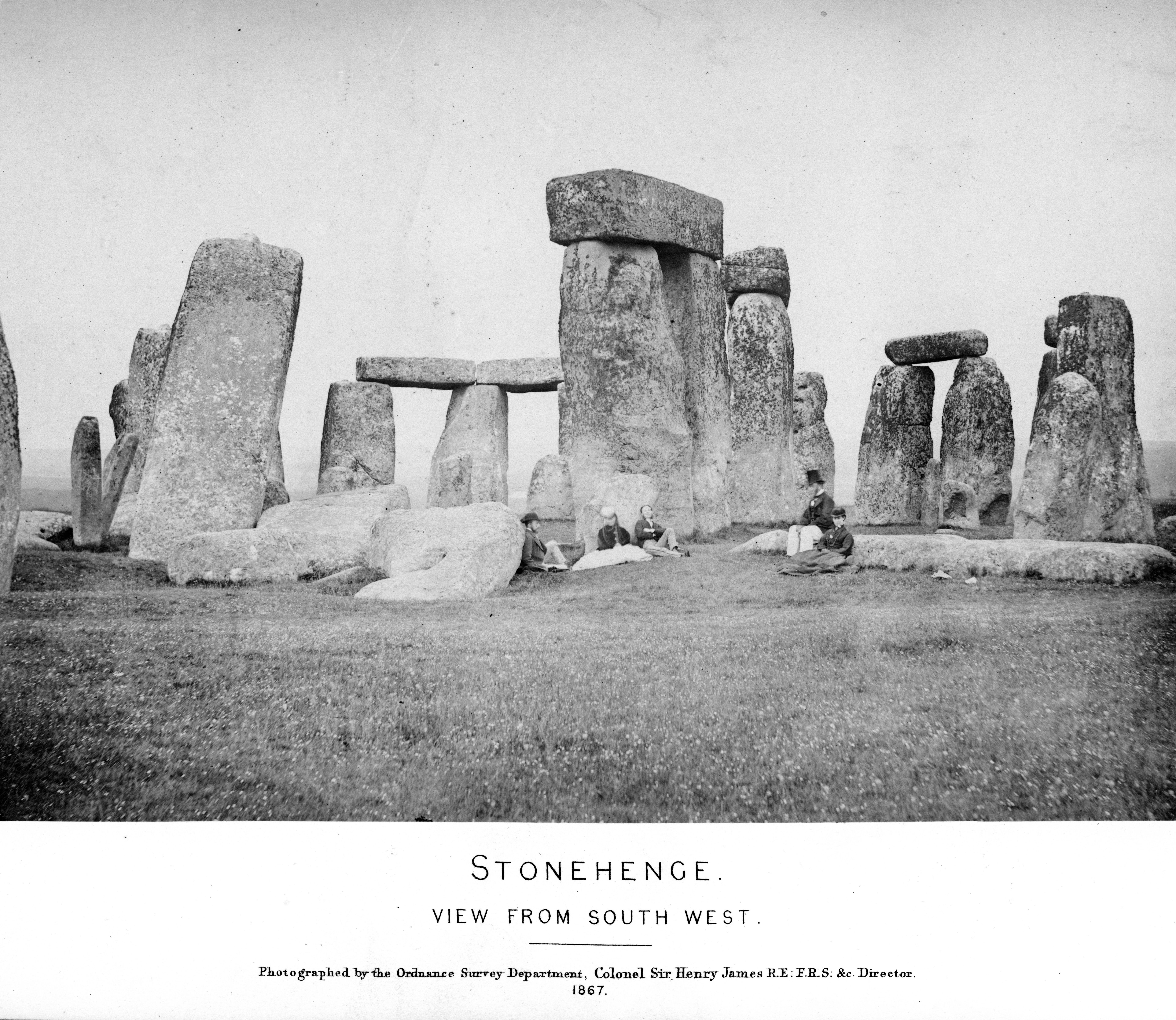
Five people enjoy a sunny day in the countryside. Some lie on the grass. Others sit on or lean against boulders. All are dressed in fine clothes, and none seem particularly perturbed by the fact that their makeshift seats are some of the most famous stones in the world.
The image above, which was recently made public by the photo research company TimePix, is from 1867, and is part of the first known photographic sequence ever taken of Stonehenge. (There are older individual photographs, in the Royal Collection.) It’s from a book called Plans and Photographs of Stonehenge, released by the U.K.’s Ordnance Survey and written by the department head, Colonel Henry James.
Since the Ordnance Survey began in the late 18th century, its workers have used various tools to get the nation down on paper. In the 1860s, much of the agency’s energy was focused on mapping all of Great Britain, county by county, at six inches to the mile. As James’s preface explains, Plans and Photographs of Stonehenge was made for the agency’s officers, to prepare them for encounters with any “Objects of Antiquity” that they might come across during their work, as well as to “stimulate them to make Plans and Sketches.”
“It was a very gentlemanly pursuit to have an interest in archaeology, or antiquities as they called it back then,” says TimePix founder Elaine Owen. James didn’t want his employees to come across an ancient treasure and mess up how they measured it.
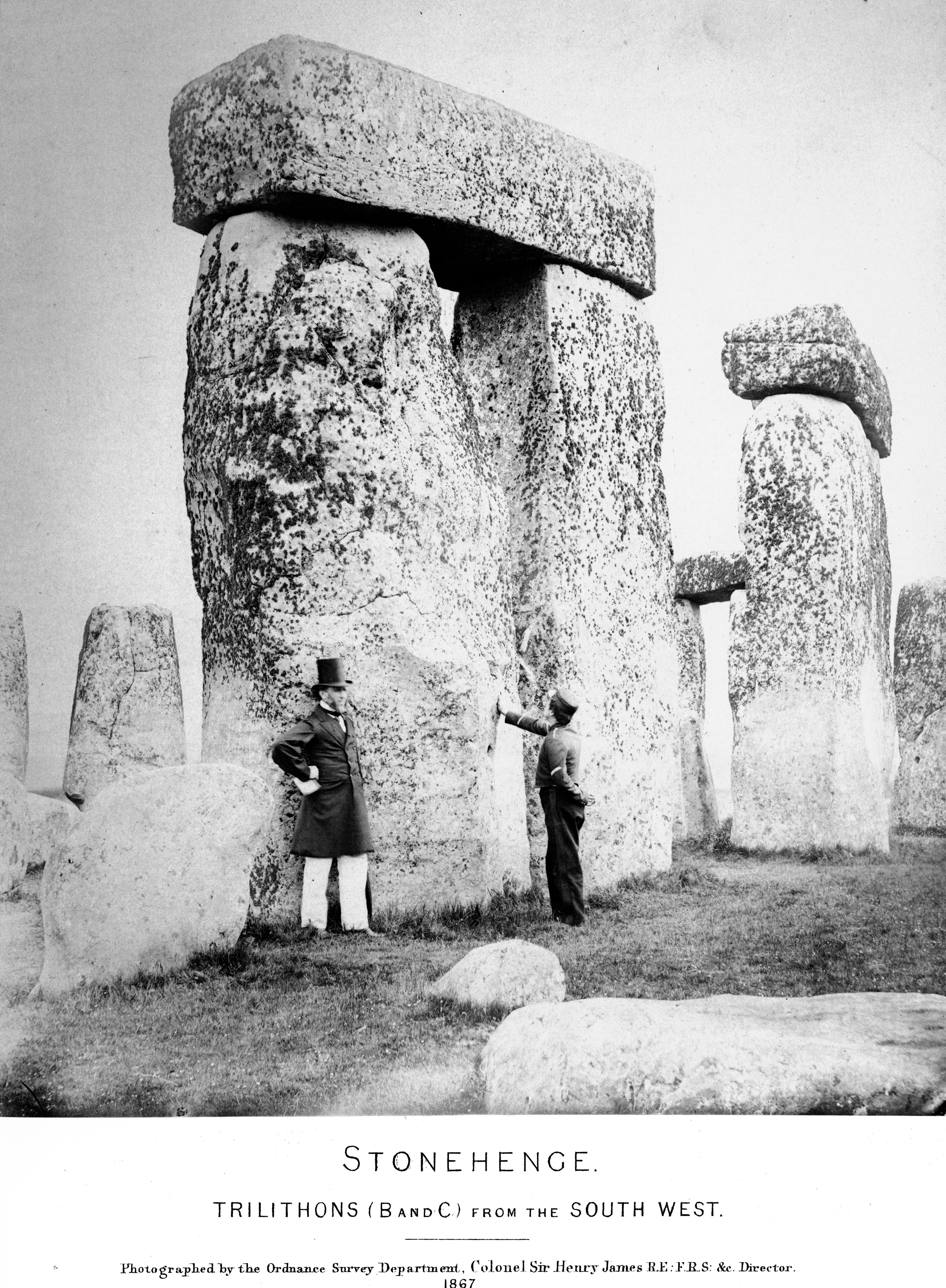
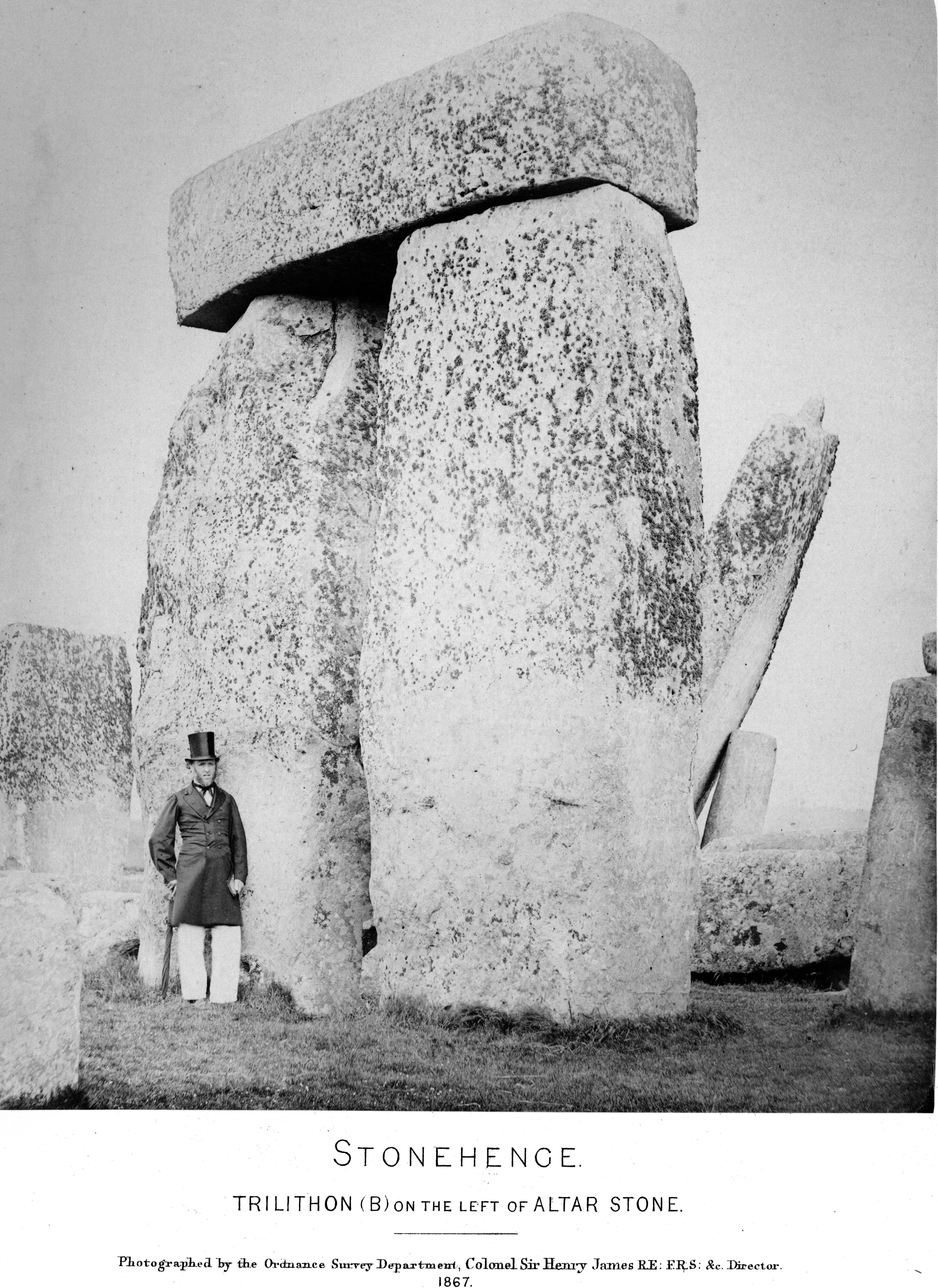
To that end, Plans and Photographs of Stonehenge is full of meticulous detail. After explaining that the center of the arrangement consists of “five stupendously large trilithons,” James goes on to note just how stupendously large they are. His careful sketches of the stones show every divot and rough surface.
But when he wasn’t busy surveying, James apparently did some lounging as well. While “we can’t be 100 percent certain” exactly who is in the photos, Owen says, the man in the tall top hat “could easily be him.” (This impression is underscored by the fact that James was quite into self-promotion—when the Ordnance Survey built new buildings during his tenure, he had his own initials carved into them.) If it is him, the other figures are likely his wife and children, making this “an early version of a family snap,” Owen writes in a press release.
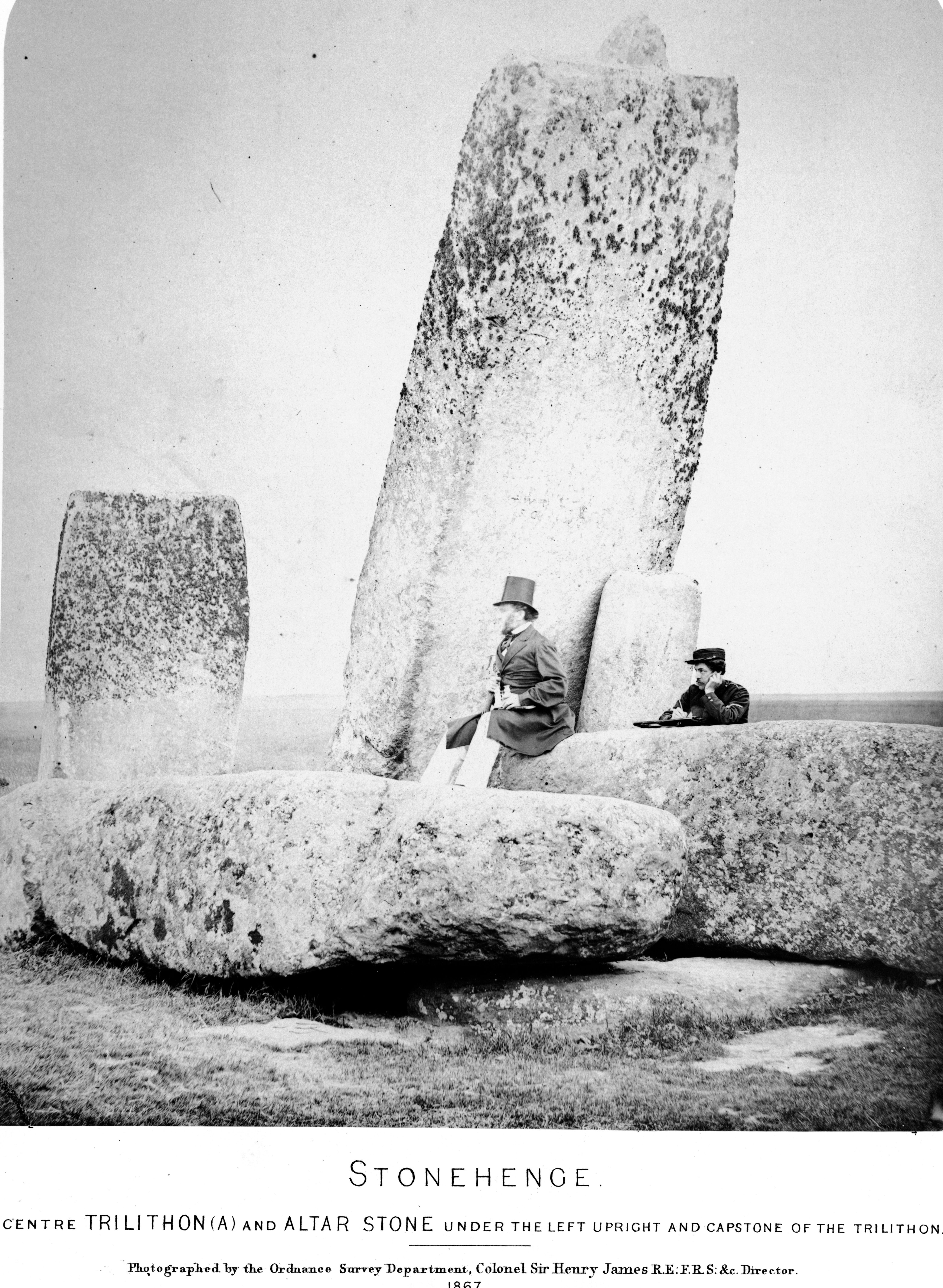
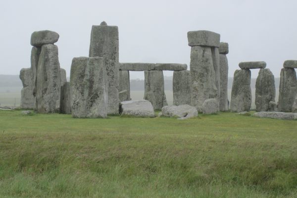
A century and a half after he published it, James’s survey is no longer accurate: Since the early 1900s, the stones have been rearranged and repositioned by various groups for various reasons. The book’s long section on the ancient Druids has also lost relevance, as scientists now believe the structure originated about a millennium before Celtic people arrived in the region. But his photographs—in which people turn an ancient monument into a carefree picnicking ground—exude a cheekiness that is truly timeless.


Follow us on Twitter to get the latest on the world's hidden wonders.
Like us on Facebook to get the latest on the world's hidden wonders.
Follow us on Twitter Like us on Facebook