Edwards AFB Satellite Calibration Targets
These colossal desert barcodes have been fine-tuning spy satellites for decades.

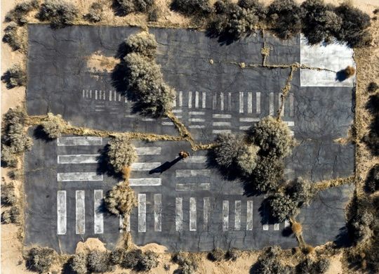
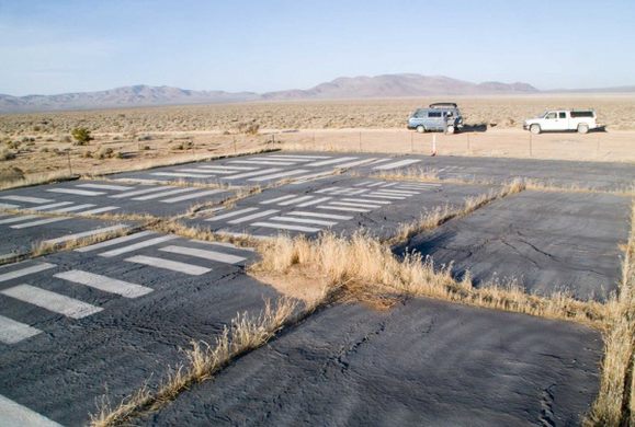
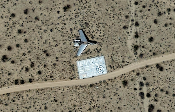
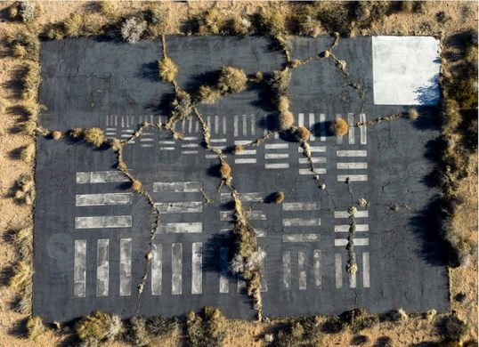

An oddly painted rectangle out on the parched Mojave flatlands around Edwards Air Force Base has a much more significant scientific purpose than your typical asphalt lot.
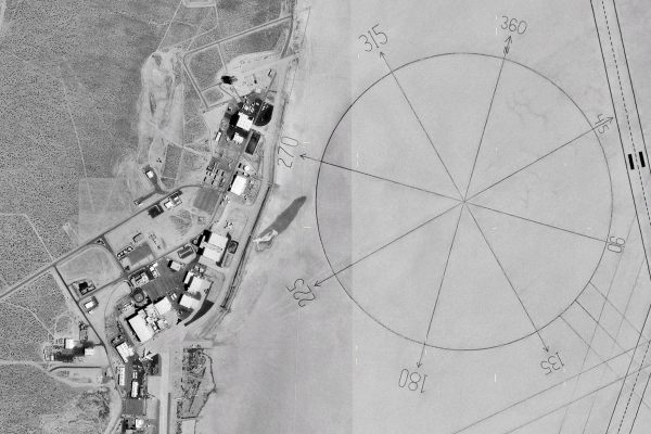
If you were to visit on a starry night and peer into the heavens, there’s a chance spy satellites hundreds of miles above might be looking right back at you. The tennis court-sized array of lines is a large satellite calibration target, used to focus outer space imagery like a super-sized version of an optometrist’s eye chart.
Its cascading zebra stripe design is a meticulously measured reproduction of the Air Force’s 1951 standard resolution test chart. It’s nearly identical to the test sheet that accompanies modern printers and scanners.
Edwards Air Force Base has the world’s largest concentration of satellite calibration targets, most of which date to the early Cold War period. This sandy locale is ideally suited for the task, as it boasts consistently low levels of cloud cover and little to no light pollution or atmospheric disturbances.
Far from the only nearby attraction intended for an aerial audience, Edwards Air Force Base is also home to the world’s largest compass rose.
Know Before You Go
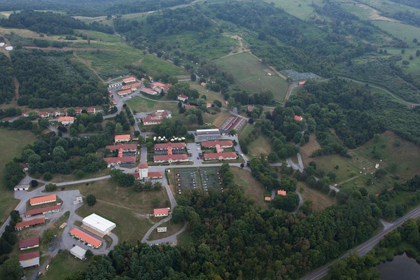
This is in a restricted access zone. Cannot see unless flying over.
Community Contributors


Plan Your Trip
The Atlas Obscura Podcast is Back!


Follow us on Twitter to get the latest on the world's hidden wonders.
Like us on Facebook to get the latest on the world's hidden wonders.
Follow us on Twitter Like us on Facebook