AO Edited
Mariscal Mine
An abandoned mine where dreams of quicksilver trickled away over 75 years ago.

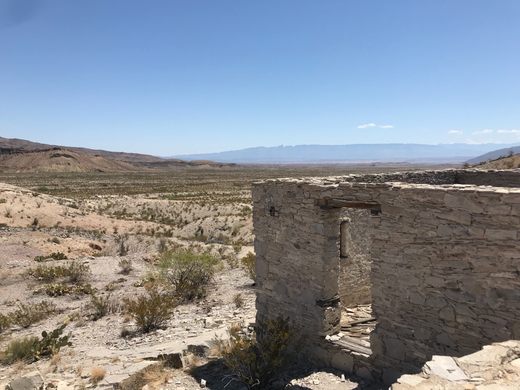
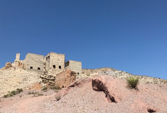
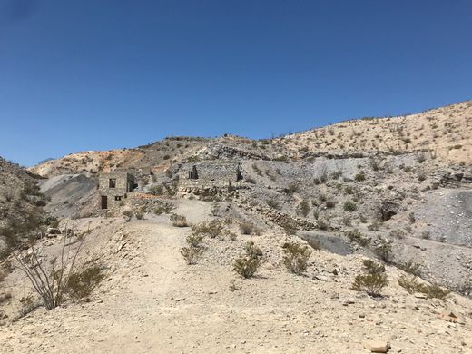
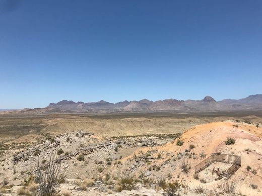
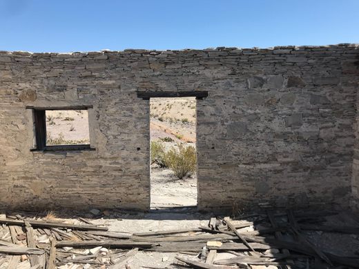
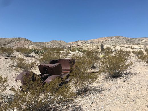
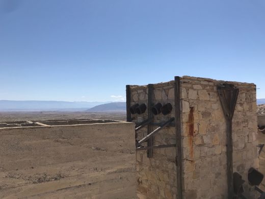

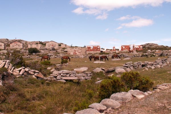
Mariscal Mine rises up like a butte on the cinnabar, shrub-stippled landscape of West Texas. Perched on a backdrop of the bluest sky, the mine’s tan bricks are assembled in three large buildings, each with two, unblinking holes at their base. The mine’s towers only distinguish themselves from the surrounding land by their orderly pilings, and by the rusted skeleton of an antique automobile suggesting that once upon a time, someone important couldn’t get their car to start.
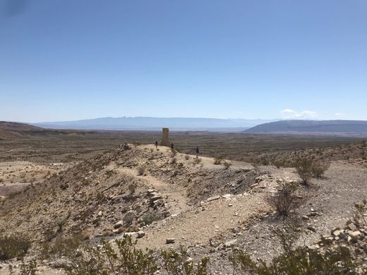
Located closer to Albuquerque than Houston, Big Bend National Park occupies land that was once Comanche and Apache territory, then Mexico, and now Texas. The southern tranche of the park is less frequented than its easterly waterways, its peaks and vistas, and its canyons. Mariscal Mine can be found in a bit of a backwater—if there was any water to speak of—off the main path for hikers and sightseers. But three quarters of a century ago, it was a popular pathway to fortune.
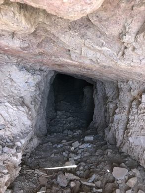
The dilapidated mine is what remains of “King Quicksilver” in Texas, a fad that trickled away as quickly as the elemental veins of the ore itself. Only nine mercury mines were ever established in the West, and Mariscal was one of the largest. Most of the workers at the mine were Mexican immigrants who walked across the border to get away from the Mexican Revolution. They earned less than $2 an hour. The work was backbreaking and sweaty, and often led to a drawn-out and painful death—the mercury they were mining induced poisoning and respiratory illnesses, occasionally causing them to loose teeth. Through their efforts, the mine produced nearly a quarter of all the mercury ever mined in the United States, according to the National Park Service website.
The mine has had numerous owners since its founding in 1900, and over its lifetime a number of brick and concrete lodgings were made around its perimeter. The mine was closed for good and its items were auctioned off in 1943, a year before the creation of Big Bend National Park. Some of the bricks from the furnace were processed, and the clay offered up a significant amount of mercury.
Now, Mariscal has warning signs posted around its perimeter, warning of radiation from the mercury residue (though these are trace elements, and it’s perfectly safe to visit). You can walk around its perimeter to realize that below the dusty, sun-scorched terrain, people’s lucrative aspirations are buried for good.
Know Before You Go
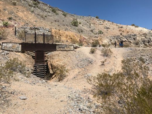
Mariscal Mine is located on the south side of the expansive park. To get there, one must traverse unpaved, unmaintained roads and across long-dried-up stream beds. There are some treacherous turns, and it’s recommended to use a vehicle with four-wheel drive. If you take the Black Gap Road, it is highly recommended that you take a vehicle with high clearance, as the “black gap” the road’s name refers to is a significant and drastic drop in the road. Though, as the mine is located on a loop road, visitors can also avoid the dicey Black Gap shortcut.
The mine is up a short hill where there is a lot of gravel, so watch your step and wear comfortable sneakers. Also, there's no shade, so don't forget your sunscreen!


Plan Your Trip
The Atlas Obscura Podcast is Back!


Follow us on Twitter to get the latest on the world's hidden wonders.
Like us on Facebook to get the latest on the world's hidden wonders.
Follow us on Twitter Like us on Facebook