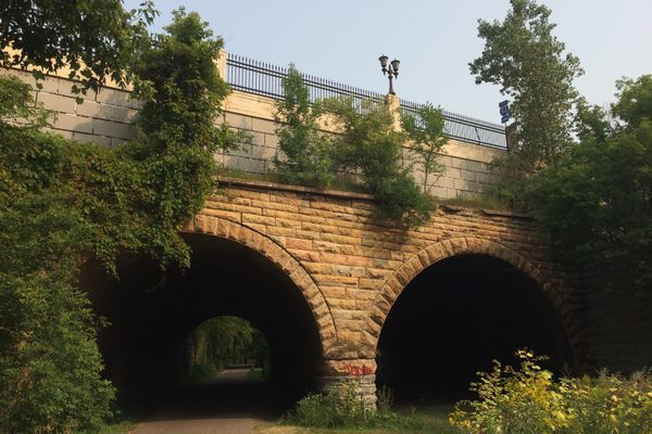
Puente General Méndez Vigo
This ''hidden'' 19th-century bridge played a simple, yet important role during the Spanish-American War.

In the southern town of Coamo, Puerto Rico, lies a rather unknown piece of history. At first glance, it looks like an ordinary bridge that many vehicles pass over daily. However, those willing to look below its concrete surface will find a 19th-century relic that doesn’t appear on your typical tourist brochure.
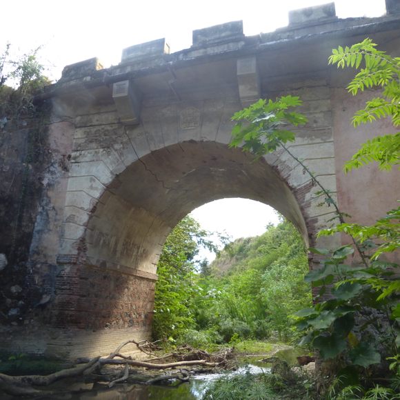
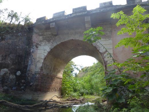
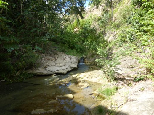
The General Méndez Vigo bridge on the PR-14 highway was originally built in 1862 as part of Puerto Rico’s Carretera Central, or Central Highway. It’s also known as Puente #173 and Puente Las Minas, the latter because its imposing 20 feet arch passes over the Las Minas river. The bridge received its name from General Santiago Méndez Vigo, governor of Puerto Rico from 1840 to 1844.
The masonry structure played a major role during the Spanish-American War of 1898. American troops coming from Ponce, led by Major General James H. Wilson, were heading toward Carretera Central. Spanish troops led by Commander Rafael Martínez-Illescas destroyed the bridge to slow down the enemy’s advancement. The plan worked at first, but eventually, Illescas was killed during the Battle of Coamo.
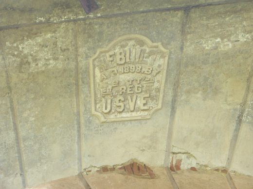
After the war, the United States Army Corps of Engineers (USACE) rebuilt the bridge the way it is today. The top of the arch is adorned on one side with a castle, the symbol of the USACE. On the other side, you’ll spot a message saying the bridge was reconstructed by the Fifth Battalion of the First Regiment of the Corps in 1898.
The General Méndez Vigo bridge is by no means a must-see tourist destination like El Morro, but instead a quick stop off the beaten path. Still, it’s a small piece of history overshadowed by the paved road above. It’s as if it’s waiting for curious explorers who surely wouldn’t hesitate to take pictures under its imposing arch.
Know Before You Go
As of February 2019, the road leading to the bridge is closed to traffic, but you can park carefully nearby and walk to it. There's a narrow dirt path at the end of the bridge leading to the stream below. Watch your footing, since there's trash and branches littering the ground. Taking the PR-14 highway is the best option as the alternate routes can be disorienting.
Community Contributors

Edited by


Plan Your Trip
The Atlas Obscura Podcast is Back!


Follow us on Twitter to get the latest on the world's hidden wonders.
Like us on Facebook to get the latest on the world's hidden wonders.
Follow us on Twitter Like us on Facebook