Stevenson Road
This little-known colonial road helped determine the Zambia-Tanzania border.


In the early days of European exploration and colonization in Africa, the only way to reach Lake Tanganyika, one of the African Great Lakes, was via an overland route from Dar Es Salaam to Ujiji. This was the route many explorers took to the lake, including David Livingstone and Henry Morgan Stanley. However, this route was controlled by the Muslim traders who dominated what would become the country of Tanzania.
The control of the overland route by the Muslim traders had several impacts on the Europeans in the area. For the missionaries of the London Missionary Society, it meant they could easily be cut off from their missions on Lake Tanganyika, such as the Niamkolo mission on the southern end of the lake. For traders and others with commercial interests, it meant that the Muslim traders dominated the trade in the region, including the lucrative ivory trade and the trade of enslaved people.
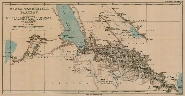
Creating an alternative route to the lake was, therefore, a viable option for both European traders and missionaries alike. James Stevenson, a Glasgow manufacturer and ardent supporter of African missions, hatched a plan to construct a road between the northern end of Lake Malawi (then Nyasa) and the southern end of Lake Tanganyika.
This route was attractive for several options. People traveling via ship up the Shire River, along the length of Lake Nyasa, over the proposed Stevenson Road, and along the length of Lake Tanganyika could penetrate 1,400 miles into the continent’s interior with only 275 miles of overland travel. The relatively high plateau between the lakes was believed to be fairly free of the tsetse fly, making the use of draft animals possible, and the route would be over entirely British-claimed territory.
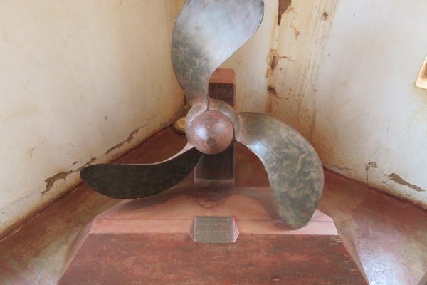
Construction on the road eventually began in 1881 after a donation by Stevenson to the London Missionary Society, and the Society’s agreement to ship a small steamship (The SS Good News, the first steamship on Lake Tanganyika) via the Stevenson Road. Unfortunately, due to the difficulties of the terrain and the death of Stevenson in 1885, the Stevenson Road was in many parts more theoretical than an actual road.
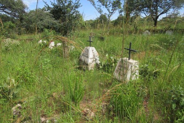
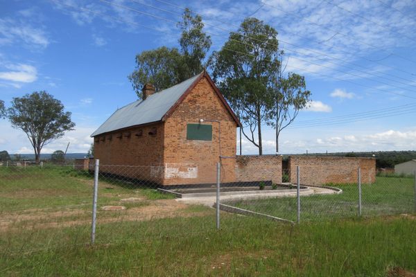
That did not, however, diminish its impact. Several missions and towns were eventually set up along the path of the road, such as Mambwe Mission, which helped to monitor and counter the slave trade in Africa. Other towns, such as Mbala and Fife, would be important during World War I. And when the German and British representatives at the “Scramble for Africa” were dividing the borders between themselves, the line between the eventual countries of Zambia and Tanzania was drawn parallel to, but just short of, the Stevenson Road.
Know Before You Go
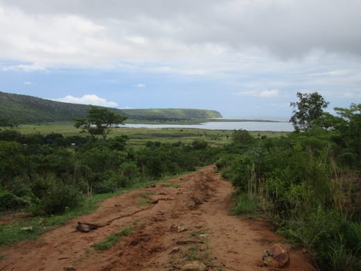
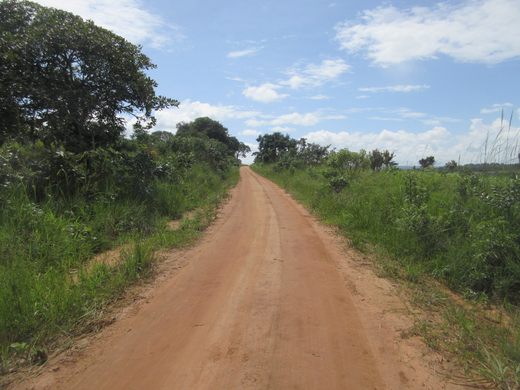
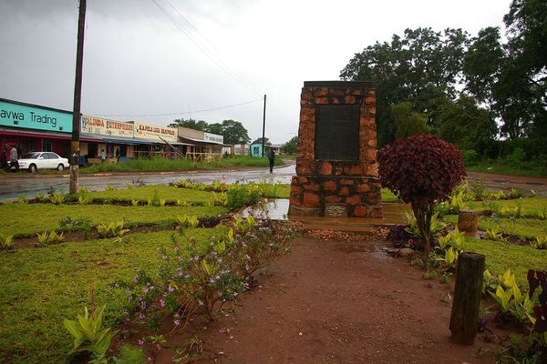
The Stevenson Road today has largely been either replaced with modern tarmac road or bypassed. Some of the easiest portions of the intact road to see are near the Zambian town of Mbala. Approximately half a mile north of Mbala, there are well-preserved portions leading up to Cemetery Hill, and the along East-West road north of Lake Chila. A dirt road leading west out of Mbala to Isoko and then to the road's terminus in Kituta Bay on Lake Tanganyika is part of the original Stevenson Road. Further information about the road can be found at the Moto Moto Museum, about a mile outside Mbala.
Community Contributors


Plan Your Trip
The Atlas Obscura Podcast is Back!


Follow us on Twitter to get the latest on the world's hidden wonders.
Like us on Facebook to get the latest on the world's hidden wonders.
Follow us on Twitter Like us on Facebook