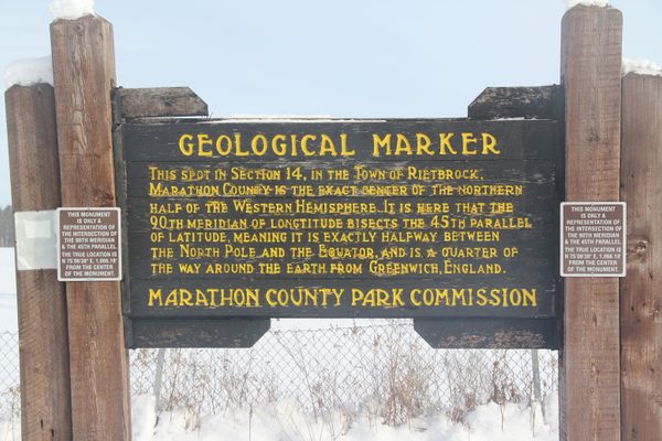
Trips Places Foods Stories Newsletters
Loading...
Loading...
Loading...
Loading...

No search results found for
“”

Make sure words are spelled correctly.

Try searching for a travel destination.

Places near me Random place

Popular Destinations

  • Paris
  • London
  • New York
  • Berlin
  • Rome
  • Los Angeles
Trips Places Foods Stories Newsletters
Sign In Join
Places near me Random place
All the United States Wisconsin Ogema Timms Hill

Timms Hill

The highest point in Wisconsin is capped by two towers that are not as mythic as Tolkien's but provide much better views.

Ogema, Wisconsin

Added By
Thomas Harper
Email
Been Here
Want to go
Added to list
CAPTION
Timms Hill   Wikipedia
Timms Hill survey marker.   Thomas Harper
Timms Hill from Bass Lake.   Thomas Harper
The wisconsin woods from Timms Hill.   Thomas Harper
Been Here
Want to go
Added to list

About

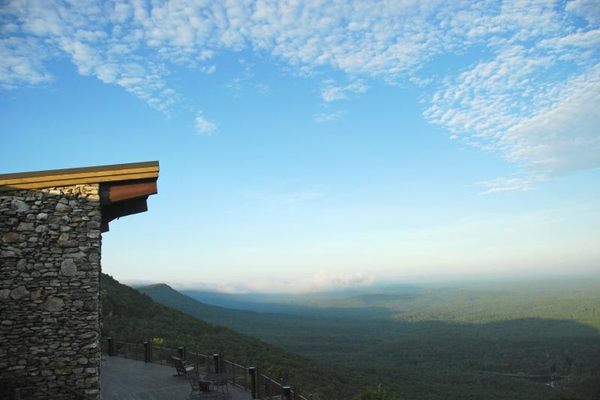
While not as impressively tall as many state high points, the two towers that stand atop Wisconsin's Timms Hill let visitors stand well above the surrounding wilderness.  

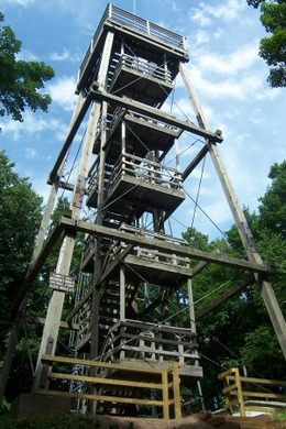
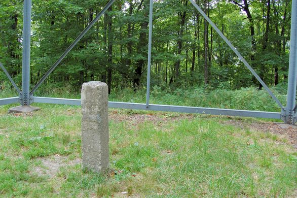
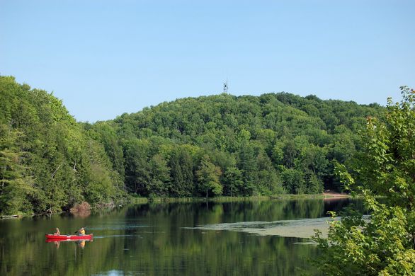
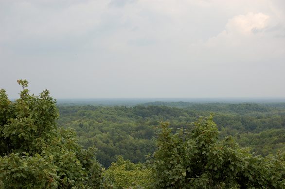
At 1,951 feet above sea level, Timms Hill is the tallest natural point in the state which is noted by its observation towers. One tower is metal and holds communication equipment, with the state high point survey marker right underneath it. The other tower is a wooden construct that can be climbed for wide views of the surrounding woodlands and lakes as well as some spectacular fall foliage. The trail leading to the summit also connects the elevation to the Ice Age Trail which winds 1,200 miles through the entire state.

Nearby is High Point Village Resort with picnic facilities, and the Hill of Beans coffee shop. The owners of the shop, Lyle and Kathy Blomberg, curate Timms Hill County Park and have welcomed visitors from across the globe to their small, but record-setting Wisconsin hill.

Related Tags

State High Points Geographic Markers Mountains

Know Before You Go

From Ogema, WI, go east on Route 86 and turn south on County Road C. Follow the signs to Timms Hill County Park.

Community Contributors

Added By

thomasharper

Edited By

EricGrundhauser

  • EricGrundhauser

Published

May 30, 2014

Edit this listing

Make an Edit
Add Photos
Sources
  • http://www.waow.com/story/15628301/leaves-changing-high-atop-timms-hill
  • http://en.wikipedia.org/wiki/Timms_Hill
  • http://www.summitpost.org/timms-hill/154441
  • http://www.pricecountywi.net/attractions/parks/timms-hill-county-park/
Timms Hill
Ring School Road
Ogema, Wisconsin, 54459
United States
45.453735, -90.199046
Get Directions

Nearby Places

Fred Smith's Wisconsin Concrete Park

Phillips, Wisconsin

miles away

45 X 90 Geographical Marker

Athens, Wisconsin

miles away

The World's Largest Penny

Woodruff, Wisconsin

miles away

Explore the Destination Guide

Photo of Wisconsin

Wisconsin

United States

Places 182
Stories 29

Related Stories and Lists

The Highest Places in America

List

By Meg Neal

The Summit Scaling Subculture of Highpointing

geographic markers

By Thomas Harper

Related Places

  • Mount Denali

    Denali National Park and Preserve, Alaska

    Denali

    The king of U.S. high points towers over every other peak on the continent.

  • Mount Rainier

    Ashford, Washington

    Mount Rainier

    The highest point in Washington state is a volcano covered in glaciers.

  • Mount Hood

    Government Camp, Oregon

    Mount Hood

    Despite a legend that says this highest peak in Oregon was climbed in high heels, scores of people have died on its slopes.

  • Gannett Peak

    Cora, Wyoming

    Gannett Peak

    The easiest way to the highest point in Wyoming is only accessible via one hefty fee.

  • Granite Peak

    Granite Peak

    The highest point in Montana is as rugged and singular as the state itself.

  • Borah Peak

    Mackay, Idaho

    Borah Peak

    This highest peak in Idaho can only be reached by traversing a formation known as "Chicken-Out Ridge."

  • Kings Peak

    Duchesne County, Utah

    Kings Peak

    The highest peak in Utah is the hardest to reach, but only if explorers choose the hard way.

  • Wheeler Peak

    Taos Ski Valley, New Mexico

    Wheeler Peak

    This highest peak in New Mexico is named after an explorer who had a habit of lending his moniker to peaks.

Aerial image of Vietnam, displaying the picturesque rice terraces, characterized by their layered, verdant fields.
Atlas Obscura Membership

Become an Atlas Obscura Member


Join our community of curious explorers.

Become a Member

Get Our Email Newsletter

Follow Us

Facebook YouTube TikTok Instagram Pinterest RSS Feed

Get the app

Download the App
Download on the Apple App Store Get it on Google Play
  • All Places
  • Latest Places
  • Most Popular
  • Places to Eat
  • Random
  • Nearby
  • Add a Place
  • Stories
  • Food & Drink
  • Itineraries
  • Lists
  • Video
  • Podcast
  • Newsletters
  • All Trips
  • Family Trip
  • Food & Drink
  • History & Culture
  • Wildlife & Nature
  • FAQ
  • Membership
  • Feedback & Ideas
  • Community Guidelines
  • Product Blog
  • Unique Gifts
  • Work With Us
  • About
  • FAQ
  • Advertise With Us
  • Advertising Guidelines
  • Privacy Policy
  • Cookie Policy
  • Terms of Use
Atlas Obscura

© 2025 Atlas Obscura. All Rights Reserved.