Trips Places Foods Stories Newsletters
Loading...
Loading...
Loading...
Loading...

No search results found for
“”

Make sure words are spelled correctly.

Try searching for a travel destination.

Places near me Random place

Popular Destinations

  • Paris
  • London
  • New York
  • Berlin
  • Rome
  • Los Angeles
Trips Places Foods Stories Newsletters
Sign In Join
Places near me Random place
All the United States Nevada Las Vegas Desert National Wildlife Refuge

Desert National Wildlife Refuge

Improbably, the largest wildlife refuge in the conterminous 48 states sits just northwest of Las Vegas, Nevada.

Las Vegas, Nevada

Added By
slgwv
Email
Been Here
Want to go
Added to list
CAPTION
Sheep Range (skylined) east from Alamo Road.   slgwv / Atlas Obscura User
Mormon Well Road, heading south. Sheep Range on the skyline.   slgwv / Atlas Obscura User
Looking south off Mormon Well Road.   slgwv / Atlas Obscura User
Sheep Range northwest from Mormon Well Road.   slgwv / Atlas Obscura User
One of the few spur roads, Sawmill Canyon Road off Mormon Well Road.   slgwv / Atlas Obscura User
Mormon Well Road in lower Sawmill Canyon.   slgwv / Atlas Obscura User
Lower Sawmill Canyon off Mormon Well Road.   slgwv / Atlas Obscura User
Mixed Joshua tree-juniper biome off Mormon Well Road.   slgwv / Atlas Obscura User
Campsite at Desert (Mormon) Pass Campground on Mormon Well Road.   slgwv / Atlas Obscura User
Ponderosa pine at Desert (Mormon) Pass Campground on Mormon Well Road.   slgwv / Atlas Obscura User
Mormon (Desert) Pass, high point on Mormon Well Road.   slgwv / Atlas Obscura User
Campground information, Desert (Mormon) Pass on Mormon Well Road.   slgwv / Atlas Obscura User
View southeast off Mormon Well Road south of Desert (Mormon) Pass.   slgwv / Atlas Obscura User
Looking back out Peek-a-Boo Canyon.   slgwv / Atlas Obscura User
Entering Peek-a-Boo Canyon on Mormon Well Road.   slgwv / Atlas Obscura User
Entrance to Corn Creek Visitor Center.   slgwv / Atlas Obscura User
Tilted strata in the Desert Range, from the Alamo Road.   slgwv / Atlas Obscura User
View northwesterly from Alamo Road.   slgwv / Atlas Obscura User
Cavernous weathering tuffs off the Alamo Road. Note figure for scale.   slgwv / Atlas Obscura User
Off the Alamo Road on the north, looking into the area closed to the public.   slgwv / Atlas Obscura User
Ponderosa pine in Hidden Forest, Sheep Range.   slgwv / Atlas Obscura User
Looking north on Alamo Road by Hidden Forest turnoff.   slgwv / Atlas Obscura User
Alamo Road, looking north.   slgwv / Atlas Obscura User
Creosote bush and young Joshua trees off Alamo Road.   slgwv / Atlas Obscura User
Joshua trees and Sheep Range (skylined) east off Alamo Road.   slgwv / Atlas Obscura User
Alamo Road west from Corn Creek.   slgwv / Atlas Obscura User
Mormon Well Road southwest from US-93. Sheep Range on the skyline.   slgwv / Atlas Obscura User
Doors to Corn Creek Visitor Center, with handles like bighorn sheeps’ horns.   slgwv / Atlas Obscura User
Interpretive sign at Corn Creek Visitor Center.   slgwv / Atlas Obscura User
Corn Creek Visitor Center.   slgwv / Atlas Obscura User
Historic cabin built out of railroad ties at Corn Creek.   slgwv / Atlas Obscura User
Interpretive trail at Corn Creek.   slgwv / Atlas Obscura User
Tule pond at Corn Creek.   slgwv / Atlas Obscura User
Entrance to paths at Corn Creek Visitor Center.   slgwv / Atlas Obscura User
Entrance to interpretive path at Corn Creek Visitor Center.   slgwv / Atlas Obscura User
Display in Corn Creek Visitor Center.   slgwv / Atlas Obscura User
Mormon Well Road exiting Peek-a-Boo Canyon.   slgwv / Atlas Obscura User
Corn Creek Visitor Center.   slgwv / Atlas Obscura User
Joshua tree forest off Mormon Well Road. Sheep Range in the background.   slgwv / Atlas Obscura User
Looking south from Mormon Well Road to skylined Las Vegas Range. Las Vegas Valley is beyond that range.   slgwv / Atlas Obscura User
View of Sheep Range in the distance, with part of the Desert Range in the foreground.   slgwv / Atlas Obscura User
View of Alamo Road looking toward Sheep Pass from the Desert Range.   slgwv / Atlas Obscura User
Been Here
Want to go
Added to list

About

 The Desert National Wildlife Refuge was originally established in 1936 specifically to preserve habitat for the desert bighorn sheep, although it is now managed for the benefit of all wildlife. It encompasses some 1.6 million acres, although about half overlaps with the Nevada Test and Training Range (NTTR) to the west, where the US Air Force carries out training missions. Formerly called the Nellis Bombing and Gunnery Range, this part has no routine public access.

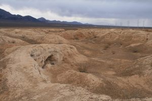
The rugged Sheep Range extends some 40 miles north-south and dominates the publicly accessible part of the Refuge. It consists largely of limestone bedrock that weathers into spectacular cliffs and ragged spires. The range supports a ponderosa pine forest in the higher elevations, while at lower elevations there is extensive pinyon-juniper forest, and at even lower elevations extensive Joshua tree and yucca stands. A typical Mojave desert flora is present in the lowest elevations of the refuge

The refuge is mostly managed as wilderness with limited vehicle access. Only two primitive roads, the Alamo Road and the Mormon Well Road, cross the public part of the Refuge, and each has only a handful of spur roads. Off-road motorized travel is not permitted. However, backcountry travel on foot, including backpacking, is allowed.

The Refuge headquarters is at Corn Creek on the south side, where there is a visitor center with a large museum and even a gift shop. There are also several short trails to natural and historic sites, some of which are ADA accessible. These trails stress the historical importance of the springs at Corn Creek to wildlife, Native Americans, and early settlers in this extremely arid area.

Related Tags

Nature Animals Wildlife Sanctuaries

Know Before You Go

The main access is through Corn Creek. It is not recommended to come in via the Alamo or Mormon Well roads on your first visit! To get to Corn Creek, take US-95 north 9.4 miles from the intersection with State Route 157 (the Kyle Canyon road). The turnoff is on the right and should be well marked. It is now 3.6 miles to the Visitor Center. Although the road is paved to the Visitor Center, the roads onto the Refuge beyond are very rough, with high clearance required at a minimum and in some cases also 4wd. A spare is a must, and be sure to fill up beforehand. Bringing plenty of water is also strongly recommended.

A primitive campground is located at Desert (Mormon) Pass, 28 miles from Corn Creek on the Mormon Well Road. It has 6 sites and vault toilets but no water, but there is also no fee. Car camping ("boondocking") along established roads in existing turnouts is also allowed with no fee.

Although there are only a few designated hiking trails, cross-country hiking and back-country camping are allowed without a permit. Dogs on lead are also OK. However, fires are not allowed in the backcountry, although backpacking stoves are permitted. Water is also extremely limited in the backcountry--there are very few springs, and no perennial streams--and adequate amounts must be brought. Also, any spring water must be treated.

Community Contributors

Added By

slgwv

Published

March 14, 2023

Edit this listing

Make an Edit
Add Photos
Desert National Wildlife Refuge
16001 Corn Creek Rd
Las Vegas, Nevada, 89166
United States
36.438685, -115.360222
Visit Website
Get Directions

Nearby Places

Tule Springs Fossil Beds

Las Vegas, Nevada

miles away

Tule Springs Ranch

Las Vegas, Nevada

miles away

Ice Age Fossils State Park

Las Vegas, Nevada

miles away

Explore the Destination Guide

Photo of Las Vegas

Las Vegas

Nevada

Places 46
Stories 15

Nearby Places

Tule Springs Fossil Beds

Las Vegas, Nevada

miles away

Tule Springs Ranch

Las Vegas, Nevada

miles away

Ice Age Fossils State Park

Las Vegas, Nevada

miles away

Explore the Destination Guide

Photo of Las Vegas

Las Vegas

Nevada

Places 46
Stories 15

Related Places

  • Cors Dyfi

    Machynlleth, Wales

    Cors Dyfi

    Ospreys visit this location every year to nest.

  • Bardia National Park

    Nepal

    Bardia National Park

    This park is the prime habitat for Nepal’s Bengal tigers.

  • A giant anteater in its natural habitat the Cerrado grasslands, Serra Da Canastra.

    São Roque de Minas, Brazil

    Giant Anteaters of Serra da Canastra

    This breathtaking national park is one of the best places to see the weird and wonderful giant anteater in the wild.

  • Canopy walkway at Lekki Conservation Center.

    Lekki, Nigeria

    Lekki Conservation Center

    This Nigerian nature reserve is home to the longest canopy walkway in Africa.

  • Moon over the Chambal River.

    Jajepura, India

    Chambal River

    An ancient curse kept humans from living on the water, and now it's brimming with rare wildlife and is one of the most pristine rivers in India.

  • This is the elusive Barasingha male deer. This is a young adult with a impressive horn structure.

    Balaghat, India

    Barasingha of Kanha National Park

    This reserve is the only place in the world where you can see the Barasingha swamp deer in the wild.

  • A patient at the Wild Bird Fund.

    New York, New York

    Wild Bird Fund

    New York City's only wildlife rehabilitation center treats more than 3,000 feathered and furry patients each year.

  • Khustain Nuruu National Park

    Mongolia

    Khustain Nuruu National Park

    The grassy landscape is home to the world's last truly wild horses.

Aerial image of Vietnam, displaying the picturesque rice terraces, characterized by their layered, verdant fields.
Atlas Obscura Membership

Become an Atlas Obscura Member


Join our community of curious explorers.

Become a Member

Get Our Email Newsletter

Follow Us

Facebook YouTube TikTok Instagram Pinterest RSS Feed

Get the app

Download the App
Download on the Apple App Store Get it on Google Play
  • All Places
  • Latest Places
  • Most Popular
  • Places to Eat
  • Random
  • Nearby
  • Add a Place
  • Stories
  • Food & Drink
  • Itineraries
  • Lists
  • Video
  • Podcast
  • Newsletters
  • All Trips
  • Family Trip
  • Food & Drink
  • History & Culture
  • Wildlife & Nature
  • FAQ
  • Membership
  • Feedback & Ideas
  • Community Guidelines
  • Product Blog
  • Unique Gifts
  • Work With Us
  • About
  • FAQ
  • Advertise With Us
  • Advertising Guidelines
  • Privacy Policy
  • Cookie Policy
  • Terms of Use
Atlas Obscura

© 2025 Atlas Obscura. All Rights Reserved.