Trips Places Foods Stories Newsletters
Loading...
Loading...
Loading...
Loading...

No search results found for
“”

Make sure words are spelled correctly.

Try searching for a travel destination.

Places near me Random place

Popular Destinations

  • Paris
  • London
  • New York
  • Berlin
  • Rome
  • Los Angeles
Trips Places Foods Stories Newsletters
Sign In Join
Places near me Random place
All Sweden Sweden's Geographical Midpoint
AO Edited

Sweden's Geographical Midpoint

The "geometrical" center of the country, as calculated in 1947.

Torpshammar, Sweden

Added By
CoolCrab
Email
Been Here
Want to go
Added to list
CAPTION
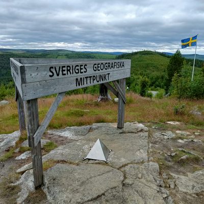
You can’t miss the sign, flag, and pyramid.   CoolCrab / Atlas Obscura User
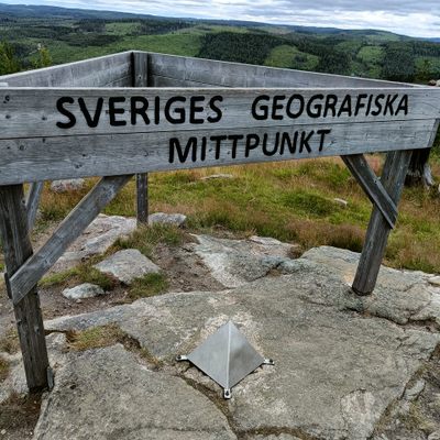
How does it feel to be in the middle?   CoolCrab / Atlas Obscura User
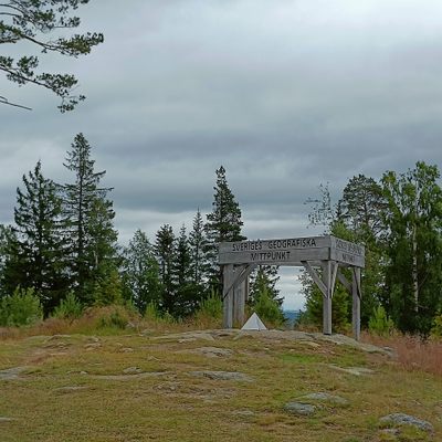
The midpoint is on top of a mountain, providing sweeping views.   CoolCrab / Atlas Obscura User
Been Here
Want to go
Added to list

About

Calculating the center of a country is a difficult and often controversial task. There are many different methods of finding such a point, varying in complexity and popularity. The midpoint at Flataklocken is the "geometrical" center of Sweden, which accounts for the country's islands without measuring the water in between. 

Geographers Nils Friberg and Tor Andeldorf of Stockholm University calculated the point in 1947. They did so using a rigid map of the country that had the islands of Öland and Gotland attached to the mainland. Friberg and Andeldorf moved a needle under the map until they landed on a spot where the shape balanced. This, going by their method, was Sweden's geographical center, or Sveriges geografiska mittpunkt.

With the midpoint decided, a group including Allt magazine editor Gustaf von Platen, explorer Hans Ostelius, and orienteer Gösta Lagerfelt trekked out to mark it. Today there is a modest metal pyramid, wooden sign, and Swedish flag at the mountaintop spot. A small restaurant beside the midpoint serves hungry adventurers.

Related Tags

Cartography Signs Pyramids Midpoints Geographic Markers

Know Before You Go

A standard car can handle the mostly paved roads to the midpoint, but note that the last part is a dirt road with many curves.

Community Contributors

Added By

CoolCrab

Published

August 12, 2022

Edit this listing

Make an Edit
Add Photos
Sweden's Geographical Midpoint
Torpshammar, 840 13
Sweden
62.38663, 16.321306

Nearby Places

Bureplatsen

Sundsvall, Sweden

miles away

King Chulalongkorn Memorial

Ragunda S, Sweden

miles away

The Dead Falls of Lake Ragunda

Jämtland, Sweden

miles away

Explore the Destination Guide

Photo of Sweden

Sweden

Europe

Places 383
Stories 42

Nearby Places

Bureplatsen

Sundsvall, Sweden

miles away

King Chulalongkorn Memorial

Ragunda S, Sweden

miles away

The Dead Falls of Lake Ragunda

Jämtland, Sweden

miles away

Explore the Destination Guide

Photo of Sweden

Sweden

Europe

Places 383
Stories 42

Related Places

  • Pointe de Almadies sign

    Dakar, Senegal

    Pointe de Almadies

    This beach in Senegal marks the westernmost point on the African continent.

  • Sign at the Cape of Good Hope

    Cape Town, South Africa

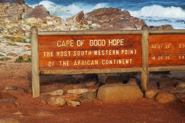
    The Most Southwestern Point of Africa

    The Cape of Good Hope is not quite as low as you can go on the African continent, but it's still geographically significant.

  • The Belgrade Milestone

    Belgrade, Serbia

    Belgrade Milestone

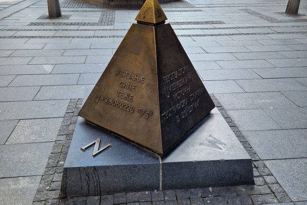
    This small bronze pyramid marks the center of Belgrade, but some say it is a Masonic symbol.

  • Markleysburg, Pennsylvania

    Old Tri-State Monument

    This original Mason-Dixon line cairn placed in the 1760s was put in the wrong location because of the gravitational pull of the Allegheny Mountains.

  • Disk marking the Idaho Initial Point

    Kuna, Idaho

    Idaho Initial Point

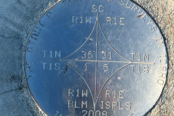
    A volcanic core jutting above the plain between the Snake and Boise Rivers, a marker identifies the reference point for all U.S. Government Surveys in Idaho.

  • North face of the monument.  170 miles, 47 chains from Oregon to here.  A “chain” is 66 feet, so there are 80 chains in a mile.

    Verdi, Nevada

    Von Schmidt Monument

    An iron monument on the 120th meridian as surveyed, one of only four marking the boundary between Nevada and California north of Lake Tahoe.

  • Repère Pierre du Niton

    Geneva, Switzerland

    Repère Pierre du Niton

    This stone in Lake Geneva was once the reference point used to determine altitude in Switzerland.

  • The sign before it was covered in stickers.

    Chicago, Illinois

    Beginning (and End) of Historic Route 66

    A journey begins with a single step, and for many, the road-trip of a lifetime started at this Chicago intersection.

Aerial image of Vietnam, displaying the picturesque rice terraces, characterized by their layered, verdant fields.
Atlas Obscura Membership

Become an Atlas Obscura Member


Join our community of curious explorers.

Become a Member

Get Our Email Newsletter

Follow Us

Facebook YouTube TikTok Instagram Pinterest RSS Feed

Get the app

Download the App
Download on the Apple App Store Get it on Google Play
  • All Places
  • Latest Places
  • Most Popular
  • Places to Eat
  • Random
  • Nearby
  • Add a Place
  • Stories
  • Food & Drink
  • Itineraries
  • Lists
  • Video
  • Podcast
  • Newsletters
  • All Trips
  • Family Trip
  • Food & Drink
  • History & Culture
  • Wildlife & Nature
  • FAQ
  • Membership
  • Feedback & Ideas
  • Community Guidelines
  • Product Blog
  • Unique Gifts
  • Work With Us
  • About
  • FAQ
  • Advertise With Us
  • Advertising Guidelines
  • Privacy Policy
  • Cookie Policy
  • Terms of Use
Atlas Obscura

© 2025 Atlas Obscura. All Rights Reserved.