Found: A Map of the Entire Internet, As of 1973
It fit on one sheet of paper.
Going through old papers my dad gave me, I found his map of the internet as of May 1973.
— David Newbury (@workergnome) December 10, 2016
The entire internet. pic.twitter.com/0krvYoRGav
Back in the 1970s, David Newbury’s dad, Paul, worked at Carnegie Mellon, one of the leading computer science schools in the country. This was in the very early years of the Internet, back when it was the secret and very small ARPANET, which had started in the late ’60s, with just four locations. By 1973, it had expanded to a small handful of government labs, research universities, and private companies—but still so few that the entire network could be mapped on a single sheet of paper.
Recently, Newbury found that map among his dad’s papers and posted it online. You can find Stanford, UCLA, Utah and UCSB, the original members, but by 1973, ARPANET had expanded east, to Case Western, Carnegie Mellon, Harvard, and MIT. There are government labs, like Lawrence Berkeley National Lab and the Army’s Aberdeen Ballistic Research Lab, and private research organizations like MITRE and Xerox.
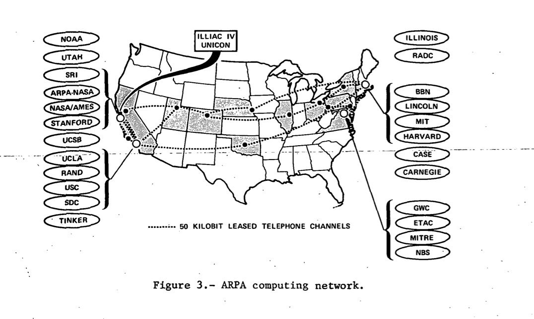
The map Newbury found was printed in a report from the NASA Ames Research Center, which also included this map, showing the geographical spread of the network. (Thanks, Cameo Wood, for pointing this out!)
After Newbury posted his map, a couple of others showed up on the same thread. Here’s one of the original nodes:
@workergnome @Crell I have this too, which are the original nodes in December 1969, when it went live. pic.twitter.com/okVGnjYiGC
— Deane Barker (@gadgetopia) December 11, 2016
And another early one:
@workergnome @Crell I have this one, which might pre-date it. pic.twitter.com/2hZGwfgUYQ
— Deane Barker (@gadgetopia) December 11, 2016
ARPANET grew quickly, though. By 1977, here’s what the map looked like:
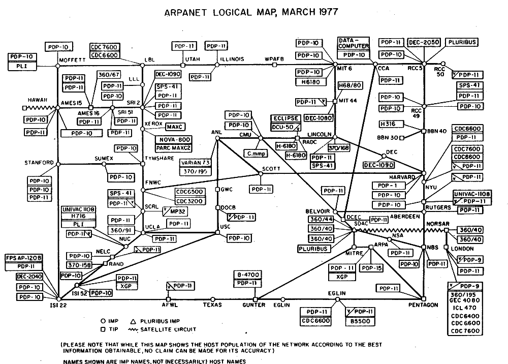
This map, though, came with a caveat. This was the “best information obtainable”—but perhaps not entirely accurate. Already the network was growing so wildly it was impossible to know exactly how far it stretched.


Follow us on Twitter to get the latest on the world's hidden wonders.
Like us on Facebook to get the latest on the world's hidden wonders.
Follow us on Twitter Like us on Facebook