About
Visiting the geographic center of the contiguous United States can leave you feeling quite centered (even if the point as actually measured by the U.S. Coast and Geodetic Survey lies 2,270 feet northwest of the existing marker near Lebanon, Kansas). But to get accurately centered, you must visit the Geodetic Center of the U.S., the point that takes into account the curvature of the Earth.
The geodetic center is actually about 43 driving miles away from the geographic center. To understand why, picture peeling an orange and then trying to press the peel flat on a table. It doesn't work so well; you have to keep cutting the peel so it will lie flat with no bumps. That's what mapping Earth is like: taking a highly complex three-dimensional shape and turning into a two-dimensional representation. Points on maps must be given coordinates, and those coordinates must correspond to actual places in order to not confuse. And to make accurate coordinates, you must have an accurate model of Earth.
For that, you need geodesy, the study of the Earth's shape. There are many things to take into account when measuring the planet aside from its surface shape and variation, including mean sea level, air pressure, the gravity field, the angular momentum of the spinning globe, and its moving tectonic plates, to name a few. Since Earth isn't a static and perfect sphere, but actually a lumpy, slightly squat, "oblate spheroid," actually termed the "geoid" (Earth shape), measuring it accurately requires iterations of mathematical and spatial work.
In the early 20th century, geographers realized they needed a more accurate point from which to measure the entire continent to create a coordinate system that didn't overlap or leave gaps. As surveys were being done across the American west and into Canada and Mexico, it was becoming apparent that small inaccuracies were compounding, creating overlapping coordinates and requiring surveyors to make corrections as they went along. It was time to create a new reference point and set things right.
In geodesy, an origination point is called a datum, and this particular point is aptly called the North American Datum. The location was chosen for its centrality (in the U.S.), and it lies near the intersection of two transcontinental arcs of triangulation for surveyors. From 1913 to 1989, the point was "recovered" repeatedly, acting as a reference point for further improvements in accuracy. In 1983, the datum was revised to include information from satellites (GPS). It remains the most accurate reference point for North America and is still in use by several government agencies including the U.S. Geological Survey.
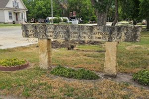
A sign marking the Geodetic Center of the "U.S." (so dubbed by the Kansas Historical Society even though the datum was named the Geodetic Center of North America when it was adopted by Mexico and Canada in 1913) now stands in a small park off the highway in the town of Osborne, Kansas. Ironically enough, this location is not precisely the geodetic center of the continent either. The actual triangulation point, marked by a bronze disc, lies on Meades Ranch, a private property some 20 miles to the south. The marker in Osborne is a replica.
Related Tags
Know Before You Go
The historical sign and replica marker are located along a side road off W 80th Drive, across the street from Crossroads Inn. The actual location of the datum marker is on private property at Meades Ranch some 18 miles away. It is not open to the public, but you could try contacting the current owner of the ranch to schedule a visit.
Community Contributors
Added By
Published
June 7, 2019
Sources
- https://www.jstor.org/stable/pdf/3625750.pdf?seq=1#page_scan_tab_contents
- https://www.ngs.noaa.gov/cgi-bin/ds_mark.prl?PidBox=kg0640
- http://www.penryfamily.com/geographicalcenters/meadesranch.html
- https://www.google.com/maps/place/Meades+Ranch+Triangulation+Station/@39.2235421,-98.5423132,172m/data=!3m1!1e3!4m5!3m4!1s0x87a2590e2df45ab5:0x470440c92d240808!8m2!3d39.2240928!4d-98.5421607