About
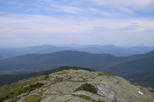
The highest point in both California and the contiguous United States, Mount Whitney is 14,505 feet above sea level, but can be a surprisingly easy climb if you have the right permit. That being said, there's other things to watch out for in the absence of falling rocks and treacherous inclines. Even stopping to enjoy a sandwich in the wrong spot can be dangerous.
Four days after the very first trail to the summit was completed in 1904, Bryd Surby became the mountain's first hiking victim. An employee of the U.S. Bureau of Fisheries, Surby had just finished a simple yet rewarding hike up the brand new trail and found a comfy spot on the summit to enjoy his lunch in the clean, fresh air. Before he could make the return trip, he was struck dead by a bolt of lightning.
Surby's unfortunate demise inspired the construction of the Smithsonian Institution Shelter, also known as the Mount Whitney Summit Shelter. Built in 1909, the three-room granite shelter was constructed not only to give hikers a safe haven from the storms, but also to act as housing for scientists camped out on the summit to study altitude, a very intriguing subject at a time when high altitude flight was just on the horizon. Gustave F. Marsh, the builder of the first trail that brought Surby's to his end, built the shelter with help from both the Smithsonian Institute as well as the Lick Observatory. The small stone hut has been the setting for many exciting studies. One intriguing example was Charles Greeley Abbot's spectroscopic observations of Mars, which investigated whether or not the planet had water.
The Summit Shelter is on the waiting list for consideration to become a National Historic Landmark. Ironically enough, it has recently been deemed less than ideal as a shelter from lightning. Hikers are warned against using it for that purpose.
Related Tags
Know Before You Go
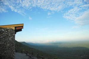
To the Whitney Portal trailhead, from Route 395 in Lone Pine, CA, take Whitney Portal Road west 11 miles to the Whitney Portal Store. It is an 11 mile hike on the Mount Whitney Trail to the summit. There is a campground at Whitney Portal, and two along the trail - Lone Pine Camp, and High/Trail Camp. The latter two can help split the 22 mile hike into a couple of days. However, just like the Whitney trail itself, they require reservations ahead of time.
The hike may not be that challenging compared to other climbs, but it's still not an easy feat. To avoid overuse, only a limited number of permits are granted, and those are dispersed through a lottery system. If you're one of the lucky ones that get a permit for the Mount Whitney Trail between May and November, you'll need sturdy hiking boots, food and water, and camping gear if you plan to backpack. This trail is usually free of snow from July to late September.
Even though this is an "easy" hike, that does not mean hikers should come unprepared. Severe thunderstorms may strike in summer. Weather may be warm and calm or cold and very windy. Campers should have their food secured in a bear canister to keep it from the occasional hungry bear and an onslaught of marmots.
Published
July 3, 2013