Along New Zealand’s Demon Trail, a Family Hunts for True ‘Wildness’
A couple and their young daughter hike the South Island’s Hollyford Track, enduring rough terrain and vicious sand flies for a glimpse of an untamed world.
Excerpted and adapted with permission from In the Name of Wild: One Family, Five Years, Ten Countries, and a New Vision of Wildness, by Phillip Vannini and April Vannini, with Autumn Vannini, published November 2022 by On Point Press and distributed by the University of Chicago Press.
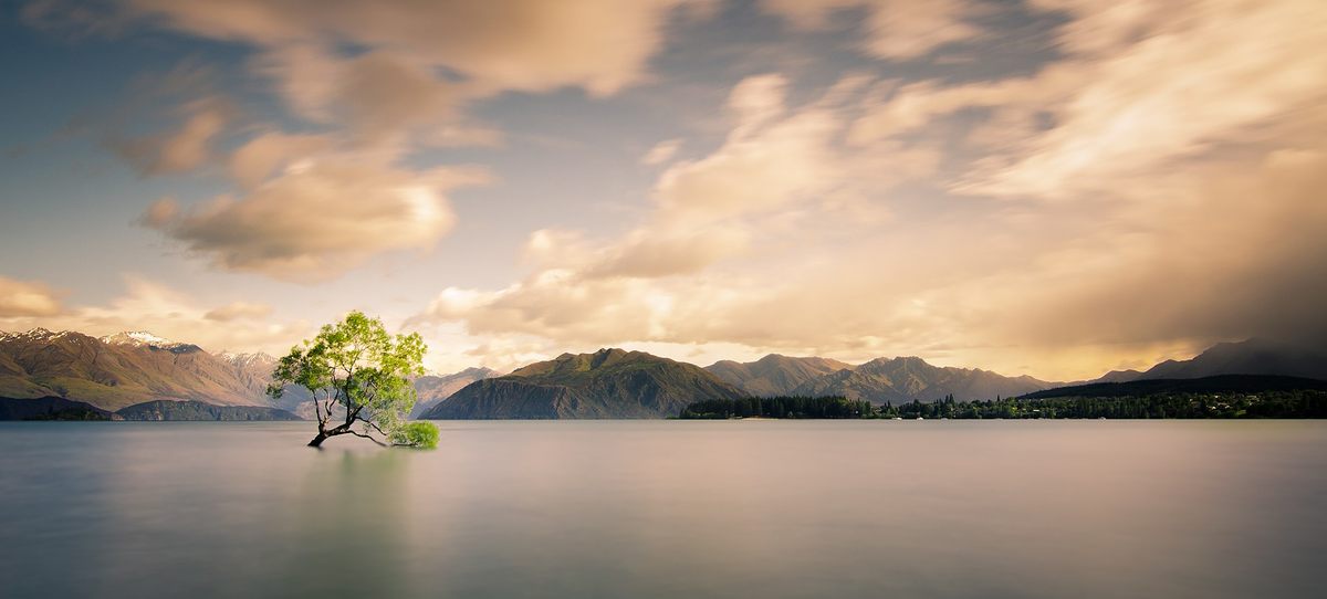
About an hour’s drive from Queenstown, New Zealand’s outdoor leisure capital, lay the pretty and much quieter town of Wanaka, tucked at the end of the eponymous lake. It was there, at their gorgeously stylish home overlooking a distant mountain chain and sweeping valley, that we spoke with Martin Hill and Philippa Jones. We had learned about Martin and Philippa through their environmental artwork. Their projects featured assemblages of found natural materials such as shells, sticks, and rocks that they arranged, balanced, or knotted into mind-bending shapes set against wild landscapes and photographed before the landscape reclaimed them through waves, tides, or other natural processes.
The middle-aged couple—he a British expat and she Kiwi-born—had given extensive thought to the meaning of wildness and had keenly agreed to meet us. “For me, wild is in my consciousness,” Martin reflected as we sipped tea. “I take the wild wherever I go, and wild, to me, is the way nature works.”
Wildness is inherent to any ecological system, he told us. Wildness isn’t something that resides only within animals, or within places, it is a force that could be awakened, or sidelined, depending on how an ecosystem functions. Wildness can come and go. Unlike ideas of virginal wilderness that hinge on the notion that once development occurs, wildness is gone forever, Martin and Philippa told us that wildness could be brought back to a landscape even after it had been scarred by industry. Rewilding, the name of this practice, was, indeed, well-established in Europe and in places where “original” wilderness zones had long been lost.
“However,” Philippa said, “New Zealand is quite unusual in the sense that we have a lot of native flora and fauna, and once you wipe that out with weeds and pest species, you lose it. So, whereas Martin might look at them and think that a piece of ground is wild, it may have actually been destroyed, farmed, and eventually gone back to the first species that colonized it, but I wouldn’t call it wild. Martin comes from a very tamed country.”
Martin smiled. “Yes, that’s why I came here!”
“So, what brought you here,” Philippa asked. “Why did you decide to come to the South Island?”
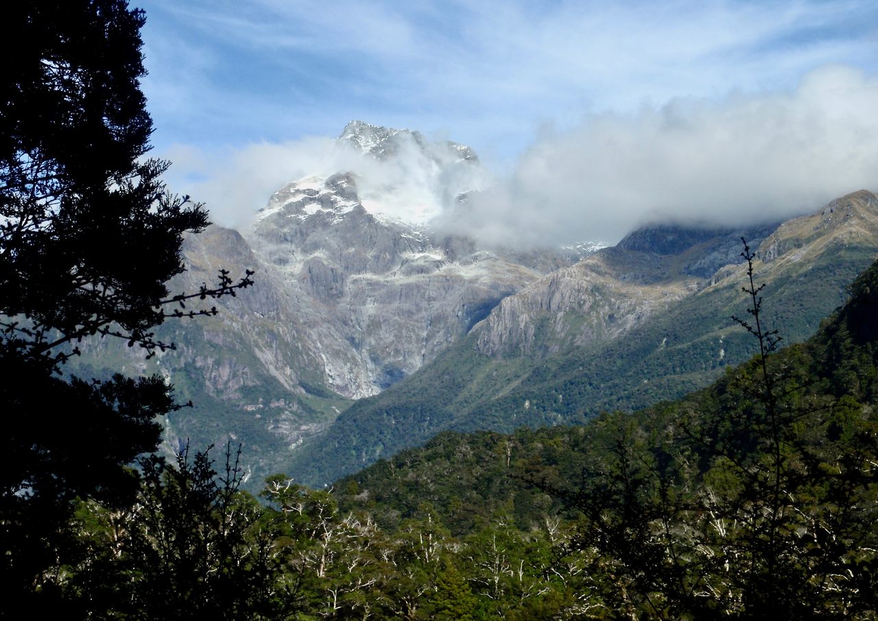
It was Te Wāhipounamu, we told her, the World Heritage Site we hoped would give us our first taste of wilderness. It stretches 280 miles along the southwestern coastline of the island and includes Doubtful Sound, Milford Sound, Aoraki/Mount Cook, and Tititea/Mount Aspiring. It’s reputed to be the home of the world’s best remnants of the original flora and fauna of Gondwana: an ancient megacontinent that encompassed Antarctica, South America, Africa, Madagascar, the Arabian Peninsula, the Indian subcontinent, Australia, and today’s New Zealand.
With sapphire glacial lakes, snow-capped peaks, fast-rushing waterfalls, and deep fjords, Te Wāhipounamu seems mystical and surreal, the ultimate wild place. “If we don’t find wildness here,” we joked with Martin and Philippa, “we may never find it anywhere.”
We had decided to hike the 56-kilometer Hollyford Track. We knew it wouldn’t be easy. The terrain was challenging, with not a single foot of boardwalk. The skimpy Department of Conservation brochure we’d downloaded off the internet back in Canada was also rather vague about a potential issue: three-wire bridges. Whatever they were, it seemed we’d have to traverse a few of them to cross fast-running rivers.
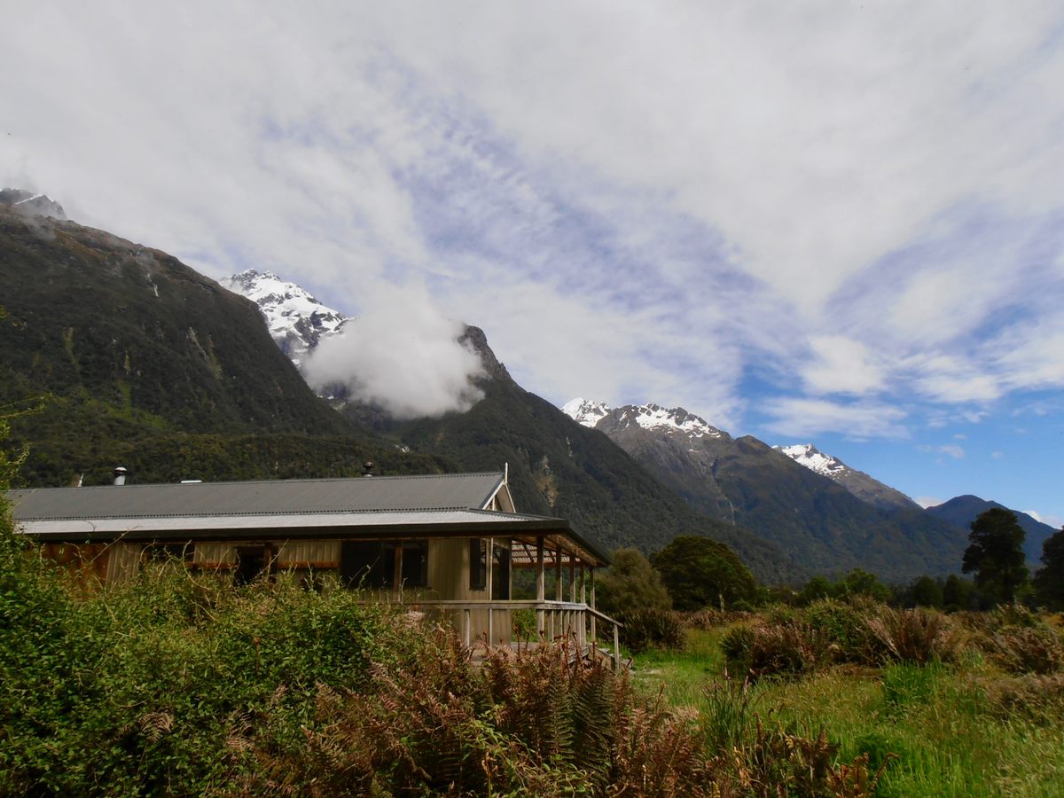
Our five-day itinerary started at the base of the Darran Mountains in Fiordland National Park and ended at Martins Bay on the ocean shore. We had our mixed nuts, our salami, our wraps, and our dehydrated foods. Plenty of water could be collected from creeks. And even though small, unserviced shelters were located along the way, we’d packed tents and sleeping mats and bags. Our only constraint on this trek was that a bush pilot was scheduled to pick us up at the Martins Bay airstrip on January 7, at 10 a.m.
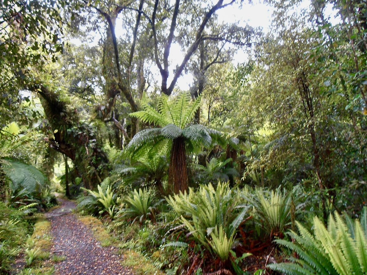
The river we followed for the first two days of our trek was the Hollyford/Whakatipu Kā Tuka. The green depths of its frigid waters rivaled that of the immense fern trees. Mountains still capped in snow cut through the cerulean sky in the distance. Inland scents redolent of the ocean wafted on a breeze. The compact soil, soft but not muddy, was utterly pleasant to tramp.
We reached Hidden Falls Hut—nine kilometers away from where we’d parked our car at the end of Hollyford Road—by lunch. It sits in a field teeming with tall grasses and sand flies. Our first day was in the books. We sliced the salami, filled a wrap each, and ended our lunch with dried fruit and a granola bar.
“Well, what do we do now?” asked Autumn. She lay on a bunk bed inside the hut and looked vaguely bored.
We cast a confused look at each other. Should we open a book? Nap? Conduct a census of the hundreds of sand flies that had snuck into the shelter? Or keep going?
We asked a grumpy-looking Eastern European solo traveler whose bad mood reeked more sharply than our socks. “The next hut doesn’t have as many sand flies. I was just there yesterday.” A glance at the map revealed that Lake Alabaster Hut was 10.5 kilometers away. It felt as though he wanted to get rid of us.
“What should we do?” April asked.
Elevation wasn’t a concern. The Hollyford coasted the river nearly all the way, and the highest point was Little Homer Saddle, a mere 200 meters above sea level. Our brochure told us the first 22 kilometers would be easy. The real trouble would start afterwards, at the beginning of the Demon Trail. As if the name wasn’t enough to make the point, the leaflet spelled out in italics that “this section of the track is maintained to a much lower standard.” It continued: “Use the orange markers on the trees to guide you. It can be muddy, rocky, or wet underfoot. Tree falls may obscure the track. Be aware that after heavy rain the river can flood and you may be stranded in the hut until river levels are lower and it is safe to cross.”
“Ok, let’s go,” April said. “We might end up needing the extra time on the Demon Trail.”
We left Hidden Falls Hut, and the track entered a section of lowland ribbonwood and podocarp forest. Ferns and mosses closed in on us, making the trail narrower and narrower. Then the first uphill ascent presented itself. The tall beech forest trail rose gradually, infinitely longer than any trail should have taken to rise a mere 200 meters in altitude.
Autumn led the way. “Mom, you’re way faster than us on level ground, but I’m faster than you uphill.”
April didn’t respond. She wasn’t feeling well.
“Give me your backpack, honey. I’ll carry it all the way up to the summit.”
She refused. An hour later, we reached the summit of Little Homer Saddle. It was now mid-afternoon. Alabaster Hut, we guessed by looking at the map, had to be another five kilometers away. April was close to fainting. It wasn’t a good sign when, minutes later, she agreed to surrender her backpack. Wondering if we would ever make it all the way to Martins Bay, we resumed walking.
Martins Bay had been a busy Māori settlement between 1650 and 1800. Known as Kotuku to the Ngāi Tahu people, the bay allowed for easy access to the food resources in nearby lakes and forests as well as the sea. Pounamu, or New Zealand jade, was also sourced there and used to make tools such as ornaments and weapons. In 1861, David McKellar and George Gunn explored the Hollyford Valley, and in 1863 Patrick Caples came by looking for gold, becoming the first European to reach Martins Bay. Later explorations yielded favorable reports on the status of other resources in the area, such as iron, copper, zinc, and, of course, timber. Caples recommended that a road be built. Neither the road nor resource exploitation ever happened, but the trail carved in those days eventually gave form to the track we walked.
A kilometer after the summit, we got two major boosts. A park warden announced that Alabaster Hut wasn’t too far, and there’d be no more elevation gain to worry about. “How old is your girl? Ten? That must be a record.” He’d never seen a ten-year-old complete the track.
Then we encountered a group of mostly Europeans and North Americans, dressed in identical t-shirts. During the first six hours of walking, we’d run into only a handful of people. A group of about 20 was quite a sight.
“You’ll see our private hut about half a kilometer before you reach Alabaster Hut. Feel free to stop by for some tea,” said their Kiwi guide. She was leading a three-day “guided wilderness experience,” including cozy refuges furnished with showers, mattresses, and soft pillows; food freshly prepared by the guides; and a speedboat ride on the river alongside the dreaded Demon Trail.
The guided group faded in the distance. “To hell with this,” we said. “Let’s finish this trek on our feet and show these spoiled lazy asses what real trekking is like.” Our pace picked up. An hour later, we passed the fancy hut. On a log by the path, the friendly guide had laid out a plate of cookies and three glasses of orange pop for us. She waved from inside as we marched on.
Five hundred meters past the cookie plate, exhausted from walking 22.5 kilometers, we reached the Department of Conservation hut. A few minutes later, we cooked our dehydrated dinner on our butane stove and fell asleep to a manic symphony of sand flies dancing on our flimsy tent.
The next morning, we woke up late, after a solid 10-hour sleep. No big deal, we thought, we’ll have the trail to ourselves. The path went on in its merry and pleasant way for two to three hours. Our legs were tired from the day before, but our spirits were high. Though we weren’t breaking speed records, we were covering ground in earnest. It was obvious, however, that things might get tough. Why else would the luxury hikers pay good money to dodge the trail by taking a boat?
Dodging the challenge, rather than enjoying it, seemed to run counter to our notion of a wilderness experience. The Western idea of wilderness is deeply interconnected with notions of fatigue, discomfort, inconvenience, and sacrifice. Historically, wilderness began to take root in the Western imagination when urban living became the norm. As cities expanded and urban dwellers became more dependent on the trappings of modern society, a small but growing number of writers such as Henry David Thoreau began penning words about the virtues of excursions to the countryside and the mountains. To spend time away from the city, in closer contact with nature, strengthened the body and reinvigorated the spirit, they wrote. To spend time in the wilderness, they argued, was a way to go back to the basics, to appreciate the pleasures of deprivation in the name of struggling for achievement.
We explained to Autumn that to feel tired was to feel good, nearly quoting Thoreau. She wasn’t listening anymore. She had turned the corner and sped off. Moments later, we caught up with her. She stood still, staring at the three-wire bridge. “Mom, Dad, what the heck is that?”
We exchanged a long look.
“Phillip, what is that? You never told me about this!”
“I did. It’s a three-wire bridge. Remember, we talked about it and then we agreed to not worry?”
“Well, we should have worried! What do we do?”
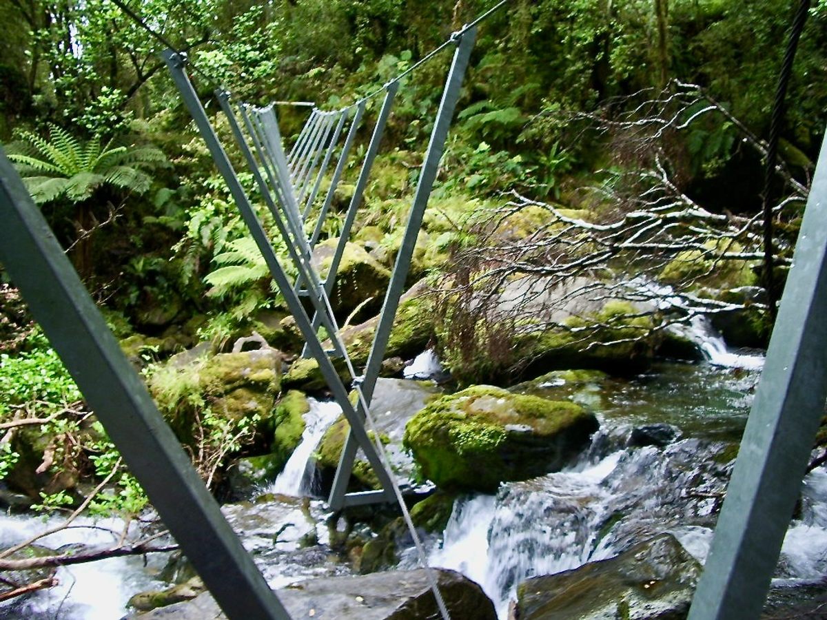
“According to YouTube, we grab the right cable with the right hand, the left cable with the left hand. We need to walk at an angle, kind of like a duck, which will put more body weight on the crossbars that intersect the lower cable. It’s important not to look down at the rushing water because that can be frightening.”
“Your daughter—”
“Yeah, the interesting thing is, she’s at an advantage because of her lower center of gravity, and we just need to reassure her that everything will be—”
“No, I mean, shut up. Look at your daughter, right now! She’s already halfway across the damn thing.”
There Autumn was—15 feet above the creek, 45 feet away from parental safety, and 145 kilometers away from a hospital—duck-stepping her way to the other side of the gorge. We hadn’t even had a chance to give her a proper tutorial. She was already too far for us to intervene (only one person at a time on three-wire bridges, or, well, you die).
It was then that Autumn stopped and turned. She had a blissful look on her face. “This is awesome! It’s like that thing at the playground!”
On the other side of the three-wire bridge, the trail went deeper into inhospitable ground. Smooth compact soil gave way to mud pools. The mud faded into a meshwork of gnarly roots, sharp rocks, and pebbles of every shape and size. More three-wire bridges, less frightening but still time-consuming, lay ahead. And more roots and more rocks.
By that point, the guided hikers must have been toasting the day’s “efforts” with a glass of champagne. We, on the other hand, were nine kilometers into our day’s walk and still six kilometers away from our destination. We were exhausted and cranky.
“We left too late this morning. We can’t make it to the Demon Trail Hut tonight,” I announced.
“What? I don’t want to sleep here,” Autumn whimpered.
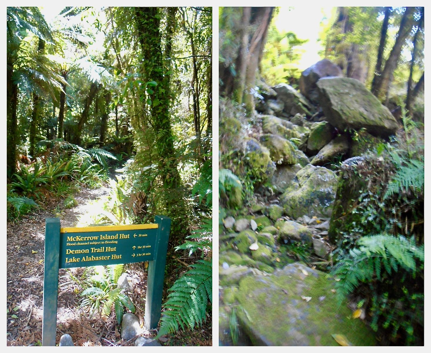
She had a point. Where would we sleep? Laying our tent out trailside would mean sleeping on gnarly roots and pointed rocks. We needed a plan B. We studied the map. A couple of kilometers away, on McKerrow Island, there was a small Department of Conservation shelter. It wasn’t the hut we had set out for, but it had a roof and a floor. It would have to do. With a favorable tide, we could cross the channel and rejoin the trail the next day.
Wilderness is a place. But it’s also a feeling. A large component of that feeling, for a lot of people, is solitude. You don’t have to be completely alone; it’s possible to feel alone when you are in a small group—or a family. For us, feeling alone meant feeling responsible for our own safety, being aware that there was no one to help us, to guide us, to make us feel more comfortable. It felt intensely wild.
We kept walking in silence. Our fatigue drowned out our thoughts. Wildness was in every breath we took in the heavy wind; it was in every wordless feeling we sensed. With nothing but a sandy shore to guide us, we lost sight of the trail. We wandered in search of footsteps, looked for openings in the bush, searched for any sign of the shelter. We studied the map uselessly. Alone, we felt the wildness of the place. When we finally found the shelter, it felt like home.
The trek the following day was short and easy. We made it to the next hut early and decided to rest and recharge. The Demon Trail awaited. “The Demon Trail is an historical cattle track,” announced the Department of Conservation leaflet. It went on menacingly: “It can be difficult underfoot in wet weather, with the track becoming slippery and with loose rocks. Some of the creek crossings can be dangerous, so extreme care is required.”
The next morning, we woke up early and set out after a breakfast of instant coffee and cereal bars. The roots and rocks continued to protest our hike, pressing through our boots with every step and threatening to sprain our ankles every time we took our eyes off them. With no other choice, we soldiered on. The trail passed through a forest of fern and podocarp, dipping dramatically for every creek and rising again sharply. With every step, the terrain worsened. Boulders increased in size, making every step uphill harder on our quad muscles and every stride downhill more injurious on our knees. We slipped. We fell. We slipped. We fell. More rocks, more roots.
Hours later, at last, we reached Hokuri Hut. Our screams of joy and tears of relief startled the occupant of the hut, a lone British chap, who ran toward us to see what on earth was happening.
“We’re okay, mate. Just happy to be here.”
The trek wasn’t over, of course. Our English hut mate, hiking the route in reverse, estimated it would take us about three hours the next day to reach the airstrip. We added an extra hour for safety and set our alarm for five o’clock. The first hour and a half would still be challenging—the last stretch on the Demon Trail followed by an off-track shortcut along the lakeshore. With no way to contact our pilot, we simply had to be at the airstrip by 10 a.m. or risk having to walk back.
We rose the next morning at 4:45. At Hokuri Creek, the river was so low that we decided to wade it near its mouth rather than spending an extra half hour heading uphill to use the three-wire bridge. The waters reached up to our knees. Then we had to find the trail again. Dawn had given way to sunrise, so we could look for footsteps left by hikers the day before. The pebbly lakeshore had enough footprints to give us a sense of comfort, but being alone, without a clear path to follow, made us feel more than ever like we were in a true wilderness.
We saw a small but bright orange marker. The trail—suddenly smooth and easy—took less than an hour from that point to the airstrip. We had made the day’s trek in three and a half hours, without encountering another soul.
Ironically, punishment rather than an award awaited us. New Zealand sand flies, for some odd reason, don’t bite you unless you stand still. After hiking 56 kilometers through hell, pacing the airstrip for an hour and a half to avoid being bitten by the bloodthirsty bastards seemed an odd way to celebrate the end of our hike.


Follow us on Twitter to get the latest on the world's hidden wonders.
Like us on Facebook to get the latest on the world's hidden wonders.
Follow us on Twitter Like us on Facebook