Watch Lightning Burst Around Hurricane Irma’s Eye
NASA’s lightning-mapping satellite might help predict the behavior of massive storms.
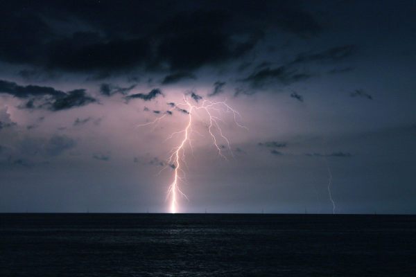
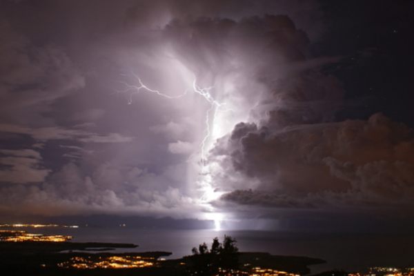
The GOES-16 satellite has been in space for less than a year, but its Geostationary Lightning Mapper has been providing some incredible images and interesting data. Its most recent observations, however, weren’t of a typical electrical storm. GOES-16 captured Hurricane Irma barreling across the Caribbean and bursting with lightning.
Hurricanes combine some of the most severe weather phenomena possible, but lightning is not typically a part of their repertoire. They lack a lot of the vertical winds that rub ice crystals and water droplets together and generate electricity that discharges as a bolt. When a hurricane does produce lightning, like Irma, it’s not a good sign. Studies suggest that when a lightning occurs in a hurricane’s eyewall, the swirling winds around the calm center, the storm tends to intensify rapidly a day later.
Eyewall lightning was observed during Hurricanes Rita, Katrina, and Emily, all large, intense storms in 2005. And GOES-16 got its first view of hurricane lightning very recently, as Hurricane Harvey made landfall as a Category 4 storm. Because the Geostationary Lightning Mapper is so new, the data it collects is still considered experimental, but it’s a promising tool for predicting hurricane behavior and, perhaps, saving lives.


Follow us on Twitter to get the latest on the world's hidden wonders.
Like us on Facebook to get the latest on the world's hidden wonders.
Follow us on Twitter Like us on Facebook