Journey To The Center Of The United States
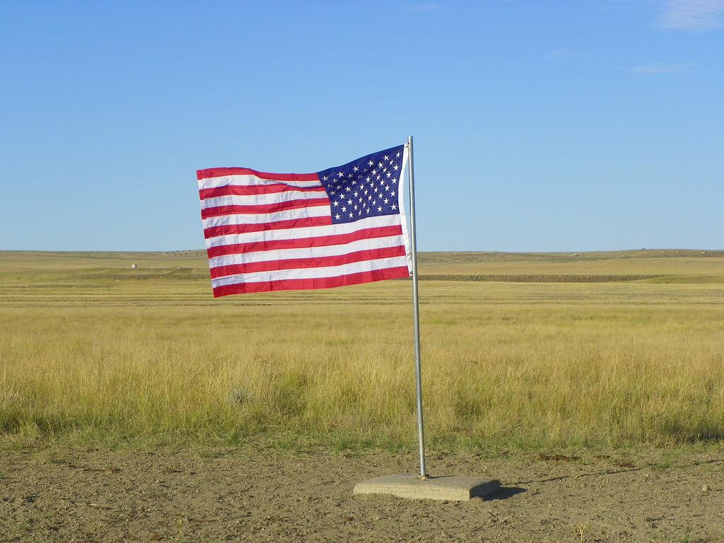
This flag, on a private ranch in Butte County, South Dakota, was first placed there in 1962, as the “real” center of the country. (Photo: J. Stephen Conn/Flickr.)
It’s a question that seems so simple as to be stupid, and yet it’s been the focus of debate among American government scientific agencies for over a century: Where, exactly, is the center of the United States of America?
In 1901, the U.S. Coast & Geodetic Survey decided, with an oddly cavalier attitude, all things considered, that a place called Meades Ranch, in Kansas, would serve as a survey marker roughly representing the center of the country. It was used for various survey calculations from 1927, when the new system went live, until 1983, when it was replaced. A big bronze disc was set into the earth, with a small cross etched in its center. The point of intersection of that cross was an incredibly important point for everyone seeking to map North America, for decades. It still exists.
That point is of value to cartographers and planners and surveyors, but it isn’t really the “center” of the United States, nor was it trying to be. It’s a problem with no particular reward to finding a solution; there’s no logistical reason to answer a mathematical question as thorny as finding the center of an irregular section of a sphere, let alone a section that includes several non-contiguous parts. But there are departments within NOAA, the National Oceanographic and Atmospheric Organization, that decided to tackle the problem.
 “
“
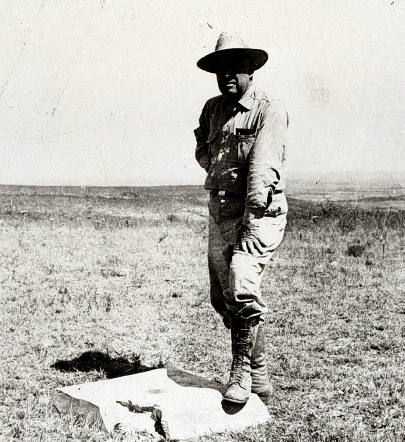
Triangulation station at Meade’s Ranch, circa 1940. (Photo: NOAA.)
A 1959 paper written by Oscar S. Adams, senior mathematician for the United States Coast and Geodetic Survey (a department in NOAA), has been the guide to finding the center of the country ever since it was written. Adams tracks the way the center was found, and it’s about as odd as the question demands.
Finding the center of a land mass gets harder and harder as the land mass you’re trying to measure gets larger. It warps as the curvature of the Earth starts to bend the land mass into a three-dimensional shape. To even begin, you have to flatten this curved land mass, basically a three-dimensional object, into a two-dimensional plane. There are plenty of ways to do that; they’re called “projections,” and they give us our maps. But there is, always, a degree of inaccuracy that comes with turning something 3-D into something 2-D. The specific projection used to determine the center of the country emerged from data points taken from the 1927 survey—the survey that relied heavily on Meades Ranch to create it.
Anyway, using this projection, Adams and his predecessors come up with a 2-D map of the United States. But how? “If the boundary is irregular so that no symmetry is present, then, any attempt to find a center of area will meet with difficulty,” wrote Adams in 1959. It’s not like finding the center of a circle. So the way they figure out the center is by what they term “the center-of-gravity method.” Basically: imagine the entire country is laid out on a piece of cardboard, cut precisely around its borders so you have a perfect, evenly thick map of the United States. Now balance that cardboard map on one point. Wherever it balances, that’s the center. It’s as good a method as any, really.
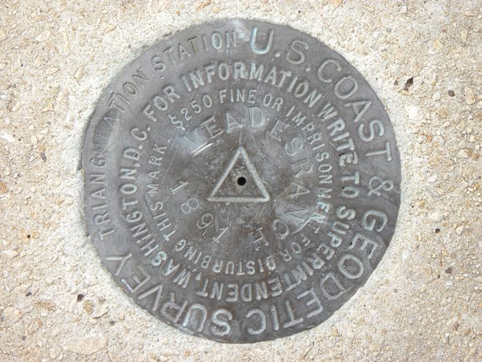
The marker in Meades, Kansas, put in the ground in 1891. (Photo: Jerold F. Penry/NOAA.)
In 1918, following the adoption of Arizona and New Mexico into the country, the U.S. National Geodetic Survey declared, using this center-of-gravity method, the location of the approximate center of the United States of America, which at that time consisted only of what we now consider the lower 48 states. It lies in Kansas, just south of the Nebraska border, near the town of Lebanon, Kansas, population approximately 218. It lies about 40 miles north of Meades Ranch.
The actual point is in a former hog farm, but about half a mile away, the town of Lebanon constructed a small stone pyramid with a plaque and a flagpole. “There really isn’t very much to see or do at the Geographical Center of the United States,” writes Keith Stokes, who maintains a website focused on Kansas attractions.
The addition of Alaska and Hawaii to the Union threw off all the calculations. Oscar Adams, from NOAA, redid the math, balancing his cardboard cutouts of enormous Alaska and teensy Hawaii along with the contiguous 48 states. The distances from these two new states to the lower 48 were discarded; Hawaii is so far away from the rest of the states that had he included that vast expanse of Pacific Ocean separating us from Hawaii, the center would have been somewhere in the ocean off the coast of California. Instead he treated Alaska and Hawaii as if they bordered the states of Washington and California, respectively, erasing the thousands of miles of Canadian wilderness and Pacific Ocean that actually separate the states.
So many centers. (Photo: Wikimedia Commons.)
A town called Belle Fourche, in South Dakota, was crowned, somewhat shruggingly, by the NOAA as the center of the United States of America, in 1959. In 2007 a huge, 21-foot marble compass was installed at the Belle Fourche Chamber and Visitor Information Center. A nice woman named Eleanor at the Center, who seemed suspicious of me and did not want me to use her last name, told me that the actual center, as denoted by the NOAA, is actually some 20 miles away. “The actual measurements put it 13 miles north on the pavement, then 7.8 miles north on a dirt road, then you crawl through a barbed-wire fence and you walk out into a cattle pasture, which is private property,” said Eleanor. “But the owner doesn’t care if you want to take your chances with the rattlesnakes.”
The center of the nation monument is prestigious in the way that superlative yet arbitrary things can be, and the town of Belle Fourche is quite proud of it; Eleanor is sending me a bunch of brochures in the mail about it. But the mathematicians at NOAA were more amused by the whole issue than anything else. “As a matter of fact, the conclusion is forced upon us that there is no such thing as the geographical center of any state, country, or continent,” wrote Oscar Adams. “The point determined will depend entirely upon the definition given by the one making the computation.” Adams, seemed kind of mystified by why anyone would want to know this question in the first place. “It is a conception that depends almost entirely for its existence upon the curiosity of mankind,” he wrote.
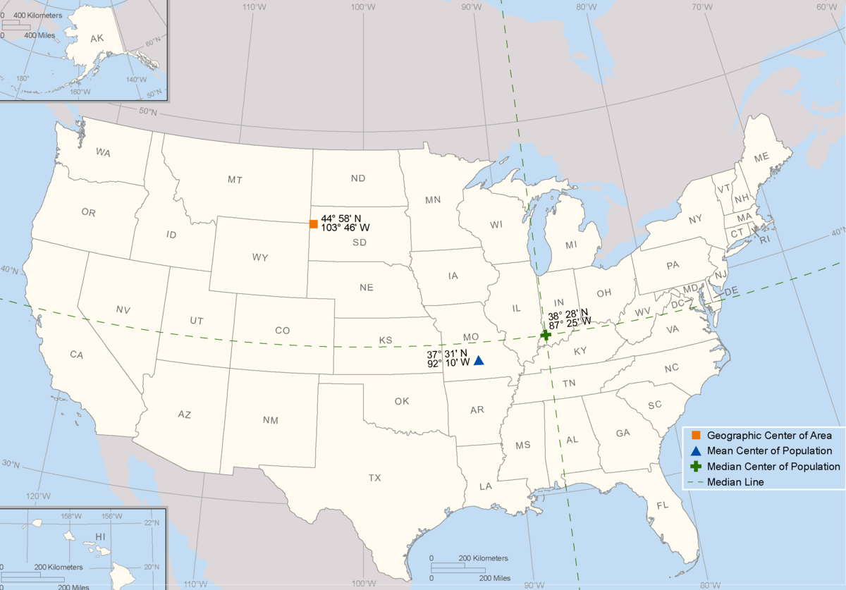
BONUS: There is another center that the U.S. government keeps tabs on—the center of population. As you can tell from the interactive map below, the population center is always changing, with the Census bureau releasing a new place every ten years. As of 2010, it was near the town of Plato, Missouri.


Follow us on Twitter to get the latest on the world's hidden wonders.
Like us on Facebook to get the latest on the world's hidden wonders.
Follow us on Twitter Like us on Facebook