Locating One’s Place in the World: Macro & Micro Cartography Across the Ages
If Merriam-Webster defines geography as “a science that deals with the description, distribution, and interaction of the diverse physical, biological and cultural features of the earth’s surface,” and cartography as “the science or art of making maps,” my interests lie in where locating one’s position in the world becomes an art, and how that artistic pursuit has drastically changed over time.
(source: Hand Drawn Map Association)
In the past, figuring out one’s place in the world was very individual-centric. Ancient mapping technologies (now virtually extinct!) practiced by indigenous cultures around the globe focused on producing three-dimensional, tactile maps depicting only the information most pertinent for the task at hand. They were well-designed works of art that made the most of all five of the user’s senses.
Inhabitants of the Marshall Islands, Polynesia, and Micronesia used open-woven coconut fronds and strings to create depictions of island chains and the major ocean swells in relation to tides. Usually the stick maps were so personalized that it was up to the individual who created it to use it 100% accurately.
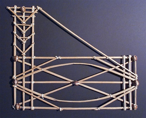
(source: No Tech Magazine)
Or, take for instance, the three-dimensional maps carved from wood used by the Inuit for navigating island chains at night by kayak. The carved edges depicted the shoreline as viewed from the sea, rather than viewing the ocean only in context as the element defining the outer edges of the land.
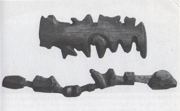
(source: Pencil and Pipette)
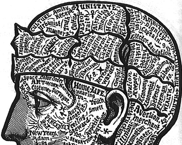
As the world began to feel smaller and smaller during the Victorian era, curiosity turned inwards. If cartography can be understood as any way of creating an overlay of the world, the science of anatomy stands as cartography of the body; rather than mapping our place in the world, anatomy maps the world contained within.
An early example of such inward-facing cartography was Dr. Alesha Sivartha, whose stunning depictions of the world inside our bodies include such gems as:
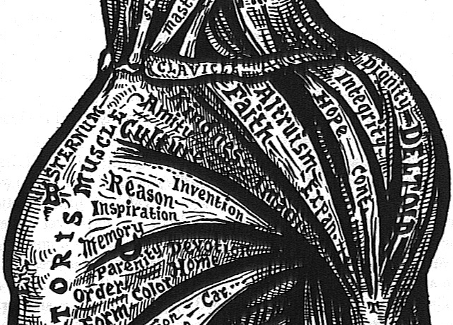
(source)
The biological accuracy (or lack thereof) isn’t the point. Sivartha’s work demonstrates a higher understanding of society’s influence on our inner workings, including locating one’s sense of self amidst the turmoil. In his representations, the world is literally internalized and compartmentalized until it becomes what makes us… us.
(source)
When it comes down to it, we are, after all, but a speck on the planet, trapped within our bodies looking outward and inward. Our geographical situation – and consequential representations thereof – are therefore inherently subjective.
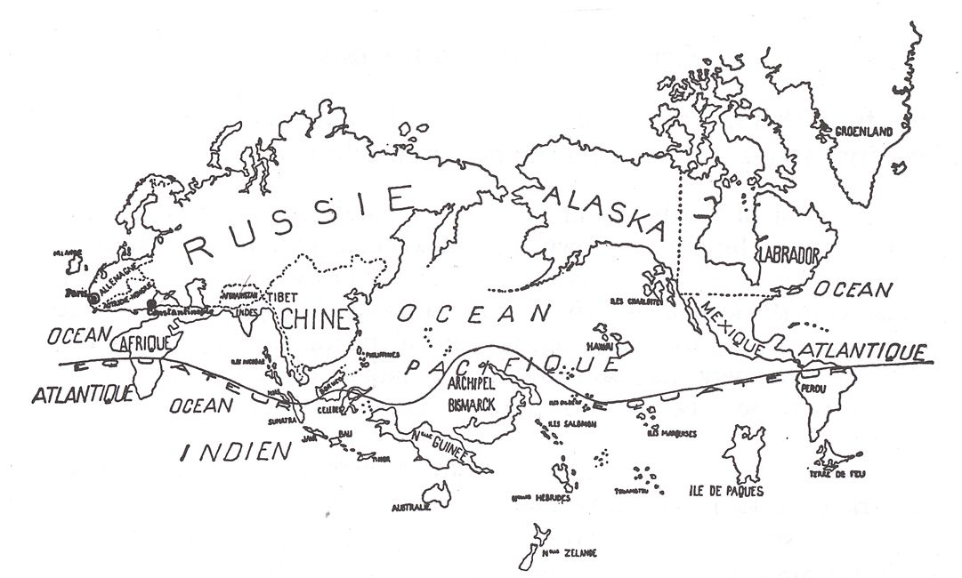
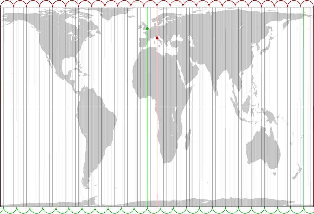
Because of this fact, it’s a damn shame school has ingrained in us that the Mercator Projection (or Gall-Peters Projection, if you went to a private hippie school like yours truly) is the end-all, be-all of the understanding of our world.
(source)
Regardless, the more we discover about how we humans fit into this mad, mad world, the more there is to know! That’s the exciting part. Satellite imaging, the Large Hadron Collider, MRIs… these are all technologies built with the express purpose of mapping out heretofore-unseen crannies of our existences, both internal and external!
.jpg)
(source)
Beyond the previous examples, there are so many options for the ways we decide to represent our location in the world. Just recently the New York Times featured reader-submitted maps of the subway system, and there’s an entire blog dedicated to alternative, hand-drawn maps. Still in doubt that cartography has long been pigeon-holed into boring depictions of latitude and longitude? Look no further than F-YeahCartography or Strange Maps to blow your mind.
The internet has given geography appreciators a new venue with which to preserve and celebrate the intersection of the history, information, and cartographic arts previously taken for granted.
Let us not lose what we once knew in our quest to learn even more, shall we?


Follow us on Twitter to get the latest on the world's hidden wonders.
Like us on Facebook to get the latest on the world's hidden wonders.
Follow us on Twitter Like us on Facebook