See Photos from the Stunning San Francisco Coal Mine That Hasn’t Been Opened in 40 Years
Looking north toward the Marin Headlands through a small portal. (All photos by Sierra Hartman)
Two hundred feet down the cliff from Deadman’s Point lies an exposed coal vein that, according to the coal miner who discovered it, contains enough fuel to change the face of San Francisco. “I am of the opinion,” the man told the San Francisco Chronicle in 1891, “that it marks the opening of a vein of coal that will develop fully as good as any that can be found on the Pacific slope.”
Found by a lifelong coal miner named Charles Jackson more than 120 years ago, the announcement rocked the young city and sparked a frenzy of development in a remote corner of Land’s End, a popular tourist attraction on the San Francisco Bay. Strangely, little documentation exists about this spectacular find; San Francisco historian John Martini helped us track down a meager three newspaper notices from the time.
Tourists rarely attempt to enter this space, though, and most locals don’t know that it exists. Aside from a few nimble raccoons, it’s likely that no one has seen the inside of this tunnel in more than 40 years, let alone photographed it.
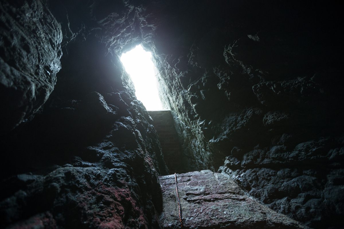
The eastern terminus is nearly sealed from 124 years of mudslides pouring over the tunnel.
Adolph Sutro owned the land where the coal was discovered and, after finding the quality to be higher than anything else on the West Coast, started development of a prospecting tunnel within days of Jackson’s discovery. Meanwhile, Jackson followed the vein north, clear through Marin County, finding deposits of coal the entire way, 30 feet underground. Every indication pointed to a bonanza of high quality coal just on the outskirts of the already booming Gold Rush city.
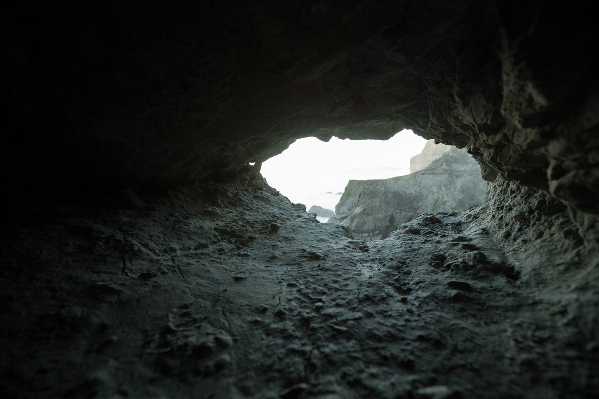
Looking west toward the cave.
Looking east from the eastern terminus.
Until that point, coal of this quality had to be shipped from as far away as Vancouver, British Columbia. Looking at the land now though, it’s clear that the vein was never fully exploited. The reason remains a mystery.
As the land around the tunnel eroded, it became more and more difficult to access until only the most adventurous neighborhood kids would venture into it. The story of the tunnel’s origins faded too. The only fragments of evidence that remain include a handful of newspaper articles from March and April of 1891, worn brick and iron infrastructure, and a 250-foot tunnel bored through solid rock, a portion of which cuts through a thick column of jet black bituminous coal.
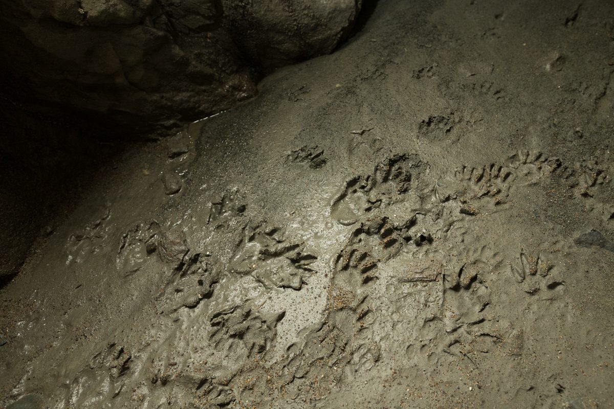
Recent raccoon footprints are evidence of the tunnel’s only regular visitors.
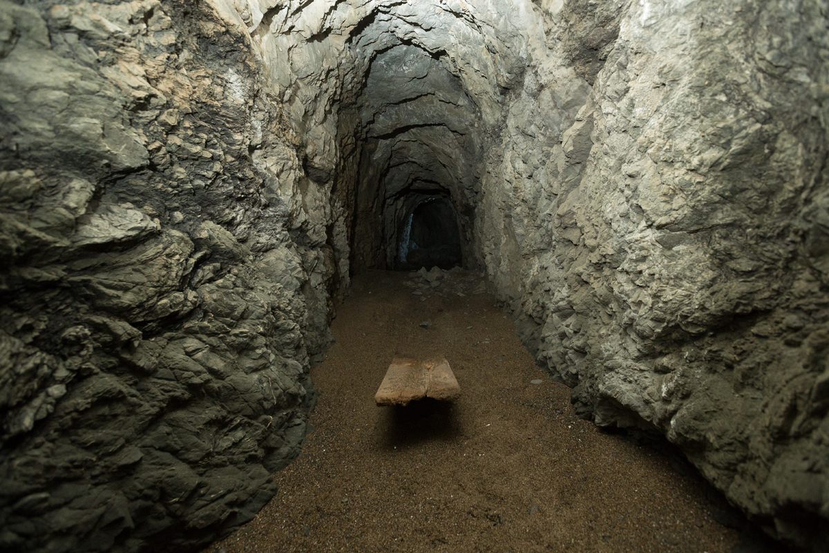
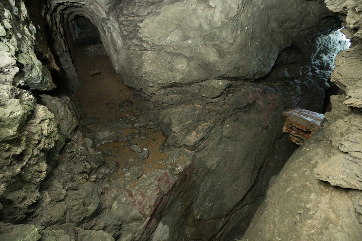
A wooden plank is buried under sand, deposited over decades of high tides washing into the cave.
Looking north from the top of the cave.
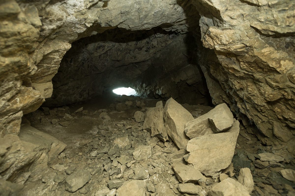
Cave-ins have nearly sealed the eastern end of the tunnel.
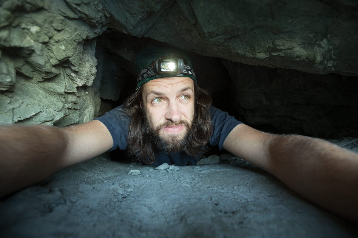
The tunnel was dug parallel to the coastline and was, at one point, accessible on either end by a footpath. Landslides have since taken out the path and portions of the tunnel, leaving it in three broken sections. One of these sections is bisected by a sea cave. This provides the only reasonable access to the tunnel but still involves technical climbing and careful planning. When it was first dug out of the cliff face, the tunnel was about seven feet high and at least four feet wide. A century of earthquakes and stormy weather have taken their toll though. There is clear evidence of cave-ins and some points have been reduced to crawl spaces.
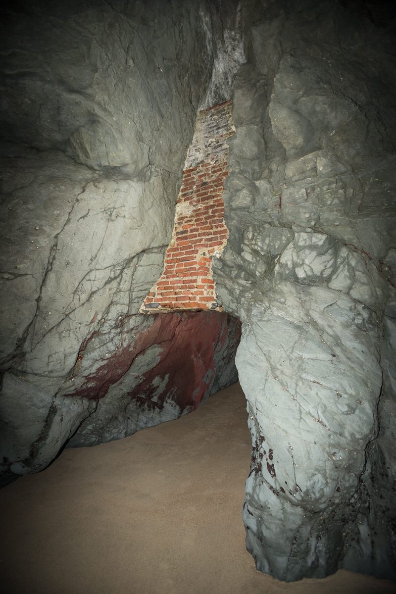
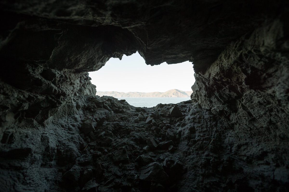
The only access point is a sea cave with remnants of brick and iron infrastructure.
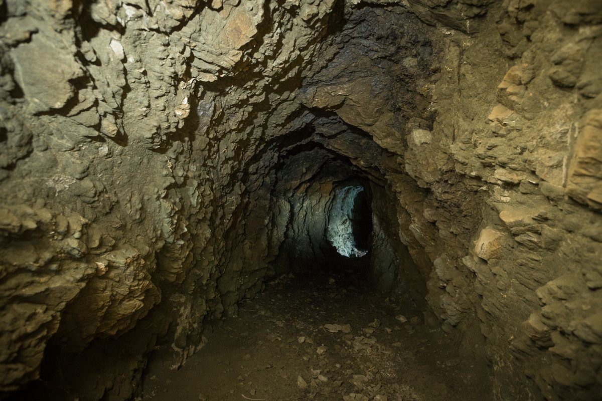
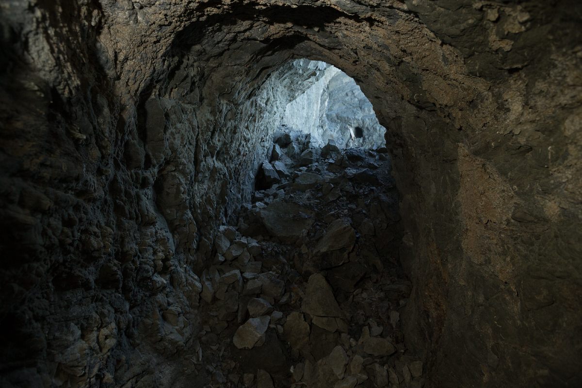
The tunnel’s clear sections were at tall enough to walk through.
Nearly half of the tunnel has been washed away, leaving a long gap between sections.
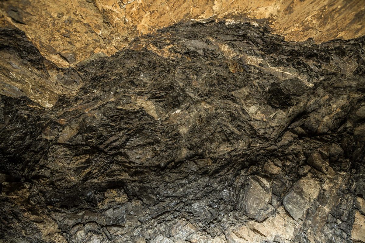
Coal veins are clearly visible.
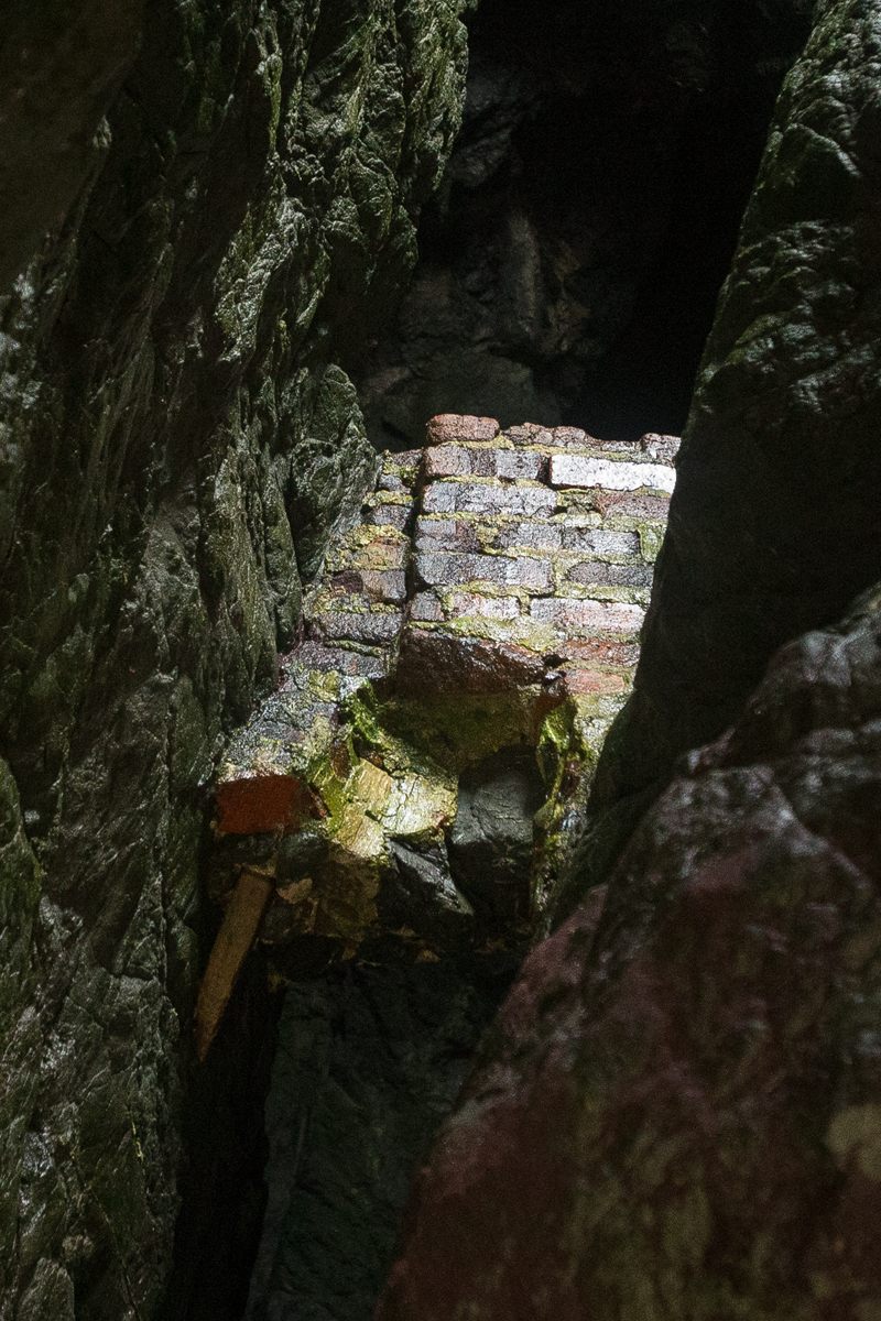
After more than a century of sand and high tides, it’s hard to say what the original structure was used for.
The tunnel and its openings are only visible from the beach below and the beach is only accessible at exceptionally low tides. Depending on the season, the level of sand can also vary dramatically, meaning the difference between walking on dry sand and wading through chest deep tide pools. Even under ideal conditions, it’s extremely important to pay attention to the tides. It’s easy to lose track of time and wind up swimming out instead. If you do decide to explore this piece of San Francisco history, understand that the name Deadman’s Point didn’t just come out of nowhere.


Follow us on Twitter to get the latest on the world's hidden wonders.
Like us on Facebook to get the latest on the world's hidden wonders.
Follow us on Twitter Like us on Facebook