The Father of Medieval Geography Is Unfairly Blamed for One Very, Very Bad Map
He also made the most accurate world map of that time—and left out the sea monsters.
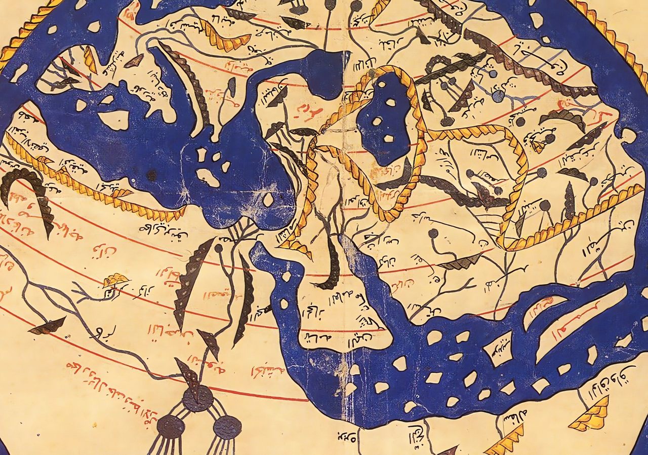
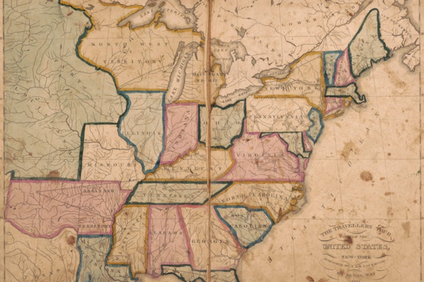
If you know one thing about 12th-century Arab cartographer Muhammad al-Idrisi, it is that he is the author of this wonky world map, which is often included in modern atlases as a prime example of medieval mapmaking skills.
That invites comparisons that do him no favors. Among the hyper-precise maps in today’s atlases, al-Idrisi’s looks like a child’s drawing. His Europe is sketchy, his Asia amorphous, and his Africa manages to be both partial and oversized. Plus, the map is a planisphere—the projection of a sphere onto a flat (and typically circular) plane—which creates the mistaken impression that al-Idrisi was a flat-Earther of the Discworld variety.
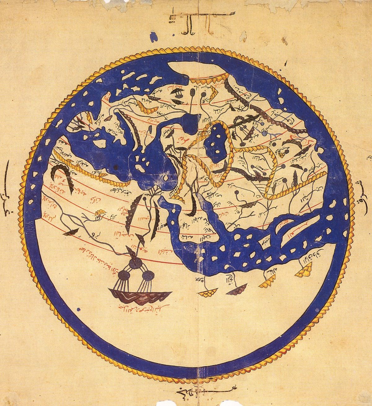
And that’s not all that’s wrong with this map. For starters, you’re seeing it upside-down. As did most Arab maps of that time, this one has south at the top. This was to help recent converts to Islam, most of whom lived north of Arabia, orient themselves toward Mecca. Moreover, this map is not by al-Idrisi himself. It’s a vignette that only shows up in some of the copied manuscripts and isn’t mentioned in the original text of the atlas. That text describes al-Idrisi’s own maps, which are much bigger and vastly more detailed.
So, this little map is a poor summary of a massive talent. Al-Idrisi’s main achievement, a huge atlas known as the Book of Roger, would remain authoritative for hundreds of years. His concept of the upper reaches of the Nile was basically confirmed by 19th-century European explorers. And the man’s biography is as exceptional as his work. Born in 1100 AD in the North African port city of Ceuta, al-Idrisi was the scion of a noble family that descended from Imam Ali, the Prophet Muhammad’s cousin, and thus had a claim to the caliphate. His ancestors had ruled Malaga, in Muslim Spain.

Al-Idrisi studied in Cordoba and traveled widely as a young man, visiting Asia Minor, Hungary, the French Atlantic coast, and even as far north as York, England. In 1138, Roger II, the Norman king of Sicily, invited al-Idrisi to his court at Palermo, possibly to explore whether he could install the Muslim nobleman as a puppet ruler in the bits of North Africa under his dominion, or in Spain, which he hoped to conquer.
As it turns out, al-Idrisi was more valuable as a scholar. Roger engaged him to produce a new and accurate map of the world. This proved to be a huge undertaking and would take 15 years to complete.
With help from the king, the cartographer interviewed ship’s crews and other seasoned travelers, but retained only those stories on which all were in agreement, leaving out the more improbable reports. So, there are no sciapods (a mythical tribe of one-legged people) or other imaginary monsters on al-Idrisi’s map.
Al-Idrisi also consulted older geographic compendia, notably Ptolemy’s Geography, as well as Islamic works. And if all that still left things in doubt, he could always ask the king to send out scouts to check or complement the available information.

The job was finished in 1154. Al-Idrisi had created a world map engraved on a 300-pound, 6.5-foot (2-m) wide silver disk. He also translated the information on that planisphere onto rectangular maps, each of which was exhaustively annotated. That atlas is known in Arabic as Nuzhat al-mushtāq fi’khtirāq āl-āfāq (translated variously as “The book of pleasant journeys into faraway lands,” or “The excursion of the one who yearns to penetrate the horizons”), and in Latin commonly as the Tabula Rogeriana (“Book of Roger”).
Uniquely, it brought together the geographic insights of Greeks, Arabs, and Vikings, three well-traveled civilizations, producing a world map more wide-ranging and, thanks to al-Idrisi’s rigorous methodology, more accurate than any that had gone before.
One of the more intriguing mentions in the Book of Roger is of Irlandah-al-Kabirah (“Great Ireland”), one day’s sailing from Iceland. Considering the Viking input he had, this is quite probably a reference to Greenland.
Al-Idrisi’s atlas consisted of 70 sectional maps covering the entire known world, ten for each of the Earth’s seven climatic zones (a concept borrowed from Ptolemy). Accompanying each map was a description of that area’s terrain, culture, politics, and economy—descriptions that became more succinct the further away the maps were from Sicily.

When compiled together, those 70 maps make up a huge and detailed map of the known world of more than 9 feet (2.7 m) long. This is al-Idrisi’s greatest achievement. The circular world map was only added to later editions of the atlas, and it exists in several versions. The one shown here (and used most often) is from the so-called Istanbul Manuscript, a copy of the Book of Roger made in 1469 by Ali ibn Hasan al-Ajami.
Despite the standard rendition of al-Idrisi’s worldview as a flat disk, the cartographer knew full well the world was round, and in fact in the introduction calculated its circumference as 22,900 miles (37,000 km), within 10% of the actual length (24,901 miles; 40,075 km).
Roger II was able to enjoy the fruits of al-Idrisi’s work for only a short while. He died within weeks of its completion. The original Latin version of the atlas (and the silver disk) were destroyed in 1160 in the chaos of a coup against William the Wicked, Roger’s unpopular son and successor. Al-Idrisi fled to North Africa with the version in Arabic, ensuring that the Book of Roger would remain influential in the Islamic world, by showing the benefits of a scientific approach to mapmaking, based on observation and precision.
Just one example of al-Idrisi’s influence: As one of the first Arab cartographers to mention the Silla dynasty in Korea, he helped fix that kingdom in the imagination of generations of Arab traders as an alluringly rich and exotic destination for trade.

Al-Idrisi’s impact on European mapmaking, on the other hand, was very limited. Had the original Latin version of the Book of Roger survived, Europe’s history of mapmaking and exploration might have turned out differently. The first new translation of the atlas into Latin, by the Maronite scholar Gabriel Sionita and known as the Geographia Nubiensis, was published in Paris as late as 1619. Only in the 19th century, with the rise of academic Oriental studies, did Europeans come to realize that al-Idrisi had produced one of the most detailed and precise world maps of the Middle Ages.
There are only ten manuscript copies of the Book of Roger in existence, of which only five have the complete text. Eight have maps, and six do not have the circular map mentioned in the text itself. The Istanbul Manuscript is the most complete, having all 70 maps.
Al-Idrisi was also called al-Sharif, or “the high-born,” yet despite his noble lineage never wielded power, political or spiritual. His other honorific, “father of geography,” is a shared prize at best. The people of Ceuta know their native son deserves better and should be remembered for more than that simplified planisphere.
That’s why his statue in that city, now a Spanish exclave in Morocco, holds out the larger, more magnificent version of his world map, recomposed of the 70 individual maps that make up his atlas.
This article originally appeared on Big Think, home of the brightest minds and biggest ideas of all time. Sign up for Big Think’s newsletter.


Follow us on Twitter to get the latest on the world's hidden wonders.
Like us on Facebook to get the latest on the world's hidden wonders.
Follow us on Twitter Like us on Facebook