The Boundary Stones: In Search of the Gravestones of Old DC
The South Cornerstone (all photographs by the author)
Hidden in the base of the seawall at the southernmost tip of Jones Point Park in Alexandria, Virginia, lies America’s first federal monument — the South Cornerstone marking the border of the original District of Columbia.
The roads leading to this “boundary stone” eventually turn into smaller bike paths, and the bike paths into unpaved walking trails that are smaller still. It seems unlikely anyone not expressly looking for this piece of history would ever encounter it. The stone itself is small and cylindrical; the words originally inscribed on the surface long since weathered away: “The beginning of the Territory of Columbia.”
The home of the “boundary stone”
At high tide, the stone is partially submerged by the Potomac River, and in the warmer months obscured by overgrowth of semi-aquatic plants. The combination of the metal grating and Plexiglas protecting it keeps out only some of the litter and detritus common along the banks of the river. The top of the boundary stone is visible through a bronze-framed viewing portal adjacent to the Jones Point Lighthouse, but to view it in its entirety, you’ll need to traverse down along the stones jutting out of the water.
The boundary stone seen through its protective window
Although currently identified by a small plaque, the boundary stone is unassuming. You may easily confuse the monument for one of the other nondescript, weather-beaten stones in the remotest part of the park. Other boundary stone locations surrounding the district are found in backyards, forests, and to the side of a shoulderless highway. Do the boundary stones fall short of their roles as historic monuments?
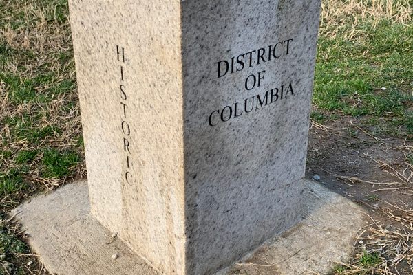
Southwest Boundary Stone 9
The District of Columbia was originally surveyed in the shape of a 10-square-mile diamond by Benjamin Banneker, who laid down the first stone in 1791. (Southwest Boundary Stone 9 is colloquially known as the Benjamin Banneker stone both in tribute to Banneker’s role in the surveying and because the stone is now is located in Benjamin Banneker Park.) The diamond was centered at the intersection the Potomac and Anacostia rivers, encompassing the port cities of Alexandria, Virginia, and Georgetown, Maryland. Yet the current map of DC shows the southern third of the original diamond repossessed below the Potomac River, leaving 14 of the original 40 boundary stones stranded in Virginia. The boundary stones of DC are unique in that the entire city was meticulously outlined by the federal government, rather than the stray stones placed by local authorities to denote boundaries as in other colonial-era cities.
Close-up of the boundary stone
Contrary to popular misconception, this retrocession was not the result of Virginia’s secession during the Civil War. Instead, the land was returned to Virginia by Congress after Virginians lobbied to reclaim it between 1840 and 1846. This was a compromise on Congress’s part to quell the growing tension between pro-slavery Virginia (particularly the slave trade based in Old Town Alexandria) and anti-slavery Washington, DC. Since Washingtonians didn’t — and still don’t — have a voting representative in Congress, the legislation to return Alexandria to Virginia was passed without opposition in 1846.
The boundary stones of DC embody a lot of what I like about urban exploring. Stumbling upon one in an overlooked park, your mind is flooded with thoughts of history. The small plaques that usually accompany these unremarkable stones never tell the whole story, but maybe that’s a good thing, encouraging you to do a bit of reading yourself. With enough digging, a stone like this can tell us one narrative of the story of America’s struggles with slavery, federalism, regionalism, and political representation. The repercussions of these struggles very much impact our lives today.
Here’s a map of all the Washington, DC boundary stones:
FIRST US FEDERAL MONUMENT: SOUTH BOUNDARY STONE, Washington, DC
Sources / Resources:
http://www.boundarystones.org/
http://www.dcdar.org/BoundaryStones.htm
http://www.nps.gov/gwmp/planyourvisit/jonespoint.htm
http://www.boundarystones.org/articles/rchs_1897.pdf
http://www.boundarystones.org/articles/rchs_1969.pdf


Follow us on Twitter to get the latest on the world's hidden wonders.
Like us on Facebook to get the latest on the world's hidden wonders.
Follow us on Twitter Like us on Facebook