The Psychedelic Moon Maps of the 1970s

Geological detail from the Byrgius Quadrangle of the moon. (Image: U.S. Geological Survey)
In the 1960s and ’70s, the U.S. Geological Survey created a Geologic Atlas of the Moon. The series of maps, best viewed while listening to Jefferson Airplane, depicts earth’s only natural satellite in a particularly psychedelic manner, using a full spectrum of colors to show the age and type of rock that makes up the moon’s surface.
The maps were created using a combination of telescopic observations, images captured by lunar orbiters and rangers, and rock samples collected during Apollo missions. They depict the three main topographical features of the moon: craters, highlands, and maria, which are large basaltic plains that formed after volcanic eruptions.
The age of these formations is measured according to the moon’s own geologic time scale, established by astrogeologist Gene Shoemaker. It differs from the geologic time scale of Earth, because it corresponds to impact events that have modified the lunar surface.
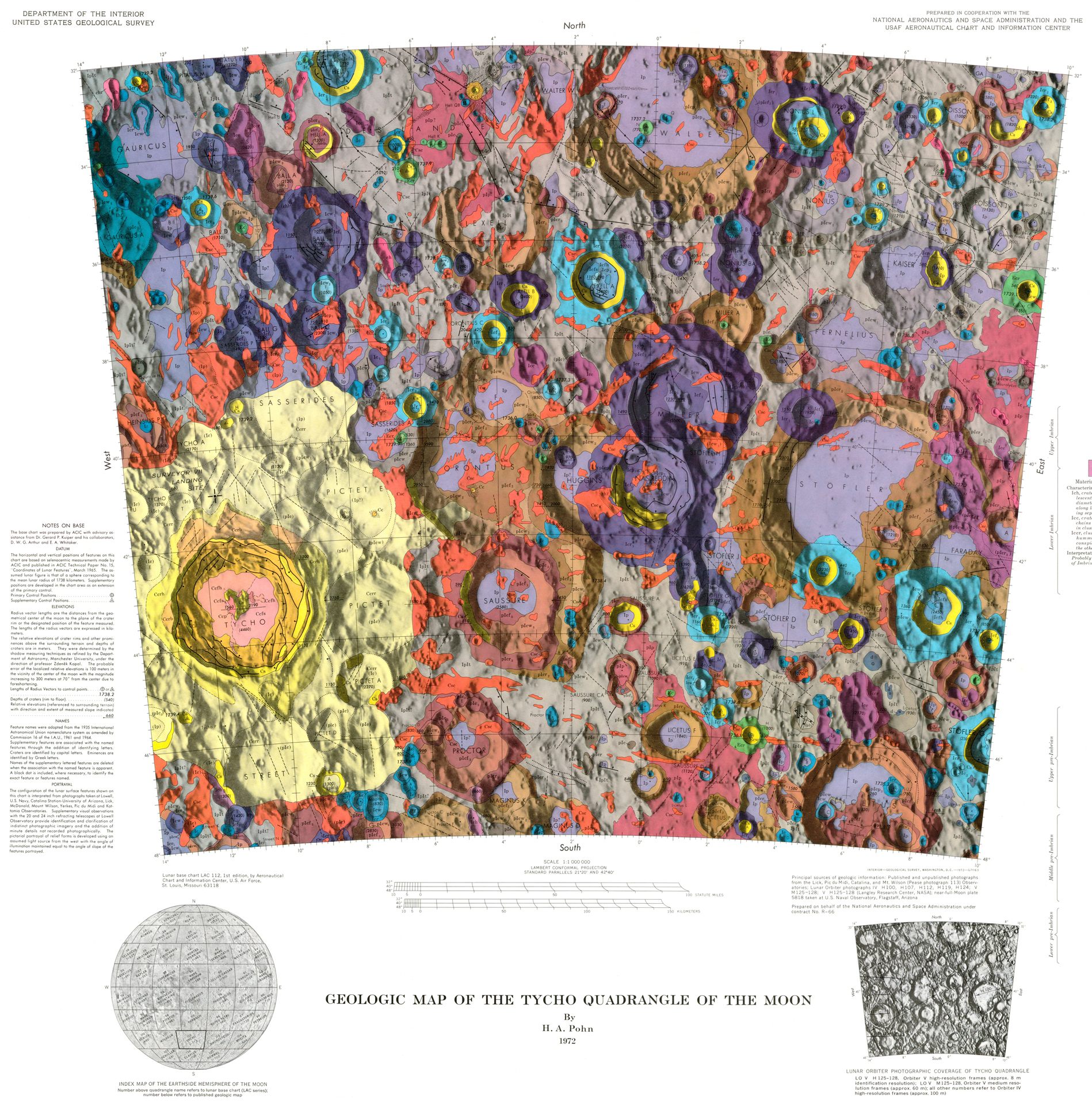
Named after Tycho Brahe, the Tycho impact crater is 108 million years old. Approximately. (Image: U.S. Geological Survey)
The five periods of the moon’s time scale—Copernican, Eratosthenian, Imbrian, Nectarian, and Pre-Nectarian—are also lettered and color-coded on the geologic maps. (Trivia: the study of the surface and physical features of the moon is known as selenography, named after the Greek lunar goddess Selene.)
Below are some of the more vivid maps from the geologic atlas. Once you’ve marveled over the trippy color combos, visit the U.S. Geological Survey moon atlas site for a comprehensive breakdown of what it all means in topographical terms.
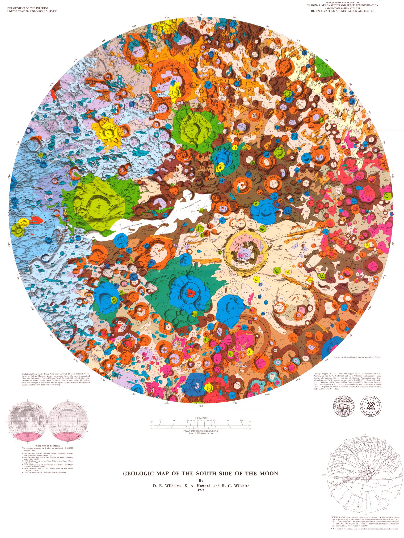 They do things colorfully down south. (Image: U.S. Geological Survey)
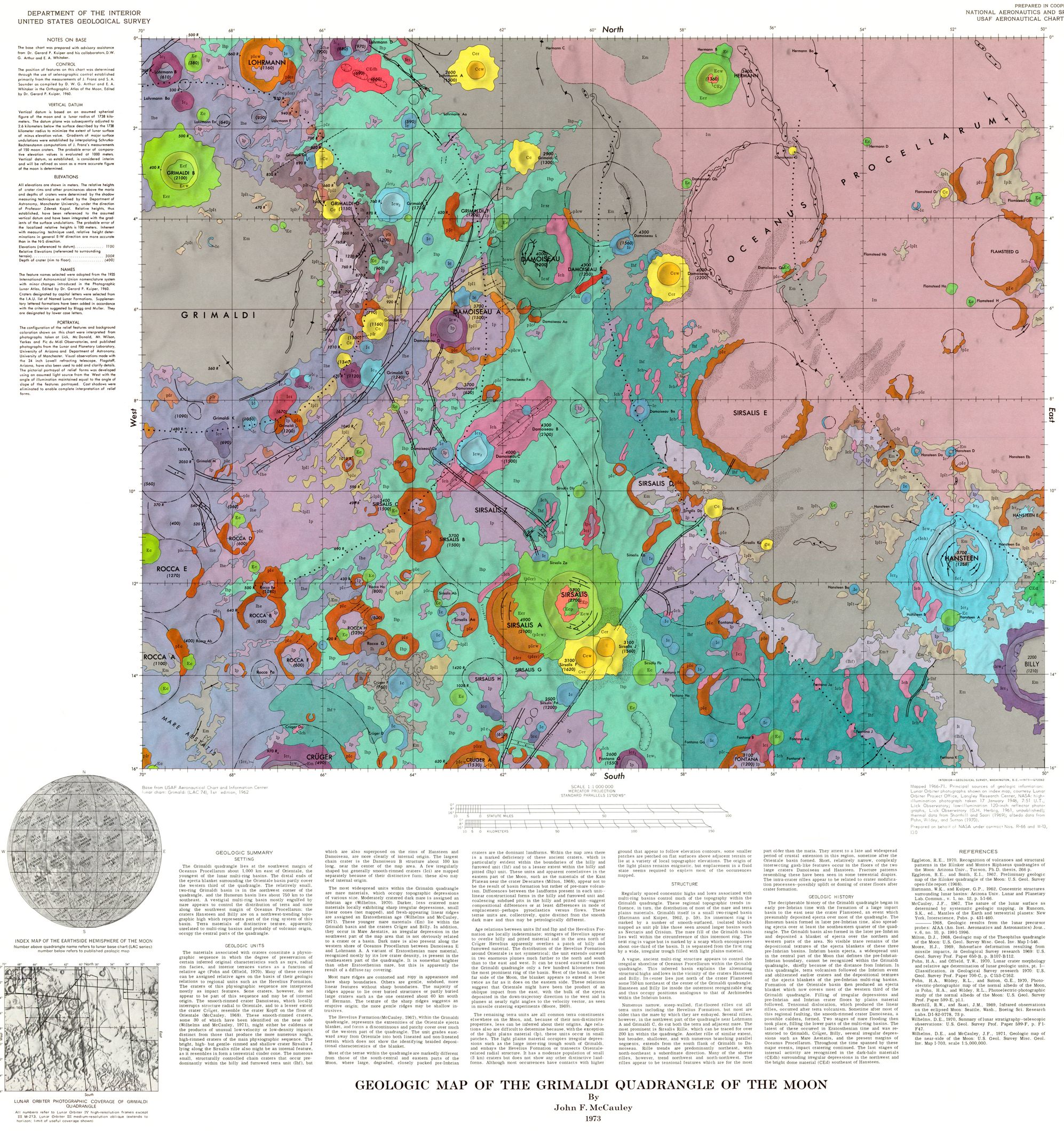
At the top left is the Grimaldi crater, which is 108 miles in diameter. At top right is the Ocean of Storms, a lunar mare. (Image: U.S. Geological Survey)
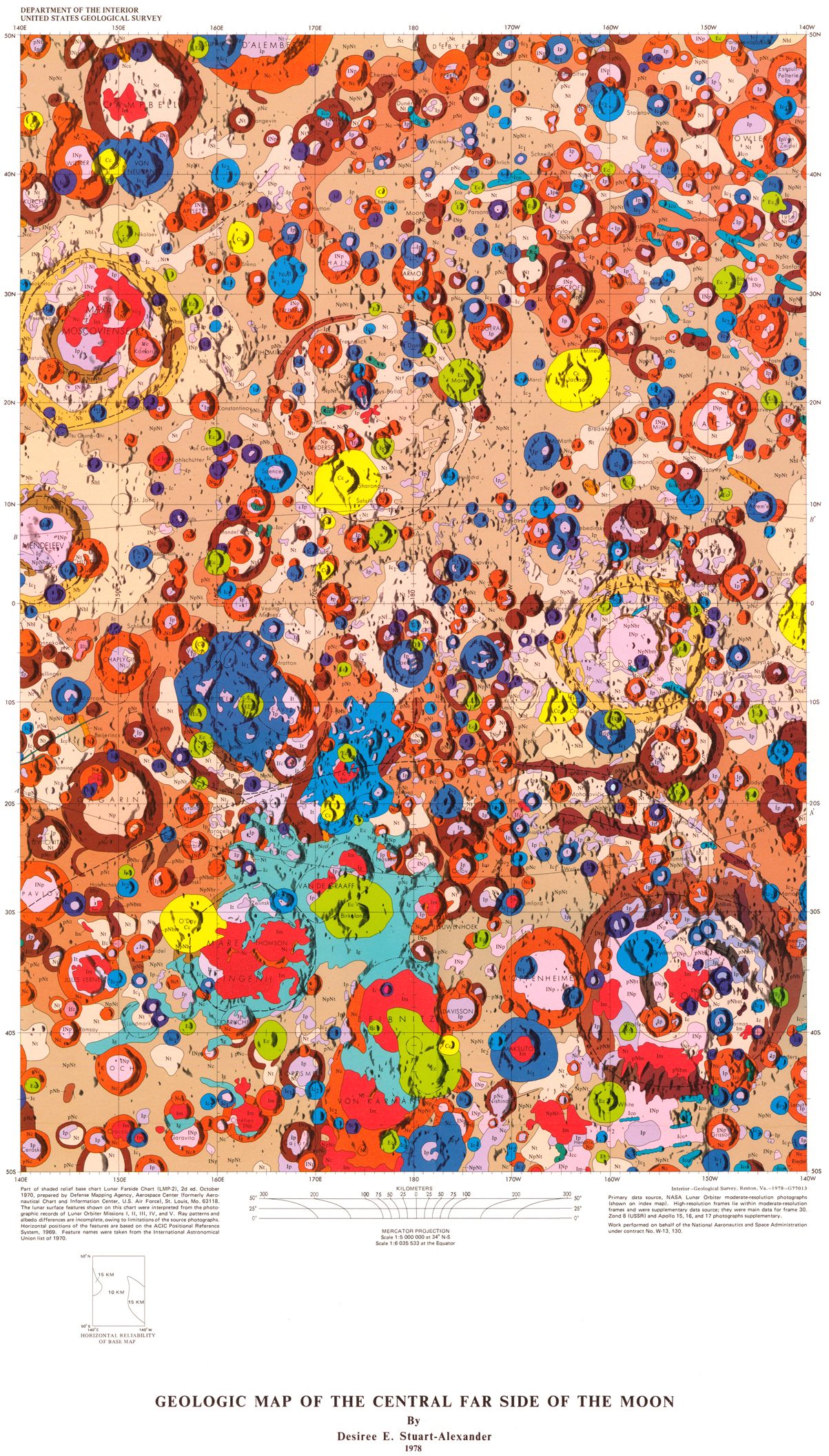
The far (out) side of the moon. (Image: U.S. Geological Survey)
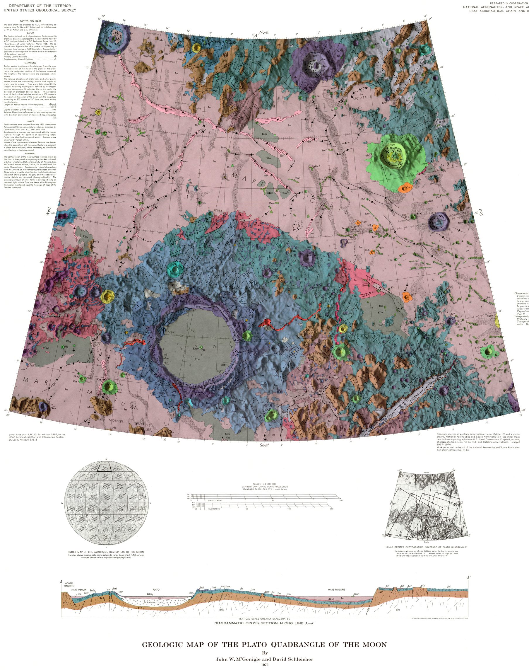
If Plato could see this, he’d be like, “Whoa.” (Image: U.S. Geological Survey)
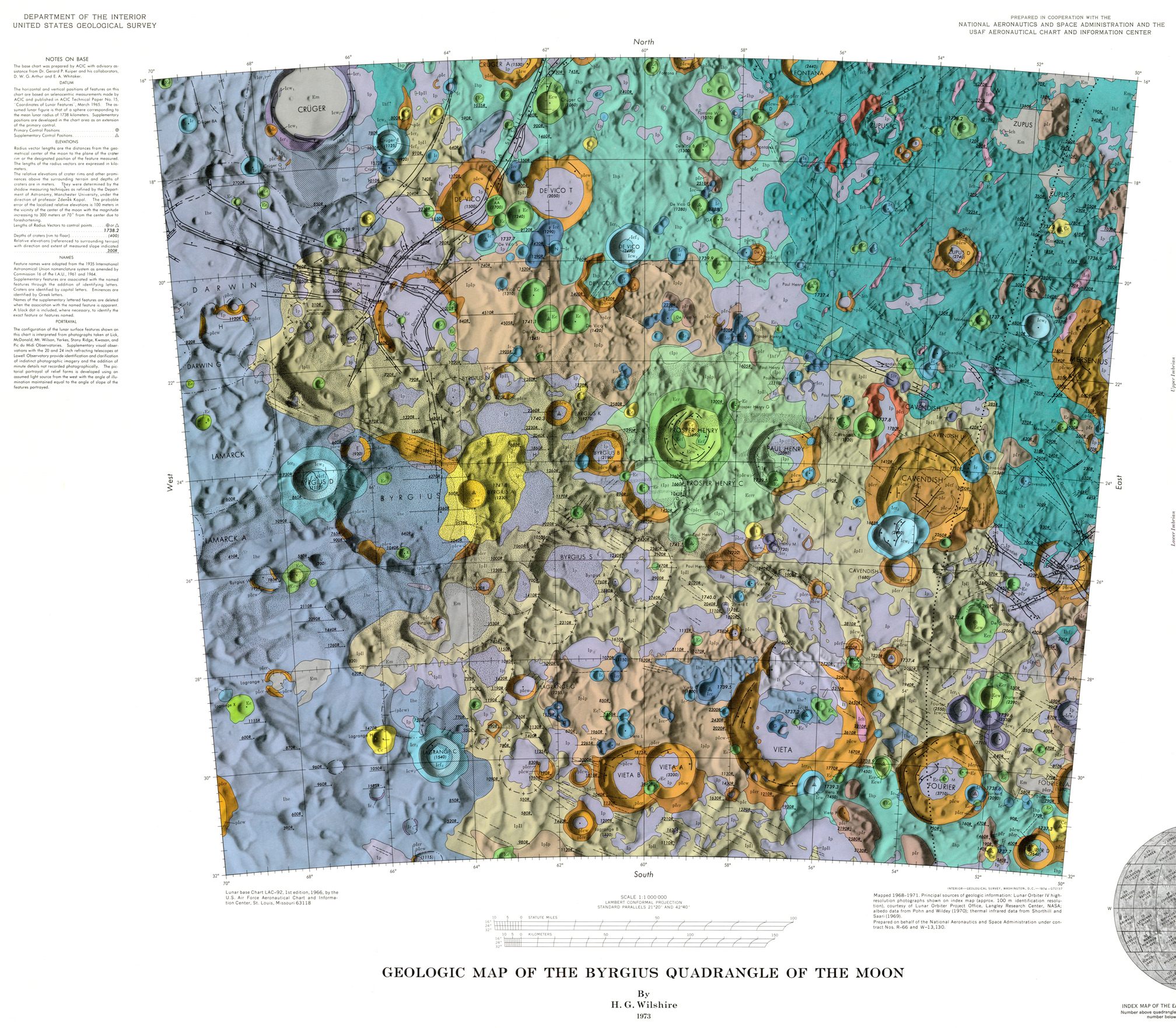
A map depicting Byrgius, a crater on the western side of the moon. (Photo: U.S. Geological Survey)
Map Monday highlights interesting and unusual cartographic pursuits from around the world and through time. Read more Map Monday posts.


Follow us on Twitter to get the latest on the world's hidden wonders.
Like us on Facebook to get the latest on the world's hidden wonders.
Follow us on Twitter Like us on Facebook