U-Boats and Octopuses Collide in These WWI Propaganda Maps
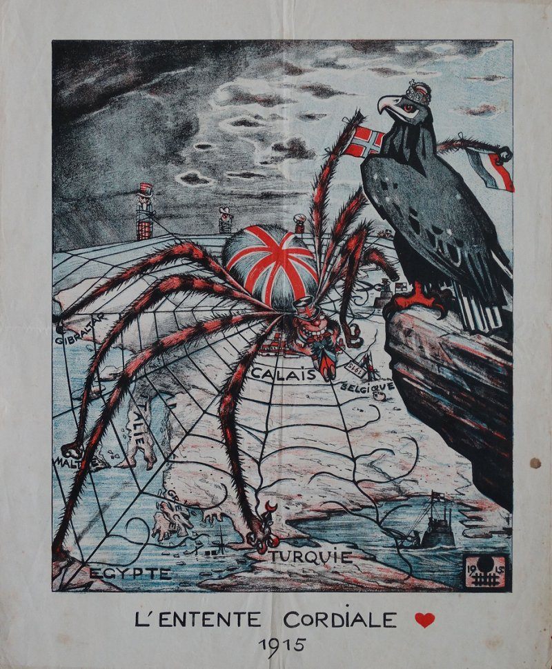 A 1915 German propaganda map where Britain is depicted as a spider weaving a web around Europe. (Photo: Courtesy Barron Maps)
While the soldiers of World War I fought on various fronts across Europe, artists and governmental departments on the home front engaged in their own propaganda battle via posters, postcards, and patriotic memorabilia.
Antiquarian map dealer Rod Barron’s collection of World War I propaganda maps provides a fascinating look at the range of persuasive images being produced by both the Allied and Central sides during the war. Below are some highlights from his collection.
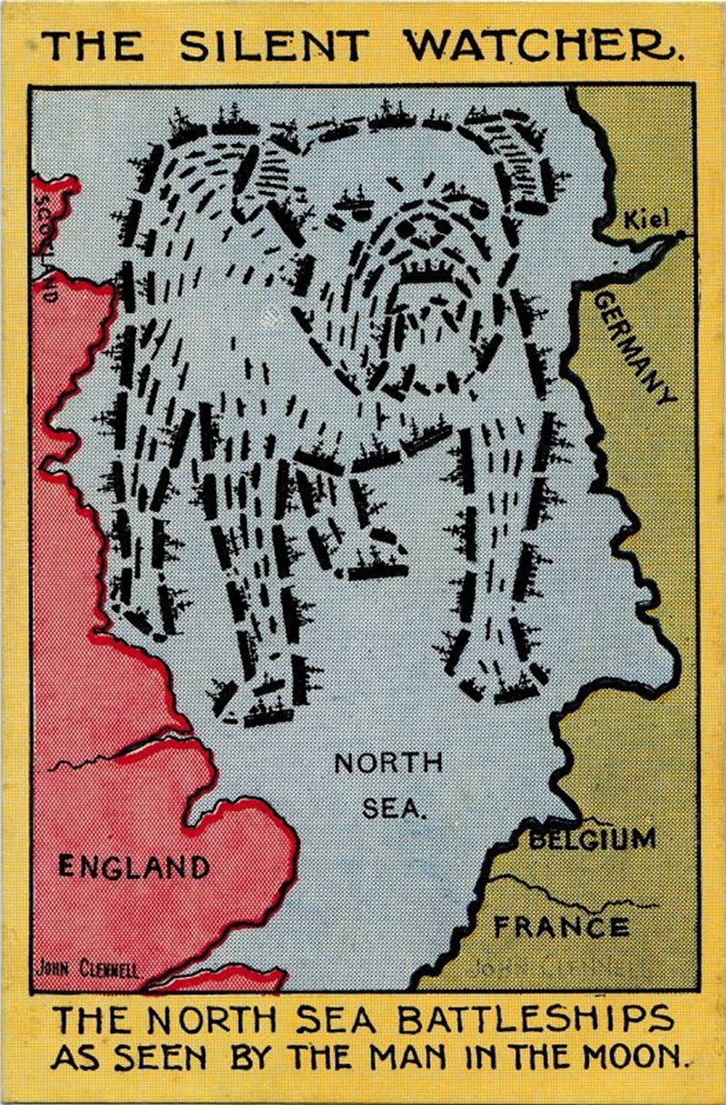 The British fleet takes the symbolic form of a bulldog in this map of the North Sea from c. 1914-1915. (Photo: Courtesy Barron Maps)
The British propaganda postcard above shows the ships of the British fleet in the formation of a tough and wary British bulldog. The dog’s eyes are fixed on the German port of Kiel, a major naval base during World War I.
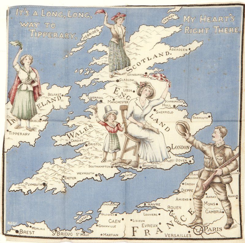
A WW1 keepsake map printed on a handkerchief, with a departing “Tommy” waving farewell to the four home nations. (Photo: Courtesy Barron Maps)
In addition to being printed in poster and postcard form, propaganda maps were also produced as scarves and handkerchiefs. The above hankie shows a British soldier, or “Tommy,” leaving home to fight on the front in Northern France. One of the women depicted waving him a fond farewell is in the middle of knitting socks for the soldiers—a patriotic pursuit that earned respect on the home front.
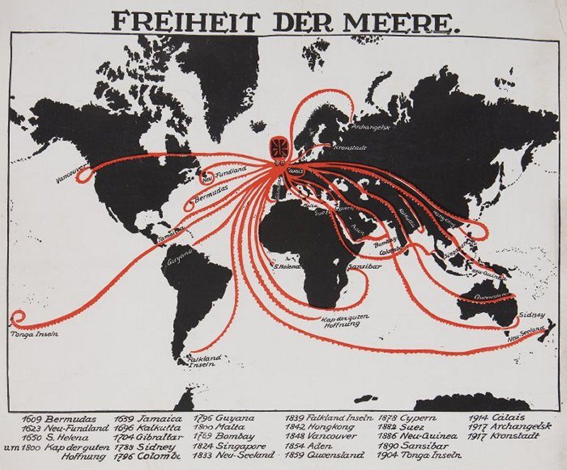 A German propaganda poster from 1918 entitled “Freedom of the Seas.” (Photo: Courtesy Barron Maps)
The German poster above, produced in 1918, depicts Britain as an evil octopus whose tentacles reach around the world. (It’s somewhat of a mutant octopus, given its 27 tentacles, but there is no established terminology for cephalopods that only exist in the minds of German propaganda poster artists.)
In 1877, British map artist Fred W. Rose became the first person to use an octopus to represent a formidable nation. Rose produced his Serio-Comic War Map, which depicted Russia as an enormous, bulging grey octopus, its tentacles seemingly poised to unfurl on neighboring nations. Ever since, octopuses have regularly appeared in satirical and propaganda maps, from the World Wars to the Cold War, and even, says Barron, “present-day Russia under Putin.”
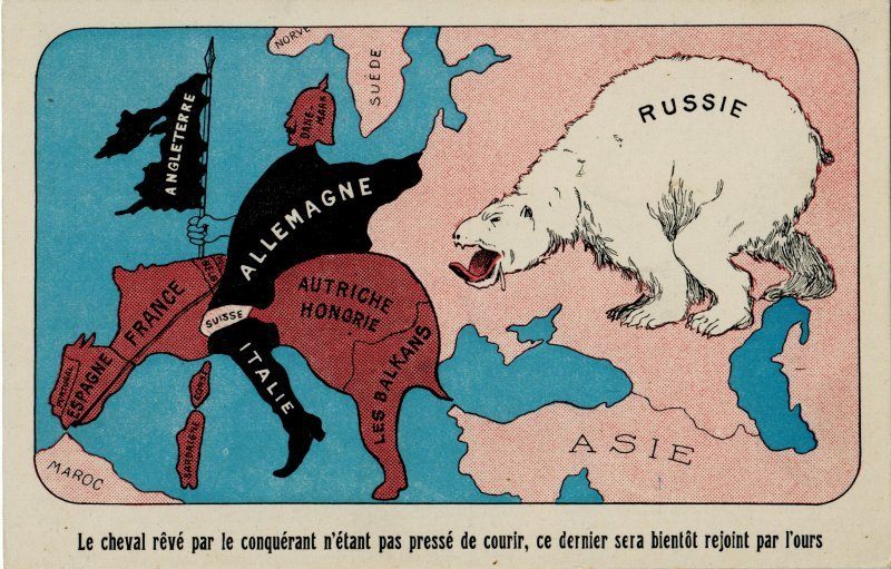 A satirical postcard c.1914, showing Western Europe taking the form of the Kaiser astride his “dream horse”. (Photo: Courtesy Barron Maps)
In this French postcard, produced around 1914, the nations of Western Europe are depicted in the form of a German kaiser riding a wretched-looking horse and wielding the British Isles as a flag. Russia, meanwhile, is shown as a salivating bear hot on the kaiser’s tail.
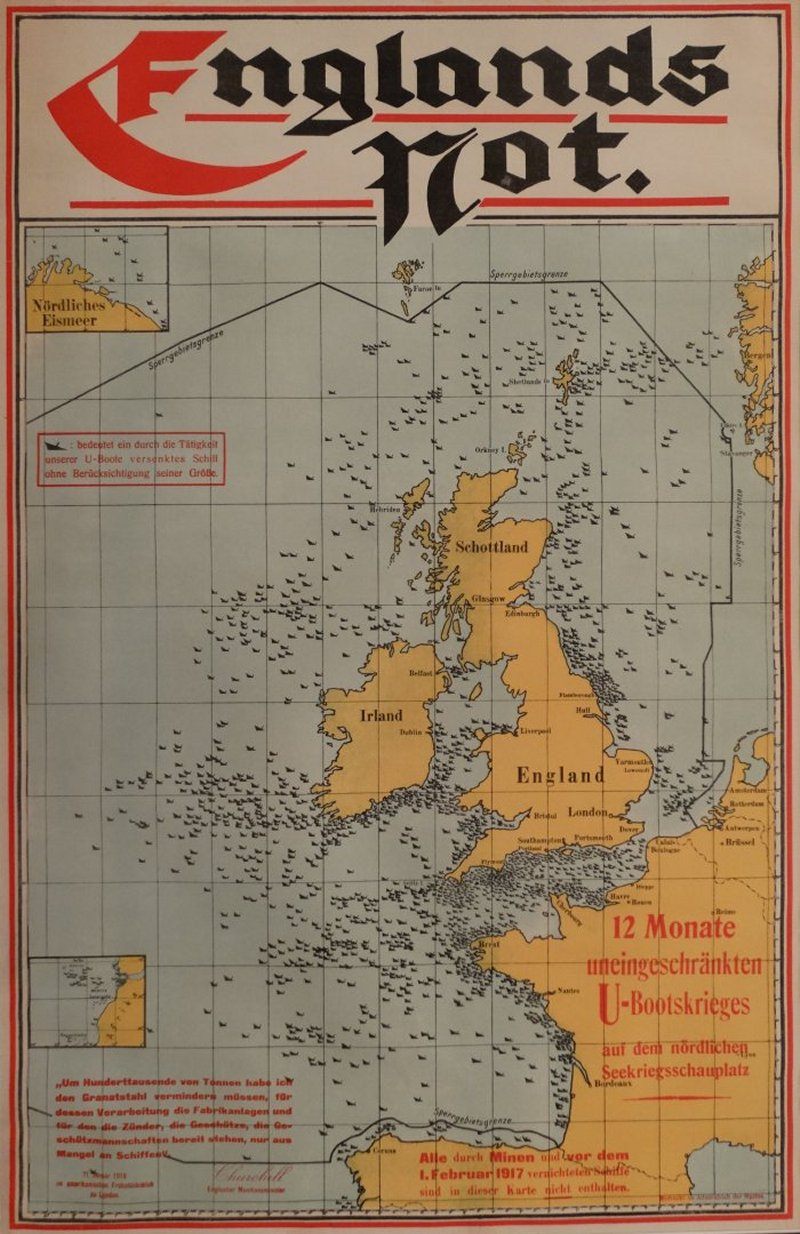 A poster from c. 1917-1918 showing the losses inflicted on Allied shipping by German U-boats. (Photo: Courtesy Barron Maps)
Germany’s Imperial Admiralty Staff created this no-nonsense map to publicize the extent of the U-Boat offensive launched against the Allies in 1917. For an extra dose of “Take that, Tommies,” Germany included a quote from Winston Churchill at bottom left in which the then British Munitions Minister mentions a forced reduction in the nation’s munitions manufacturing due to merchant shipping losses.
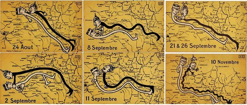 A set of six satirical map postcards from 1914. (Photo: Courtesy Barron Maps)
This set of six postcards, produced in Britain, depict French leader Marshal Joffre and German Kaiser as noodle-bodied figures squabbling to shift the front lines during 1914.
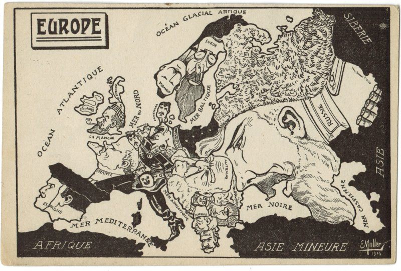 (Photo: Courtesy Barron Maps)
Created by French artist E. Muller, this satirical map from 1914 assembles a version of Europe dominated by the faces of its political leaders.
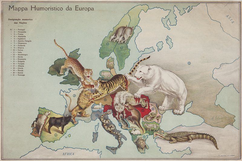 A humorous and zoomorphic map of Europe c.1914-1916, from Portuguese artist A. Soares. (Photo: Courtesy Barron Maps)
Portuguese artist A. Soares created this map of Europe, which was printed around 1916. Barron describes it as “one of the strangest and most curious” examples of a zoomorphic World War I satirical map due to the particular animals involved—they do not reflect the usual national stereotypes. The kangaroo representing Serbia and the Turkish crocodile are particularly perplexing.
Map Monday highlights interesting and unusual cartographic pursuits from around the world and through time. Read more Map Monday posts.


Follow us on Twitter to get the latest on the world's hidden wonders.
Like us on Facebook to get the latest on the world's hidden wonders.
Follow us on Twitter Like us on Facebook