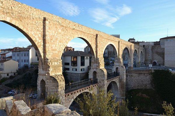
Albarracín-Cella Roman Aqueduct
This ancient tunnel is one of the most important examples of Roman hydraulic engineering in Spain.


Built in the first century BC, the series of water tunnels and channels between Albarracín and Cella in Aragon represents one of the most important examples of Roman hydraulic engineering in Spain, and was possibly one of the first aqueducts in history that diverted water from one river catchment to another.
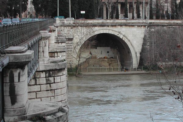
The word “aqueduct” generally brings to mind the bridge-like arched structures used to carry water above the valley, but the term actually includes all the engineering works that were used to convey water from one place to another. In terms of Roman hydraulic engineering, that would include tunnels, trenches, and cuttings, as well as the iconic arched structures (such as the impressive structure at Tarragona about 200 miles away).
The 16-mile-long aqueduct in Aragon, however, has no remaining arched bridge structures, and as far as archaeologists know, it never had any. The aqueduct took its water from a spring near Albarracín and transmitted it to Cella at an estimated rate of 66 gallons per second. Cella was an important Roman town but certainly not large enough to warrant this volume of water just for domestic supply, so it may have also had agricultural and industrial uses.
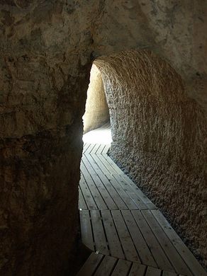
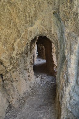
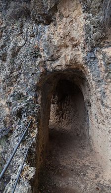
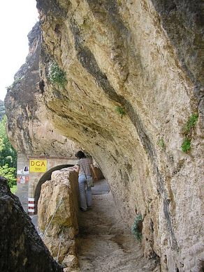
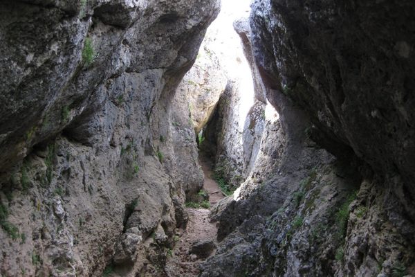
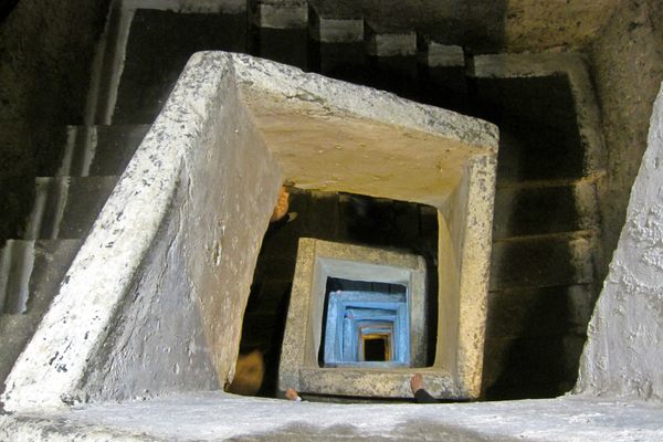
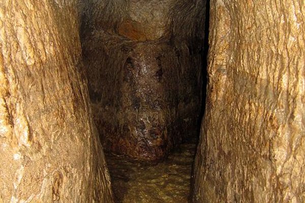
The transmitted water followed a route very close to the current A-1512 secondary road, and the construction of this road actually destroyed certain sections of the aqueduct. Still, many parts are freely accessible and in great condition today. One of the closest sections to Albarracín is located near Santa Croche Castle. Starting with an above-ground channel, it then enters the mountain through hand-dug galleries with numerous windows (known as lumina) open to the exterior. Here, the tunnel is typically about 6 feet high and 4 feet wide.
The most spectacular section of the aqueduct is probably the Barranco de los Burros. The Roman engineers “contour followed” the valley, often through tunnels dug by hand through the rocks. Further downstream is a 3- mile-long tunnel, close to Las Hoyas, often at some depth, where ventilation shafts can be seen. At La Tereria the aqueduct runs in the open in an artificial channel through the Rubiol ravine and onto Cella, where the aqueduct came to an end.
Know Before You Go
The map coordinates above are for the visitor center at Gea de Albarracín (just east ofAlbarracín), which is a great place to start. It has been open since 2015 and will provide a great basis for your visit. If you're able to do the visit on foot, there is a waymarked trail called the Sendero Aqueducto Romano. At the various accessible parts you'll find useful info boards, though they are only in Spanish. Take caution as the trail is close to the road and sometimes there is no footpath alongside it. The authorities have made some effort to improve access and safety, with some sections provided with duckboards for walking on and a number of steps and safety barriers.


Plan Your Trip
The Atlas Obscura Podcast is Back!


Follow us on Twitter to get the latest on the world's hidden wonders.
Like us on Facebook to get the latest on the world's hidden wonders.
Follow us on Twitter Like us on Facebook