AO Edited
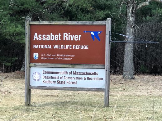
Assabet River National Wildlife Refuge
In the middle of a New England forest sit the crumbling ruins of World War II-era ammunition storage bunkers.
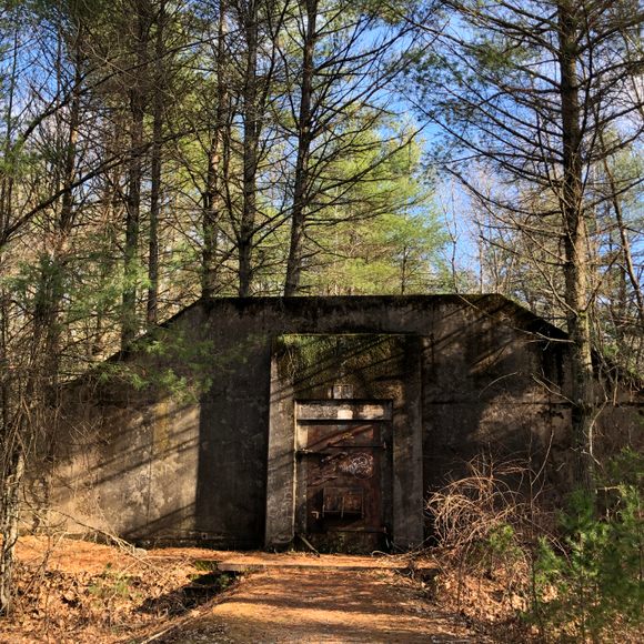
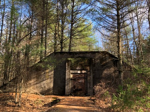
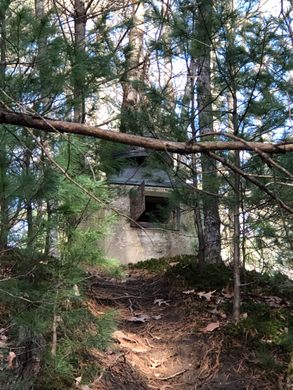
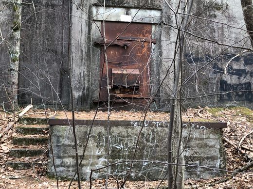
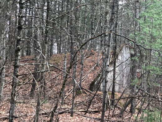
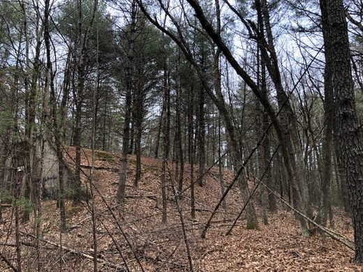
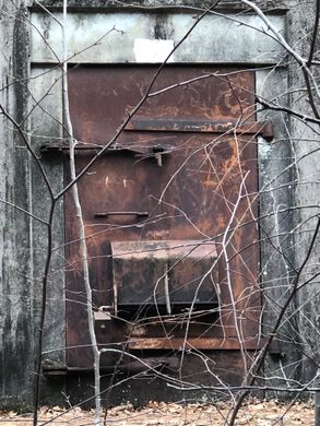

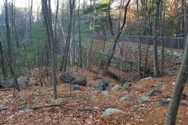
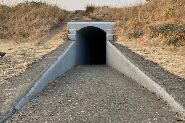
One doesn’t expect to see them looming in the woods along the trails of a wildlife refuge. Long and low with rounded tops, they resemble ancient burial mounds or crypts. The back end of each curves down to the ground while the front has a flat concrete façade secured by a heavy iron door. A ventilation port projects from the top. Some of these structures face the trails while others stand in isolation among the trees
These are concrete bunkers built by the United States Army in the woods of Massachusetts to store live ammunition. Now abandoned, they are covered with dirt and pine needles, while saplings and second-growth trees sprout from the top and sides, as well as all around them.
A conservation area of three and a half square miles, the Assabet River National Wildlife Refuge began as a temperate pine forest marked by ponds and multiple swampy areas. It served as hunting and fishing grounds for the Nipmuck Tribe of the Wampanoag Indians. Colonial settlement converted the area into farms and homes in the towns of Maynard, Stow, Hudson, and Sudbury.
America’s involvement in World War II changed all that. The United States Army took over 2,450 acres by eminent domain in 1942. This action displaced more than 80 family homesteads, farms, and orchards, many of them going back several generations. The Army then closed the roads and sealed off the land with security patrols. They turned the combined area into the Maynard Ammunition Storage Backup Point (MASBP).
During WWII, the Army used the MASBP to store ammunition—a function for which they built the concrete bunkers—before shipping it to the European theater. The location was deemed far enough inland that shells from a German battleship in Boston Harbor couldn’t reach it. That gave rise to the Annex’s nickname of “The Ammunition Dump.”
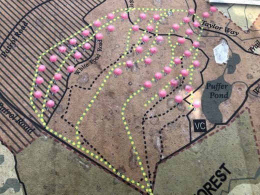
The dozens of bunkers, each one numbered, all face in the same direction, northwest. They were built with barrel-vaulted tops in case of an explosion. The shape would channel the rubble straight up and then back down instead of blasting outward in all directions. The bunkers were also spaced far apart, presumably so an explosion in one wouldn’t set off any of the others. A network of railroad tracks that connected to the Massachusetts Central Railroad linked the 50 bunkers, which made loading and shipping the ammunition fast and easy.
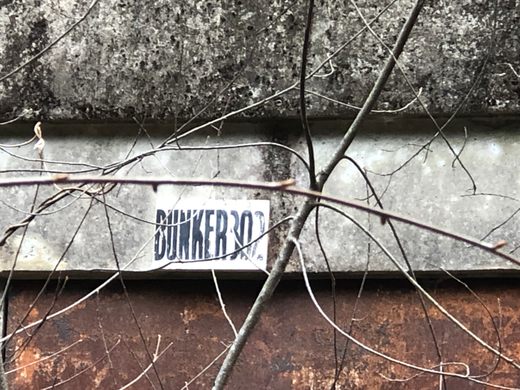
The bunkers are empty now, like concrete Quonset Huts swept clean, and the railroad tracks have been taken up. Only their spirit remains in the straight lengths of some trails. A long vehicle track that encircles the refuge is still called the Patrol Road.
After the war, the MASBP became the Sudbury Annex of Fort Devens in Ayer, Massachusetts, used for training personnel. Army Reservists most recently used the Sudbury Annex in 1991 for field troop training during Operation Desert Storm. (Because a Massachusetts pine forest looks just like the Kuwaiti Desert—not.)
In the 50s, the Army began dumping toxic waste from their Natick Laboratories at the Annex, both in barrels and in pits dug into the ground. This contamination continued until the eighties when they converted the Annex to train personnel for various units.
An oil spill in 1985 alerted the Army to the possibility of groundwater and soil pollution at the Annex. An investigation a year later confirmed this and identified the primary substances as volatile organic contaminants (VOCs), insecticides, and pesticides. The government placed the site on the Superfund National Priority List in 1989. The nine-year Superfund cleanup that followed removed underground storage tanks, and gallons of poison along with tons of contaminated soil and creek sediments.
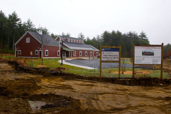
Once the worst toxins had been taken away, the U.S. Army transferred 2,332 acres of the Annex to the U.S. Fish and Wildlife Service in the fall of 2000. The Assabet River National Wildlife Refuge opened to the public on October 23, 2005, after 63 years of military use. The Wildlife Service manages the Refuge for the conservation of migratory birds.
Today, the Assabet River National Wildlife Refuge bears no resemblance to its previous military incarnation. Instead, it has reverted to forest, wetland areas, vernal pools, and large ponds. These provide important feeding and breeding areas for migratory birds and other wildlife.
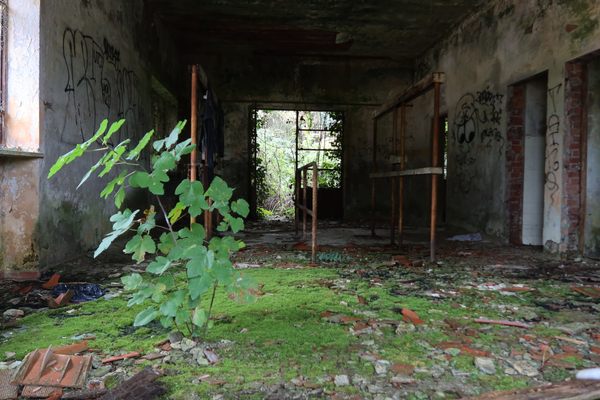
In short, the land is once again to the kind of forest it used to be—with one big exception. Those concrete bunkers still loom in the woods. They are all sealed off to prevent intrusion. Depending on the weather and the light, they can look benign or somewhat creepy. But you can’t go inside—although people do try.
Know Before You Go
The bunkers appear along some of the 15 miles of the refuge's trails and are scattered through the woods. To see the bunkers, you can download a trail map of the Refuge on the Assabet River National Wildlife Refuge website.
The Assabet River National Wildlife Refuge is open to the public year-round, from sunrise to sunset. It is easily reached by car at 680 Hudson Road in Sudbury, MA and you can park in one of three areas. The trails are well maintained and clearly marked, used by runners and walkers, as well as cross-country skiers in the winter. No dogs or horses are allowed. You can enjoy catch-and-release fishing from two docks on Puffer Pond. (You don't want to eat them, trust me.)
NOTE: The Visitor Center has been closed since the Covid-19 pandemic.


Follow us on Twitter to get the latest on the world's hidden wonders.
Like us on Facebook to get the latest on the world's hidden wonders.
Follow us on Twitter Like us on Facebook