Duncan's Cove Ruins
Explore the ruins of war and maritime history along this gorgeously ferocious North Atlantic seascape.

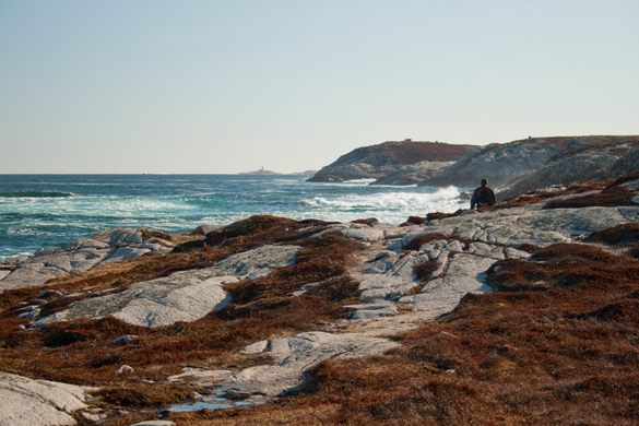

Few places evoke the fury of the North Atlantic quite like the rugged coastline of Nova Scotia, yet within that area, few places provide a more walkable glimpse into the maritime threats faced here than the obfuscated hiking trails snaking along the shores at Duncan’s Cove.
Though a proper, legitimized hiking trail, merely finding the path in question alludes to the remoteness of the world trekkers are choosing to enter. Located on the Chebucto Peninsula outside a small rural community of the same name, the lighthouses, batteries, and bunkers have been used as Halifax’s first line of defense since the 18th century.
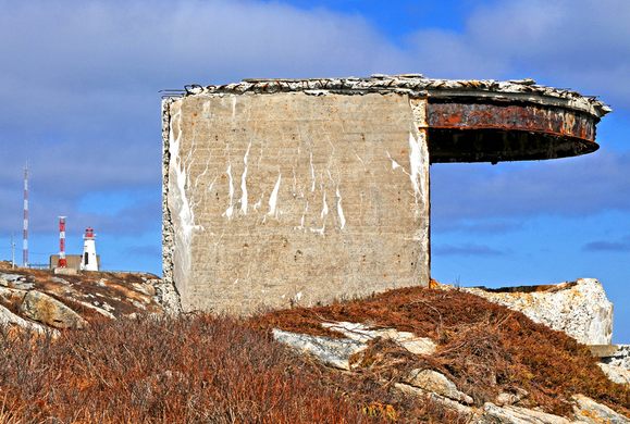
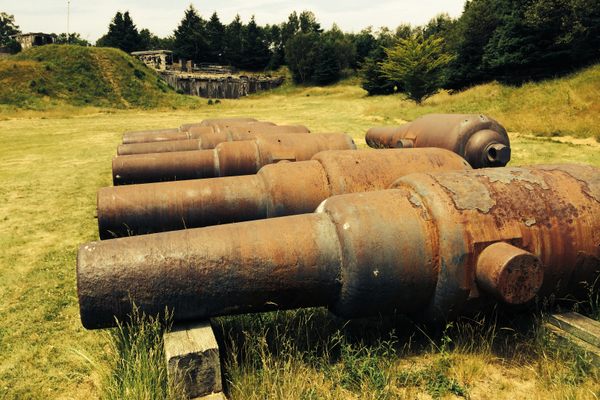
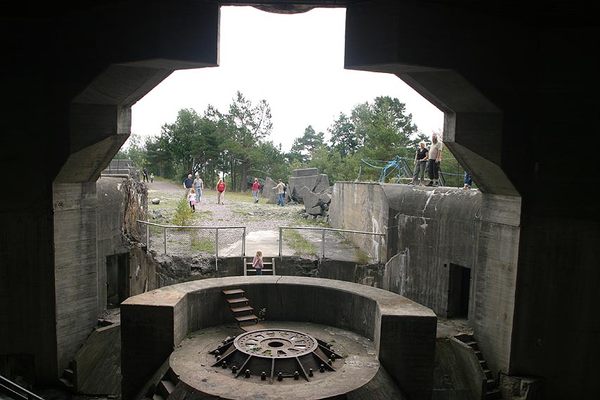
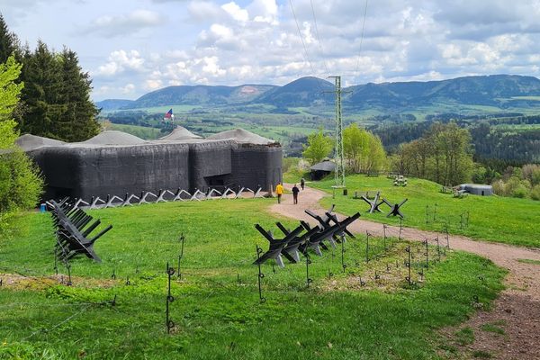
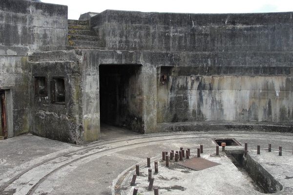
Throughout World War II, Duncan’s Cove became a fully fortified coastal battery, complete with a four-story concrete director tower built along the trail’s eastern shore, intended to house cannons. In the process, the original 1872 Chebucto Lighthouse was displaced a few hundred meters from its original location in order to make room for the tools of war. Today, a few of the original lighthouse’s ruins can be seen, though the brunt of the light-keeping duties have been transferred to a concrete tower and a series of foghorns built in 1967, complete with fully-automated light.
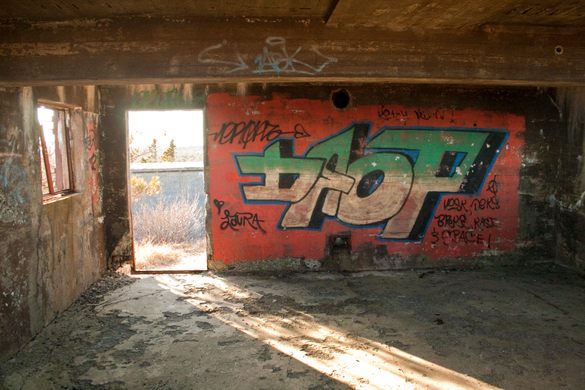
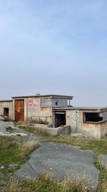
As the trail’s coastal forest gives way to barren granite rock faces cut through with fissures, explorable ruins of the cliffside bunkers from WWII – many of whose interiors are covered in vibrant graffiti – stand as modern reminders pointing at the area’s quietly complex history, which extends so much deeper than ferocious seas populated with migratory whales in the spring and summertime’s inspired landscapes covered in wild blueberries as far as the eye can see.
Update August, 2017:
Recently, Duncan’s Cove has suffered a series of issues that stem from overuse of the area. Duncan’s Cove is a Protected Nature Reserve that supports endangered plants and a extremely delicate maritime ecosystem. Heavy foot traffic is accelerating erosion and wiping out large areas of plants that have taken hundreds of years to grow.
Due to the protected status of the land that the hiking trail covers, it is not possible or desired to construct infrastructure that would help protect the ecology of the land, erosion, etc. Lack of infrastructure and signage also puts hikers at increased risk of injury or death, both of which have occurred in the past on the trail.
Please be respectful of private homes and note that there are no facilities, no infrastructure and limited parking.
Know Before You Go
The trailhead of the walking trail is somewhat hidden from view so after an approximately 20-meter walk down the road towards the water, to the right there will be a dirt road heading in almost the opposite direction. Look for and old gate and follow this road uphill where there will be a large house near the cliff edge; immediately to the right, at the top of the hill, will be rocks which mark the beginning of the walking trail. Follow path on right along coast. Beware of erosion along some sections and use caution because footing can be tricky when wet.


Follow us on Twitter to get the latest on the world's hidden wonders.
Like us on Facebook to get the latest on the world's hidden wonders.
Follow us on Twitter Like us on Facebook