Trips Places Foods Stories Newsletters
Loading...
Loading...
Loading...
Loading...

No search results found for
“”

Make sure words are spelled correctly.

Try searching for a travel destination.

Places near me Random place

Popular Destinations

  • Paris
  • London
  • New York
  • Berlin
  • Rome
  • Los Angeles
Trips Places Foods Stories Newsletters
Sign In Join
Places near me Random place
All the United States Minnesota Duluth Ely's Peak and DWP Railroad Tunnel

Ely's Peak and DWP Railroad Tunnel

A spooky defunct railroad tunnel now part of a sprawling trail.
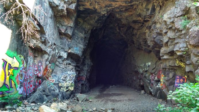
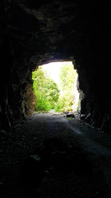
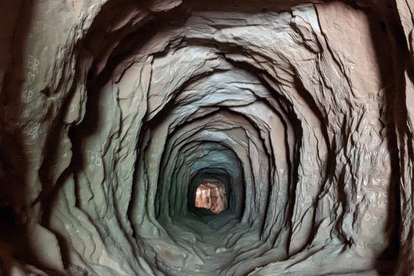
Duluth, Minnesota

Added By
Emily
Email
Been Here
Want to go
Added to list
CAPTION
Entrance to the tunnel.   Emily Sue / Atlas Obscura User
Tunnel art.   Emily Sue / Atlas Obscura User
Other end of the tunnel.   Emily Sue / Atlas Obscura User
Boardwalk from parking area.   Emily Sue / Atlas Obscura User
View inside.   Emily Sue / Atlas Obscura User
Been Here
Want to go
Added to list

This Place Is a Stub

Help improve this place with additional information or photos.

Make an Edit

About

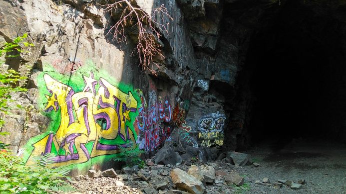
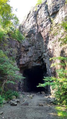
When you just round a bend on the DWP (Duluth, Winnipeg and Pacific Railway) Trail you'll encounter a massive surprise; an old railroad tunnel excavated more than a century ago. The out-of-use tunnel is now part of a multi-purpose trail around Ely’s Peak. Expect to share the path with bikers, hikers, and runners. Don't be surprised to hear a few screams as people encounter each other in the dark. The tunnel is also a popular spot for rock climbers. 

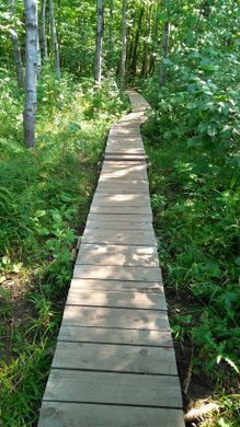
Along the DWP Trail are great spots for viewing the St. Louis River and western Duluth. The trail is a gentle one, made for biking or walking. Climb to the top of Ely's Peak for even more spectacular views.

Related Tags

Tunnels Subterranean Sites

Know Before You Go

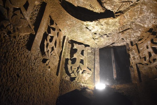
Bring a flashlight or headlamp, it's completely dark in the middle of the tunnel.

Community Contributors

Added By

Emily Sue

Published

August 13, 2019

Edit this listing

Make an Edit
Add Photos
Ely's Peak and DWP Railroad Tunnel
DWP Trail
Duluth, Minnesota, 55810
United States
46.678557, -92.252192
Visit Website
Get Directions

Nearby Places

Grassy Point Railroad Bridge

Minnesota

miles away

A World of Accordions Museum

Superior, Wisconsin

miles away

Free Range Film Barn

Wrenshall, Minnesota

miles away

Explore the Destination Guide

Photo of Duluth

Duluth

Minnesota

Places 7

Nearby Places

Grassy Point Railroad Bridge

Minnesota

miles away

A World of Accordions Museum

Superior, Wisconsin

miles away

Free Range Film Barn

Wrenshall, Minnesota

miles away

Explore the Destination Guide

Photo of Duluth

Duluth

Minnesota

Places 7

Related Places

  • Orderville, Utah

    Belly of the Dragon

    Nature has shaped this drainage tunnel into the digestive tract of a mighty beast.

  • One of the chambers, with reliefs of Sanskrit characters.

    Yokohama, Japan

    Taya Caves

    A network of ancient tunnels and vaulted chambers with mystical Buddhist reliefs, built for ascetic training.

  • Asakusa Underground Street.

    Tokyo, Japan

    Asakusa Underground Street

    Stuck in a bygone era, the oldest subterranean shopping street in Japan hides beneath the popular Asakusa district of Tokyo.

  • Houston, Texas

    Downtown Houston Tunnel System

    The largest underground pedestrian tunnel system in the U.S. mostly caters to the people working in the offices above, but provides a great, air-conditioned way to traverse the city.

  • Pune, India

    University Tunnel

    This 300-foot-long underground tunnel was once used to transport food from the kitchen into the main building.

  • Doai Station platform

    Minakami, Japan

    Doai Train Station

    Would you spend the night in Japan's deepest train station?

  • Free Expression Tunnel

    Raleigh, North Carolina

    Free Expression Tunnel

    In a pedestrian tunnel on North Carolina State’s campus resides an expressive and artistic free-for-all.

  • Tunnels of Claudius

    Avezzano, Italy

    Tunnels of Claudius

    This Roman underground canal was the longest tunnel ever built until the late 19th-century.

Aerial image of Vietnam, displaying the picturesque rice terraces, characterized by their layered, verdant fields.
Atlas Obscura Membership

Become an Atlas Obscura Member


Join our community of curious explorers.

Become a Member

Get Our Email Newsletter

Follow Us

Facebook YouTube TikTok Instagram Pinterest RSS Feed

Get the app

Download the App
Download on the Apple App Store Get it on Google Play
  • All Places
  • Latest Places
  • Most Popular
  • Places to Eat
  • Random
  • Nearby
  • Add a Place
  • Stories
  • Food & Drink
  • Itineraries
  • Lists
  • Video
  • Podcast
  • Newsletters
  • All Trips
  • Family Trip
  • Food & Drink
  • History & Culture
  • Wildlife & Nature
  • FAQ
  • Membership
  • Feedback & Ideas
  • Community Guidelines
  • Product Blog
  • Unique Gifts
  • Work With Us
  • About
  • FAQ
  • Advertise With Us
  • Advertising Guidelines
  • Privacy Policy
  • Cookie Policy
  • Terms of Use
Atlas Obscura

© 2025 Atlas Obscura. All Rights Reserved.