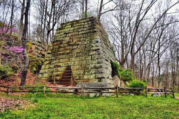
Fries Mill Ruins
The remains of an old sawmill, gristmill and the surrounding industry dating back to the 18th century.

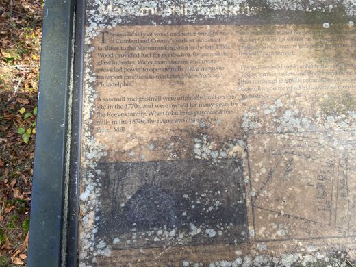
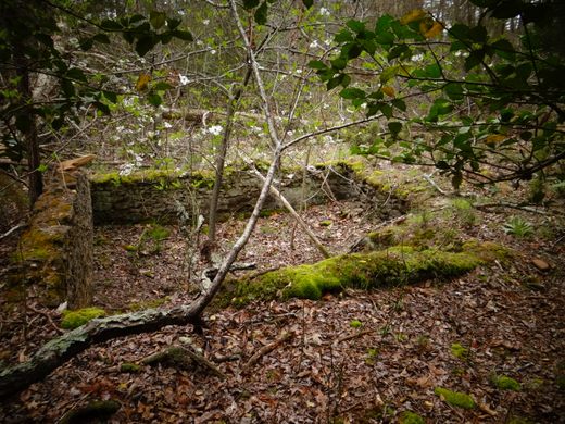
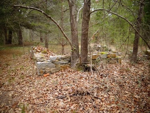
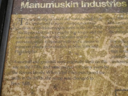
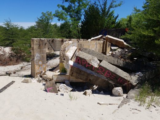

There are many places where an industry rose and fell and left its footprint behind. In this case, a few ruins at Fries Mill in New Jersey are all that’s left of a once-thriving sawmill and gristmill, which later served a concrete industry and is in ruins remain today.
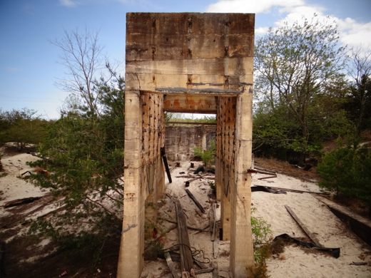
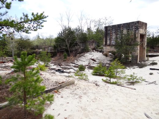
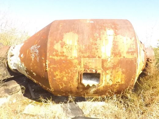
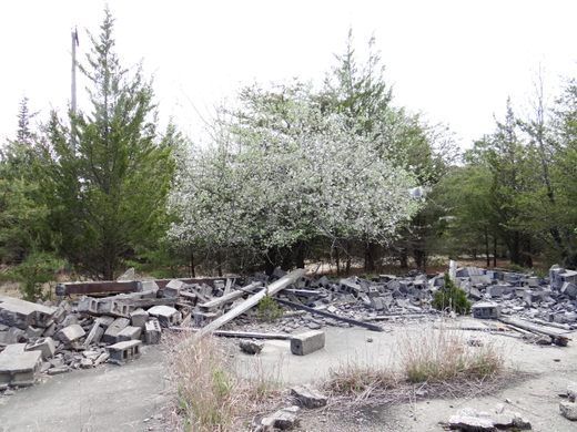
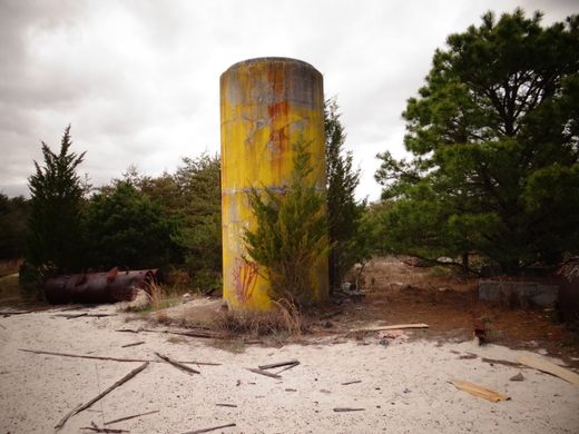
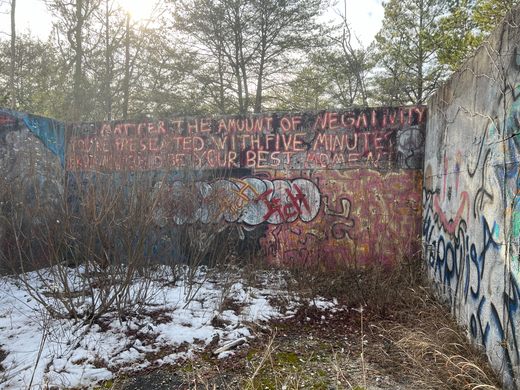
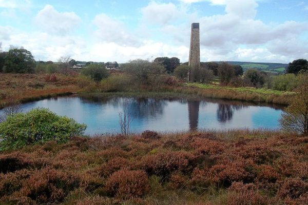
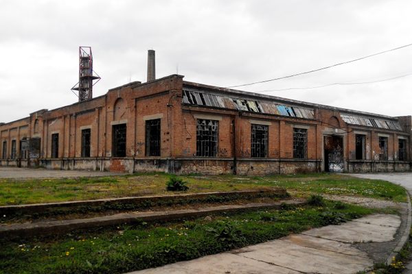
Located in the Pine Barrens on the Manumuskin River Preserve tells the tale of a couple industries, the concrete structures are of an old concrete company that quarried the area in the early-to-mid 1900’s. One of the conveyor belts can still be found on the site and even old tools. Sand from the Pine Barrens is slowing covering the these ruins with sand drifts.
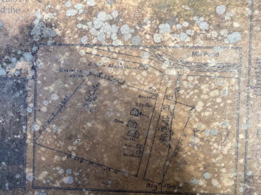
The Fries saw mill and grist mill was mostly constructed of wood and was founded in the 1770s. With wood and water so abundant in the area and iron forges nearby, it was the perfect location. The wood provided fuel for the iron furnaces and water powered the mills. It wasn’t until almost 100 years later that John Fries purchased the mills and the name was changed.
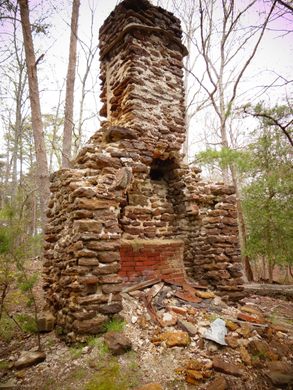
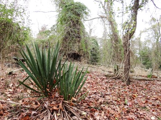
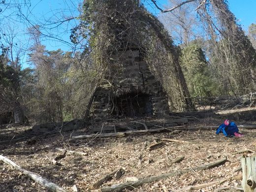
Aside from the concrete ruins, the surrounding area also has chimneys and foundations of the former homes and even a tavern for the mill workers of Fries Mill. There is a nice worn horseshoe trail that will lead you to these chimneys and foundations—a total of three stone chimneys can be found on the trail. There are leftover signs of the people who once lived here, such as yucca plant near one of the chimneys and a cherry tree near the sawmill, both not native to the Pine Barrens.
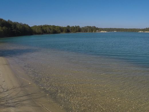
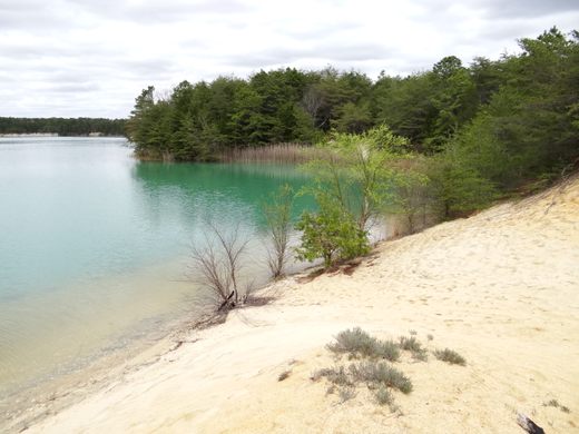
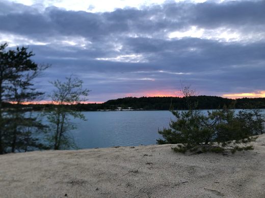
Once you pass by the other foundations on the trail, you’ll come to the blue water lake, which is locally known as a blue hole. It’s a beautiful color with a sandy beach.
Update April 2017: The concrete industry tower ruin has been knocked down.
Update June 2020: Corrected historical accuracy thanks to Tom Lynskey. Updated photo of the now crumbled concrete industry tower ruin.
Know Before You Go
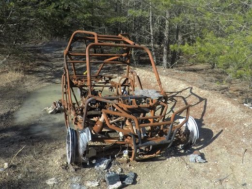
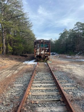
Park at the coordinates 39.3352193,-74.9613468. Walk along the railroad tracks heading northwest, but do not walk on the railroad tracks. There may be train cars parked there, but it's okay to walk along the tracks. Keep walking until you reach the sandy portion after the bridge. Once you reach that spot, there will be a trail opening to the right. That is the horseshoe trail that will take you to the chimney ruins and foundations, eventually leading you to the blue lake. If you want to see the concrete industry ruins, do not take the horseshoe trail. Keep walking until you see a third trail opening (the second opening is the exit of the horseshoe trail). Walk along the trail, you may come across and abandoned dune buggy that has been there for a while. You'll then be walking on asphalt covered with sand. Walk along the trail and you will come up on the ruins. But don't worry if you past the third worn trail, you can keep walking until you come across another opening. You may see an Osprey nest on the electrical pole. Keep in mind that the ruins are not that far from the train tracks.


Follow us on Twitter to get the latest on the world's hidden wonders.
Like us on Facebook to get the latest on the world's hidden wonders.
Follow us on Twitter Like us on Facebook