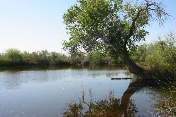
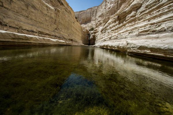
Laws Spring
This remote desert watering hole has a connection to a curious chapter of American history.

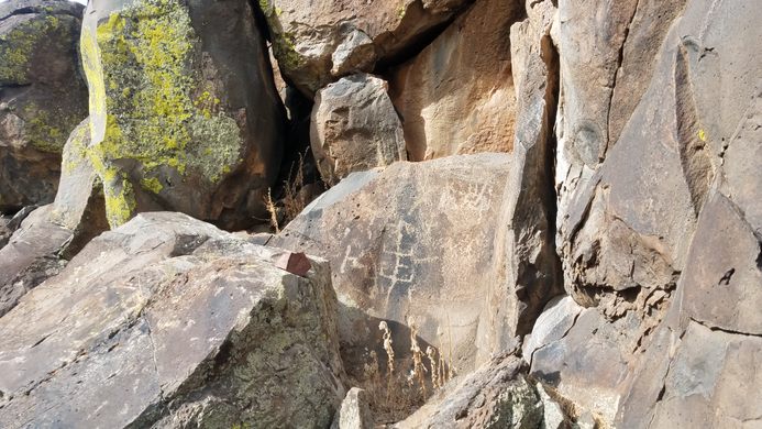

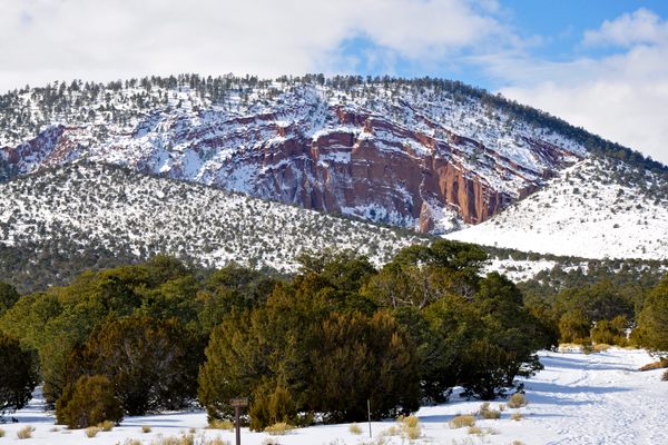
Deep in the Kaibab National Forest, in the high elevation deserts of northern Arizona, there is a rare perennial source of freshwater. Petroglyphs on the boulders and cliff faces bordering the springs have been credited to the Cohonina people, who inhabited the area between approximately 700 and 1100. Evidence suggests that the Havasupai people were also familiar with the springs and periodically visited the area.
The spring would later find itself part of a largely unknown piece of the history of the American West. As the United States expanded during the 1800s, the spring became an important stop for pioneers and soldiers traveling westward, as a year-round source of freshwater in the deserts of Arizona became invaluable.
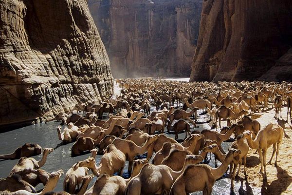
In 1857, the United States government dispatched Lieutenant Edward Beale to survey and construct a road between Fort Defiance, Arizona (New Mexico at the time) and the Colorado River to the west where it formed the boundary with California. But this wasn’t the only thing they tasked Beale with—he was given an additional assignment to test the efficacy of camels compared to horses and mules in the American deserts.
To this end, the U.S. government supplied Beale with 25 camels. While initially skeptical and frustrated at having to shoulder this additional burden alongside his road-building tasks, Beale was surprised at the strength and endurance of the camels and grew to trust them more than his other animals, commenting that he “would rather have one camel than four mules.” Over the subsequent years the U.S. government purchased dozens of more camels for Beale and his crews to continue to test their use.
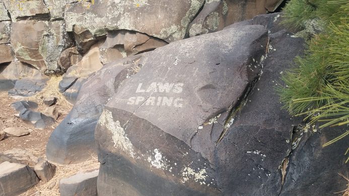
Between 1857 and 1859, Beale and his crews repeatedly crossed the route of the road they were constructing, improving and expanding it each time and extending the eastern terminus to Fort Smith, Arkansas, and the western terminus to Los Angeles, California. It was in July of 1859 during one of these crossings that Beale’s crew stopped to camp at a familiar spring in northern Arizona. Honoring a member of his crew, Beale decided to give a name to the watering hole and named it Laws Springs after Major W. L. Laws. Another member of the crew, Peachy Breckenridge, who was the son of then Vice President John C. Breckenridge, inscribed the new name of the springs on a rock above the water.
The outbreak of the American Civil War put a stop to both the road construction and the experiment with camels. Edward Beale’s wagon road saw heavy use for about 30 years, with some accounts saying that it carried as much traffic across the United States as the more famous Oregon Trail. Surveyors for railroad companies used Beale’s road while mapping the route of future transcontinental railways, with some inscribing their initials on the rocks around Laws Spring as they passed. The road began to decline in use when the Atlantic & Pacific Railroad constructed tracks that ran parallel to almost the entire route in 1883.
Another testament to the surveying skills of Edward Beale is that when highways were later built across the region in many cases they found that the most efficient route was the one that had already been marked by decades of wagon ruts. The legendary Route 66 and its modern replacement, Interstate 40, each follow large sections of Beale’s wagon road. The downside of this is that now many parts of the historic route have been paved over and lost.
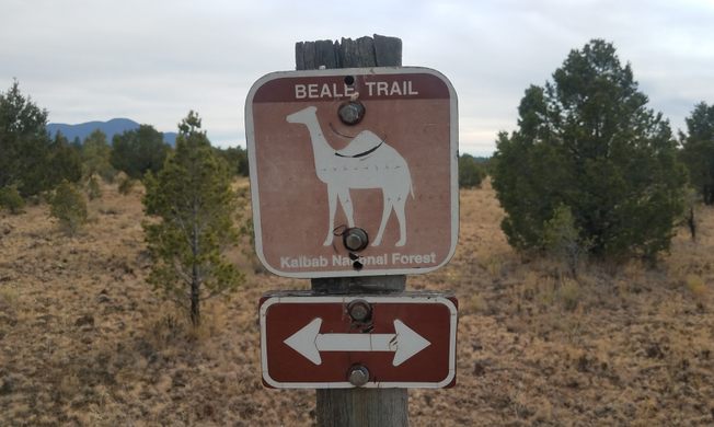
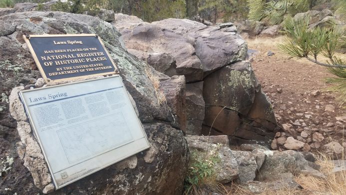
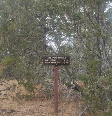
In the Kaibab National Forest, however, 23 non-contiguous miles of Beale’s road still exist, preserved as trails for hikers and horseback riders, and in some cases as dirt roads for vehicles and bikers. In many sections, though, it has become largely overgrown and is only recognizable by the lines of larger rocks that were moved off to the sides of the former road. Thankfully, alongside one semi-preserved section is the remote Laws Spring, which was recognized for its historic importance and added to the National Register of Historic Places in 1984.
Know Before You Go
Laws Spring is not labeled on Google maps, so it can be somewhat difficult to navigate to if you don't prepare in advance. Putting the coordinates into Google maps mostly works but will occasionally attempt to navigate you down impassible routes or nonexistent roads. By using Google's navigation as a rough guide and erring on the side of staying on the larger, more maintained dirt roads and the occasional Forest Service sign you can get there with little confusion. The Forest Service also provides rough written instructions on their website for finding Laws Spring.
The dirt roads on the way to Laws Spring are fairly well maintained and graded and most vehicles should be able to reach them, except perhaps after recent rain or snow. Once you reach the parking area it's only a walk of a few hundred feet to the spring and an additional few hundred feet beyond that to the Beale Wagon Road.


Follow us on Twitter to get the latest on the world's hidden wonders.
Like us on Facebook to get the latest on the world's hidden wonders.
Follow us on Twitter Like us on Facebook