Trips Places Foods Stories Newsletters
Loading...
Loading...
Loading...
Loading...

No search results found for
“”

Make sure words are spelled correctly.

Try searching for a travel destination.

Places near me Random place

Popular Destinations

  • Paris
  • London
  • New York
  • Berlin
  • Rome
  • Los Angeles
Trips Places Foods Stories Newsletters
Sign In Join
Places near me Random place
All New Caledonia Monument de Balade
AO Edited

Monument de Balade

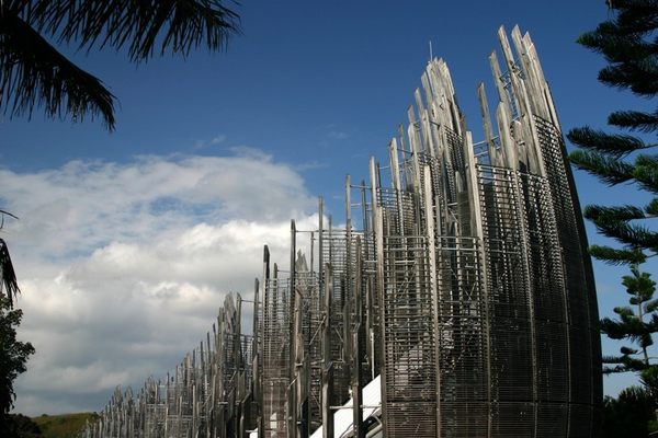
An overgrown monument remembers 60 years of French control in New Caledonia.

Balade, New Caledonia

Added By
mperdeck
Email
Been Here
Want to go
Added to list
CAPTION
  mperdeck / Atlas Obscura User
  mperdeck / Atlas Obscura User
Sign at the monument   mperdeck / Atlas Obscura User
Road side sign   mperdeck / Atlas Obscura User
maps.me screenshot of the location, inside the circle   mperdeck / Atlas Obscura User
Been Here
Want to go
Added to list

About

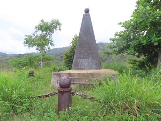
This monument was erected in 1913 to mark 60 years since the French violently took possession of New Caledonia in 1853. Erected with much fanfare, the large pyramid-shaped monument sits atop a stone base on top of a small hill. 

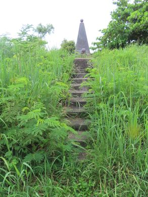
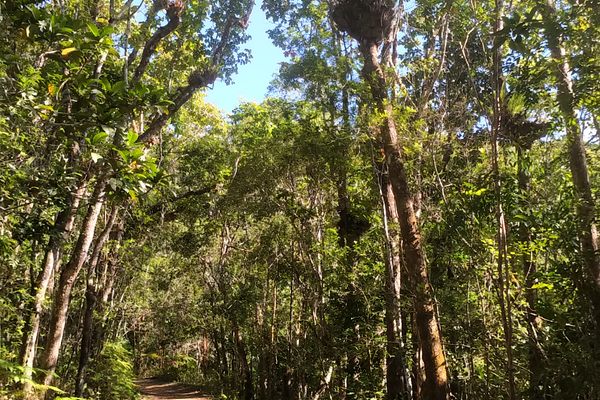
Today, more than a hundred years later, the monument has fallen into obscurity. An overgrown path leads to the monument and the area where the monument sits is also overgrown with knee-high grasses. Today, few visit the area.

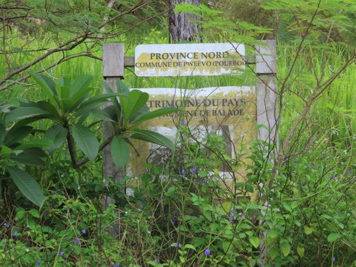
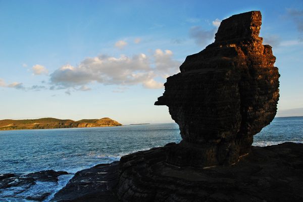
Located on the far northeastern corner of Grande Terre, the largest island of New Caledonia, a few miles from the village of Balade along the RPN7 main road. The monument is easy to reach, as long as you know where to look.

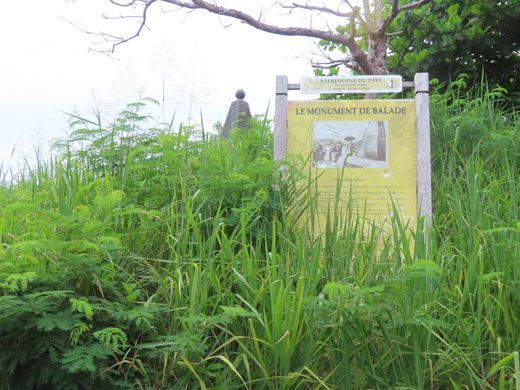
Adding to the difficulty of finding this monument is (1) it is not shown in Google Maps and (2) the sign at the nearby road marking the spot is easy to miss, because it is small and nearly overgrown.

Related Tags

Colonialism Beach Hiking Trails Hidden Monuments

Know Before You Go

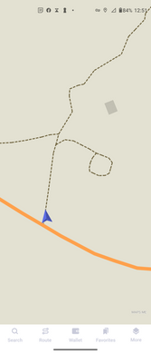
The monument can be found at: -20.297345, 164.474412

It is located along the RPN7, just north of the road, about 2 miles (3 km) west of the Balade church, and about a third of a mile (600 meters) west of the turnoff to Maamaat beach. Search maps for "Maamaat". In maps, look for a small trail west of the Maamaat beach turnoff shaped like a circle. The monument is in the middle of that circle.

Community Contributors

Added By

mperdeck

Published

March 22, 2023

Edit this listing

Make an Edit
Add Photos
Sources
  • http://www.albert-videt.eu/photographie/carnet-de-route/nouvelle-caledonie_11-2004/nouvelle-caledonie_11-2004_180.php
  • https://www.lonelyplanet.com/new-caledonia/north-of-hienghene/attractions/monument-de-balade/a/poi-sig/1526350/1338420
Monument de Balade
Balade
New Caledonia
-20.297345, 164.474412

Explore the Destination Guide

Photo of New Caledonia

New Caledonia

Oceania

Places 4
Stories 1

Explore the Destination Guide

Photo of New Caledonia

New Caledonia

Oceania

Places 4
Stories 1

Related Places

  • The view of the Blue Ridge Mountains here is spectacular.

    Canton, North Carolina

    Black Balsam Knob

    On a clear afternoon, you can see mountain peaks more than 40 miles away from this clearing in the Pisgah National Forest.

  • Water rushes through the upper reaches of the scar.

    Westmorland and Furness, England

    Ewbank Scar

    Water demonstrates its carving power along a Cumbrian trail.

  • Touch nothing at this fragile archeological site.

    Hayfield, California

    Carey's Castle

    Hidden deep in the Joshua Tree Wilderness, this 1940s miner's cabin built into a gap between two mega-sized boulders.

  • Overlooking Mamurra’s villa and baths.

    Formia, Italy

    Parco Naturale Regionale di Gianola e Monte di Scauri

    This little visited park is a treasure trove of ancient Roman ruins.

  • The water tank

    Oxford, England

    Slade Camp

    A lost World War II military camp and post-war suburb swallowed by the woods.

  • Healy, Alaska

    Suntrana Canyon

    This often-overlooked canyon dazzles and intrigues with its many layers of colors, shapes and odd formations.

  • Storefront that has replaced the house of exile.

    Freetown, Sierra Leone

    Prempeh I Exile House

    An Asante king spent four years in exile in a house on this very spot.

  • Remains of the flume supports

    Naples, Utah

    Dry Fork Flume Site

    This hiking trail is scattered with the remains of a failed attempt to provide water to farmers in Dry Fork Canyon.

Aerial image of Vietnam, displaying the picturesque rice terraces, characterized by their layered, verdant fields.
Atlas Obscura Membership

Become an Atlas Obscura Member


Join our community of curious explorers.

Become a Member

Get Our Email Newsletter

Follow Us

Facebook YouTube TikTok Instagram Pinterest RSS Feed

Get the app

Download the App
Download on the Apple App Store Get it on Google Play
  • All Places
  • Latest Places
  • Most Popular
  • Places to Eat
  • Random
  • Nearby
  • Add a Place
  • Stories
  • Food & Drink
  • Itineraries
  • Lists
  • Video
  • Podcast
  • Newsletters
  • All Trips
  • Family Trip
  • Food & Drink
  • History & Culture
  • Wildlife & Nature
  • FAQ
  • Membership
  • Feedback & Ideas
  • Community Guidelines
  • Product Blog
  • Unique Gifts
  • Work With Us
  • About
  • FAQ
  • Advertise With Us
  • Advertising Guidelines
  • Privacy Policy
  • Cookie Policy
  • Terms of Use
Atlas Obscura

© 2025 Atlas Obscura. All Rights Reserved.