Qurnat As Sawda
Lebanon's highest point offers expansive views, martian terrains, and eerie ski lifts.


Many mountains dwarf Qurnat as Sawda in size, but few can offer the experience of ascending such beautiful, untrodden terrain. Summiting this peak carries the added satisfaction of seeing a place few visitors to Lebanon ever experience themselves.
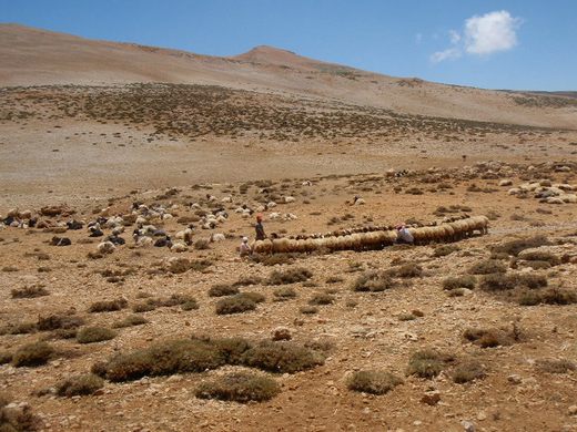
Hiding in plain sight, shrouded by political unrest and pushed aside by cultural preference, hiking to the top of Lebanon’s highest point, one is more likely to pass a Bedouin camp with grazing ponies and sheep than a fellow outdoor enthusiast.
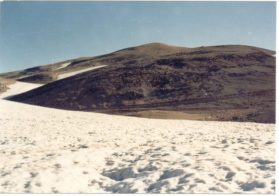
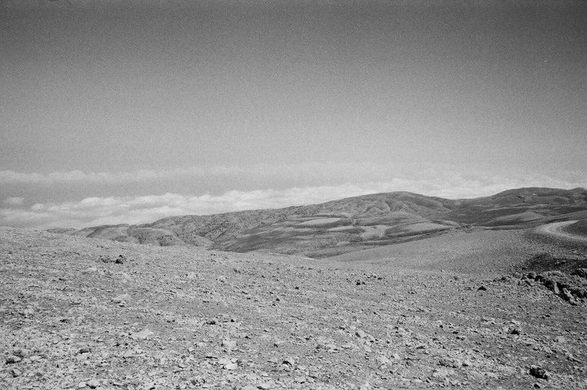
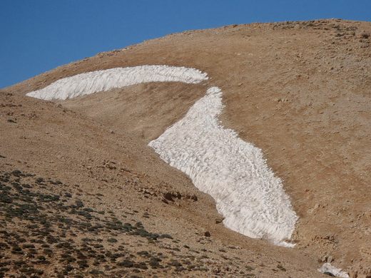
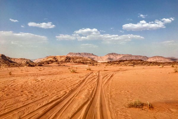
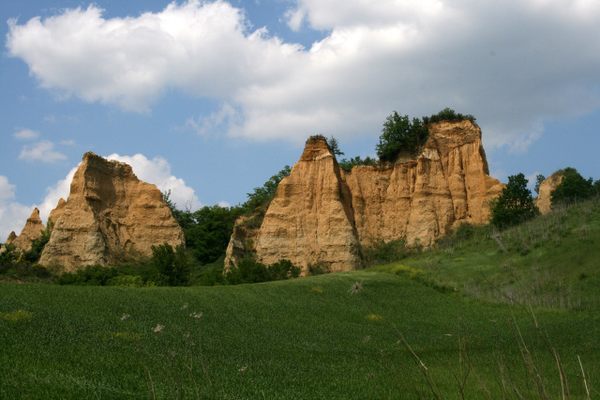
The scenery along the way is spectacular. Expansive desert stretching to all sides is something to behold, especially the sharp juxtaposition of dry rocky soil and permanent snow fields classified as “alpine tundra.” Then, just nine miles east of Qurnat as Sawda’s summit, Mount Lebanon (the common term for the entire range), drops off more than 8,000 vertical feet, revealing breathtaking views and impressive cloudscapes.
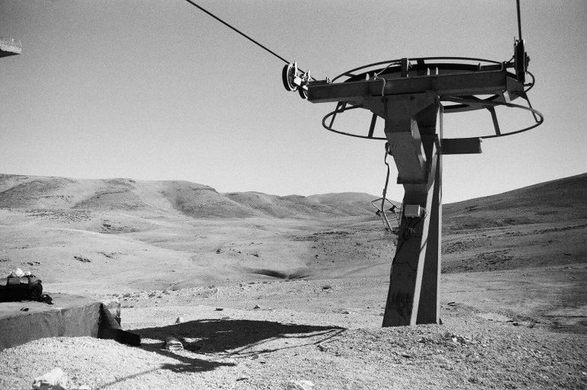
Hikers making the trek in early fall, summer, or late spring will encounter a significant bonus in the seasonally abandoned Cedar’s Ski Resort, whose empty chairlifts to nowhere look post-apocalyptic amidst their Martian surroundings.
The hike itself should be easy enough for any moderately fit individual, but navigation poses something of a challenge. It is advised to thoroughly review online maps, all materials at one’s disposal, and the most recent political movements before departing. Moreover, no water is available after departing the town of Ariz, at the base of the Cedar’s resort, so pack plenty for the hike out and back.
Know Before You Go
Helpful advice from ericharrisbernstein's firsthand experience:
"Good trail maps for As'Sawda are hard to come by. Available online topos are practically useless due to a complete lack of landmarks, trails, and roads. Having scoured the web, I think it best to eschew proper maps and do your research online.
The trail that I followed on my ascent in the summer of 2010, and which is shown in some of the posted pictures, is obscured on google earth but was very easy to follow. The longitude/latitude of the summit, according to peakbagger.com, is 34 18'; 36 7' E, which places it about 3.5 miles Northwest of the peak of the northern-most chair lift of the Cedar's Ski Resort, which I have pointed out in a ski are map.
It sounds a bit scattered and daunting, but I found it fairly easy to find when I was there (it is, after all, "the tallest one")
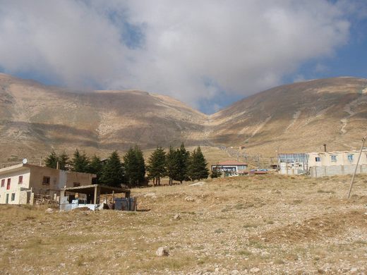
From Bcharre, walk or take a cab east, towards Cedar's. There is only one road headed in that direction, and it is easy to identify - it is the one that goes up. It's about 11 km to the base of the resort, where your off-trail hike will begin.
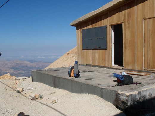
From the base, head up the main slope. There are switchbacks that make the loose rock easier to manage. It shouldn't take more than 90 minutes to get to the top of the lift and the isolated lift operator's shack pictured. We spent the night here and did not see a soul to give us trouble, but I would bet squatting is frowned upon.
From the hut, the valley runs Northwest, funneling visitors to As'Sawda. After about 2.5 miles Northwest along the dirt valley road you will meet with a slightly more established dirt road that will take you another three quarters of a mile Northwest before heading North and a little East to the stout summit (although its prominence is listed around 2,400 m, it is a short jaunt from the valley to the top - from google earth, I estimate it is no more 700 vertical feet from the valley floor to peak), which is marked by a rickety metal structure."


Follow us on Twitter to get the latest on the world's hidden wonders.
Like us on Facebook to get the latest on the world's hidden wonders.
Follow us on Twitter Like us on Facebook