AO Edited
Ru du Pan Perdu
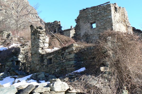
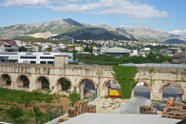
For centuries this cliffside aqueduct was believed to be of Roman origin, but it actually dates to the medieval era.

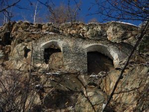
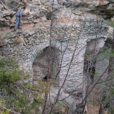
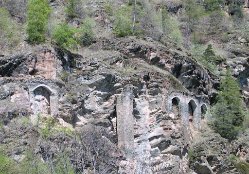

Far in the northwest corner of Italy, in the town of Antey-Saint-André, an ancient, little-known aqueduct hugs the hillside. Dating back to the ninth century, the medieval aqueduct, known as Ru Du Pan Perdu, was originally built as an irrigation canal. The structure would collect water falling from mountainside streams and funnel it to the agricultural land below. The name Ru Du Pan Perdu literally means “channels of lost bread” and indicates that the laborers who built the aqueduct were likely never paid for their work and therefore did not complete the project.
The site became a popular spot on the European “Grand Tour.” From the 17th to the mid-19th centuries, European wealthy young people would embark on these Grand Tours across Europe and the Middle East, often spending months or even years away. One such tourist, Edward Whymper, who climbed the Matterhorn in 1865, wrote about seeing the aqueduct in his diary: “One sees from the path, at several places on the right bank of the valley, groups of arches which have been built high against the faces of the cliffs.”
At the time, almost everyone thought these impressive arches were Roman, not medieval. Guide books of the era repeated the falsehood. But Whymper correctly guessed the aqueduct was a later construction. He wrote, “the work has not the usual Roman solidity. The arches have always seemed to me to be the remains of an unfinished work.”
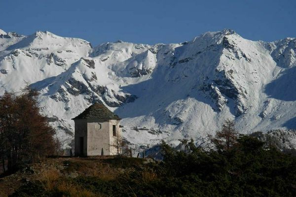
Today, the aqueduct is visited far less frequently than in the 19th-century. But for those willing to make the trek, the structure also offers stunning views of the surrounding Alps.
Know Before You Go
After reaching Antey-Saint-André, drive on the highway towards Chatillon. From there, follow signs to Breuil-Cervinia. There’s a parking lot to the right of the tourism office and that’s where the trailhead for path 105 starts.
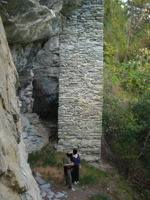
Once on the trail, keep your eyes peeled for an engraving that reads "1879 7B", just before a large rock with a yellow trail mark. Then follow a smaller trail to the left for about 40 yards. There you’ll see the base of an 8-foot-tall pillar that’s part of the aqueduct.


Follow us on Twitter to get the latest on the world's hidden wonders.
Like us on Facebook to get the latest on the world's hidden wonders.
Follow us on Twitter Like us on Facebook