Rulison Nuclear Test Site
The site where a nuclear bomb was lowered over 8,000 feet underground and detonated as an experiment in natural gas extraction.
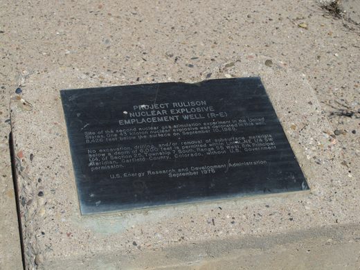
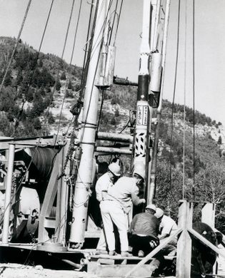

On September 10, 1969, the United States Atomic Energy Commission detonated a 40-kiloton nuclear bomb (nearly twice as powerful as the one dropped on Hiroshima at the end of World War II) 8,400 feet beneath the rural community of Rulison, Colorado.
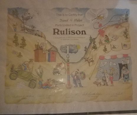
The aim of the detonation was to test whether mining for natural gas could be aided by freeing the gasses with nuclear bombs. The nuclear test at Rulison was part of a series of detonations conducted under Operation Mandrel, though this was the only one carried out near a human population. The others were on remote federal land in Nevada and New Mexico or on an uninhabited Aleutian island in Alaska.
Locals were evacuated on the day of the detonation. Those who watched from afar described it feeling like an earthquake, with the ground shaking, rocks crumbling off cliffs, and parked cars being shaken around. Some nearby homes even suffered broken chimneys and cracked windows.
In one sense, the test was a great success. Massive amounts of natural gas were released from the vaporized underground stone. But the gases were irradiated and deemed unusable. To this day, the Environmental Protection Agency tests municipal, well, and groundwater in the area once a year to make sure no radioactive contamination has seeped away from the underground blast site. Both the federal government and state of Colorado have placed restrictions on mining and drilling in the area.
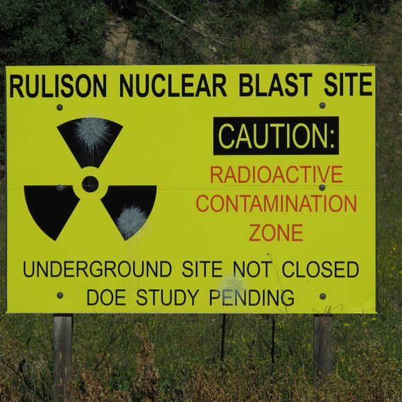
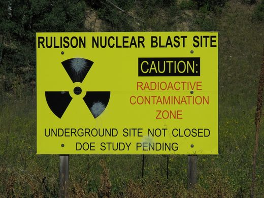
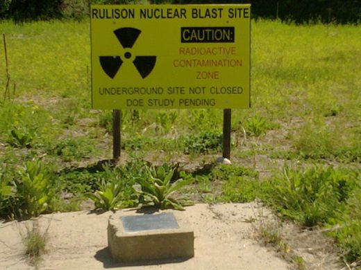
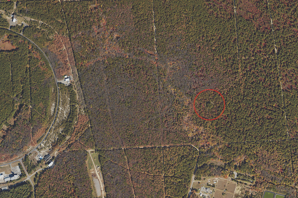
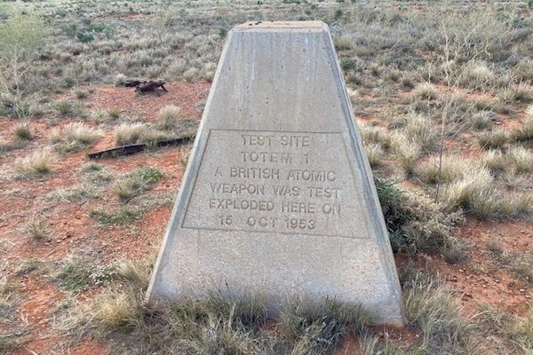
There is little evidence of the nuclear test conducted there. The shaft where the nuclear bomb was lowered has been cemented over and marked with a plaque and a sign warns visitors of potential radiation.
At about the same time as Project Rulison in western Colorado, a similar detonation was planned for the Pinedale area of western Wyoming, called WASP, the Wyoming Atomic Stimulation Project. After the lack of a successful increase in usable natural gas flow at Rulison, WASP was abandoned.
Update as of August 2020: The sign has been removed.
Know Before You Go
The site is hard to reach. You have to drive down various rural dirt roads, some unnamed. From N. Battlement Parkway, turn onto CR 310. Follow CR 310 until it dead-ends (after approximately one mile) and turn right onto an unnamed road. Stay on this road for approximately three miles and keep going straight when the road makes a sharp left. In about 1,000 feet look for the bright yellow nuclear blast site sign behind a wooden fence.
The sign and plaque are located on private property, viewing is very limited and only available from the fence line.


Follow us on Twitter to get the latest on the world's hidden wonders.
Like us on Facebook to get the latest on the world's hidden wonders.
Follow us on Twitter Like us on Facebook