Explore an Interactive Aerial Map of the Past
Historic Aerials is like Google Maps for time travelers.
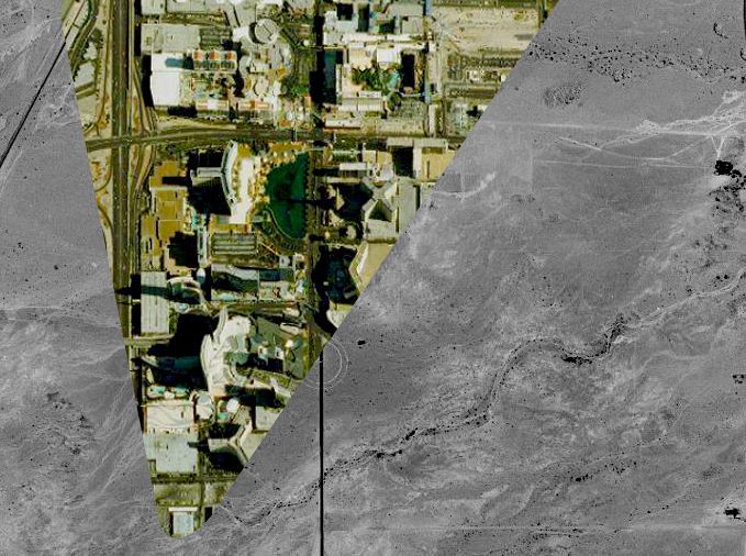
Maps are great and all, but they’re generally just snapshots—a region as it exists at a very specific point in time. But since we’re living in the future, of course we’ve found a way to make maps change with time. A cartography project called Historic Aerials is attempting to create an interactive photographic map that lets you change the year—as if Google Maps had existed since the 1940s. And like many great innovations, it sort of began by accident.
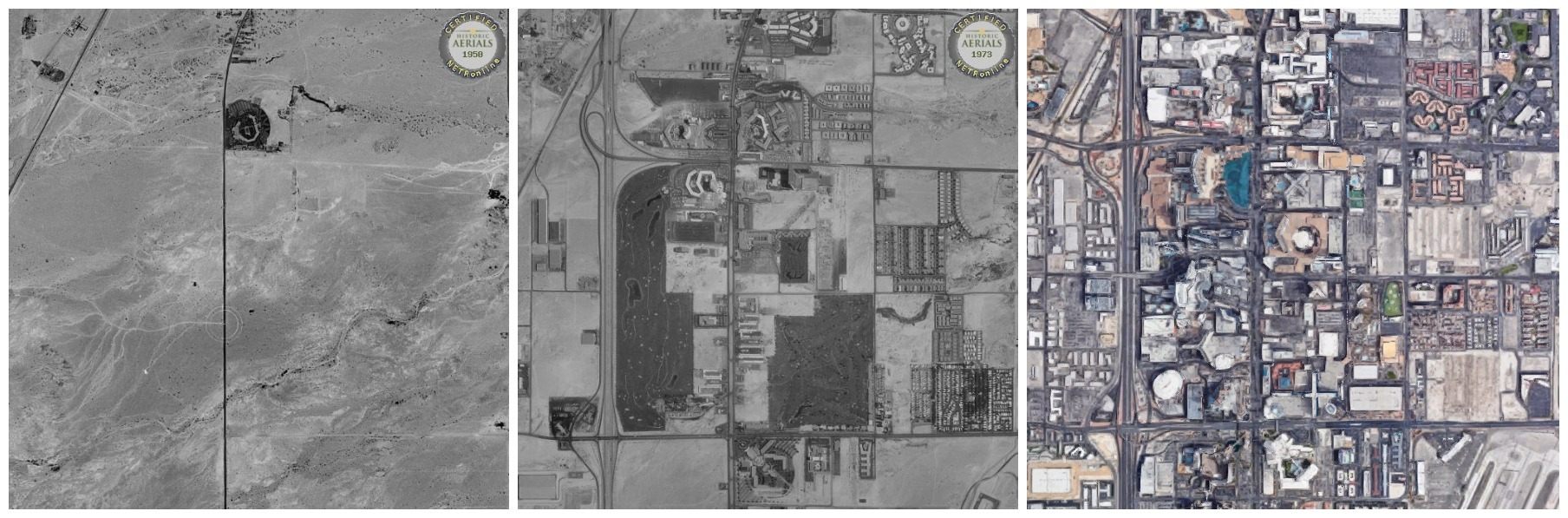
Historic Aerials makes money by selling historic land and property photos, but their lasting legacy may be the map tool they built to make this possible. The project is an offshoot of Nationwide Environmental Title Research (NETR), a company that provides research for investigations into cases of environmental contamination. NETR’s work often involves looking into land use and property lines as they once existed, for comparison with how they exist today, to determine who was doing what and where. The company ended up amassing a large collection of aerial photography (sometimes dating back as far as the 1920s) from the United States Geological Survey and other government archives, as well as private collections. While the images themselves provide an interesting look at land history from 35,000 feet, they aren’t perfect maps by themselves, in part because they come from different altitudes and often aren’t taken from directly overhead.
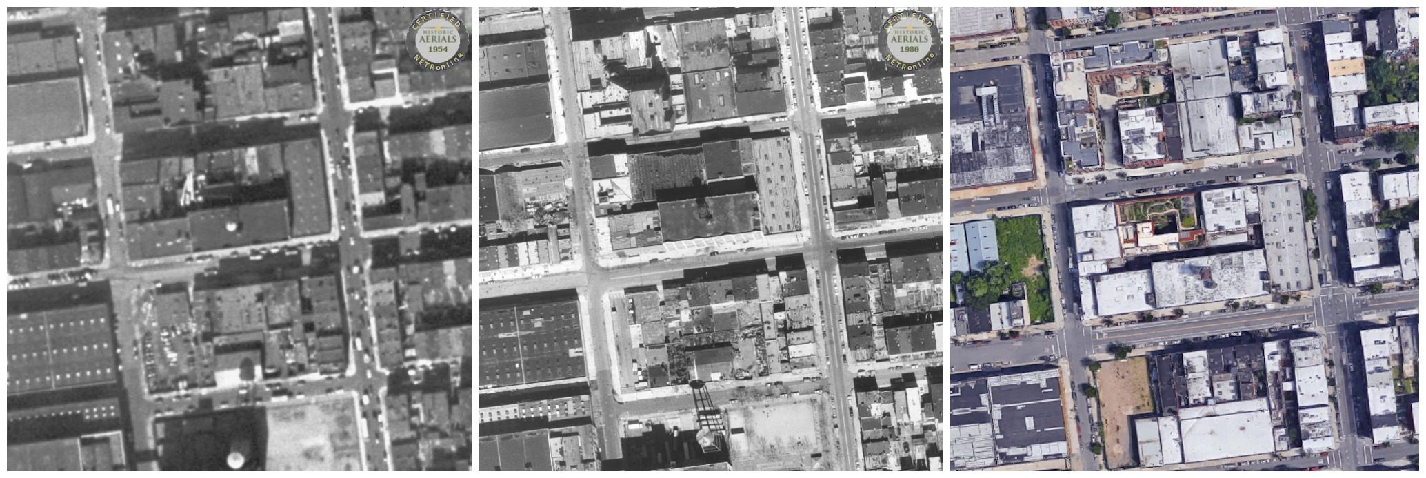
“The photos aren’t really spatially correct, and you can’t really line them up with streets, and you couldn’t really locate, with pinpoint accuracy where [an] actual boundary was,” says Brett Perry, one of the minds behind the Historic Aerials project. When Historic Aerials translates an old image for use in their modern map tool, they correct for ground elevation, the height from which the image was taken, and other measurements to correlate their old images with modern ones. “When you’re just looking at a raw photo, the only part that was actually correct was the part that was directly below the planes. All the other information corrects for that, just as they do with the modern imagery, but we have to do that with the historic stuff.”
While there are all kinds of online mapping tools that allow you to place filters, overlays, and other information on aerial and satellite imagery, this map tool makes time a variable, so you can see what a location—roads, buildings, forest, and more—once looked like. You can then add all the modern overlays we’re used to—like opening a portal across decades. “We refer to it as a virtual time machine,” says Perry.
Right now, the maps only cover certain parts of the United States, but Perry and his small team will continue to acquire images and fit them in. This discovery process, however, is slow and inexact, so the expansion of the map is irregular. At present, the map has the most coverage in areas such as New Jersey, Las Vegas, and Arizona, where NETR is based. “For Las Vegas you can go back literally every single year,” Perry says. “Eventually we’ll have that for Phoenix.”
Since the project began with environmental investigation, many of its early users were environmental consultants. Increasingly others have been finding new uses for the map tool. “We have landscape architects, archaeologists, attorneys, land developers,” says Perry. “People who have metal detectors who are trying to locate areas that might be prone to have old coins and old structures. Then you have other enthusiasts, like model train builders who are trying to see what an old train depot looked like way back when. It’s a pretty wide spectrum.”
Though the growth is slow, Perry says that he would one day like for the Historic Aerials interactive map to cover the entire world, for as long as aerial photos have been possible. “Right now we’re trying to get the ’80s. The ’80s, for some reason, has been sort of a challenge to get good quality imagery,” says Perry. “[I’d like] at least something in every decade from at least the ’40s, if not the ’30s. Europe pre-WWII. To be able to go back and see buildings that were lost during the war, whether that’s London or Germany or something like that.”
Check it out, see if your home region is covered, and get a sense of just how much it’s changed.


Follow us on Twitter to get the latest on the world's hidden wonders.
Like us on Facebook to get the latest on the world's hidden wonders.
Follow us on Twitter Like us on Facebook