The Iceberg Trackers Keeping an Eye on the Ocean’s Behemoths
As well as smaller bergs that can be more dangerous to ships.

When icebergs make news, it is generally due to something rare and dramatic: a chunk twice the size of New York City, another threatening the ecosystem of an entire island, or, of course, Titanic. But each day human eyes are watching bergs of many shapes and sizes, mapping their movements at both ends of the Earth and helping ships steer clear of these icy hazards.
Call them iceberg trackers. Or iceberg-ologists. Or ice scientists, perhaps. They peer through clouds using radar and satellite technology, and descend through fog in specially equipped cargo planes to get close-up looks at the meandering giants and environmental conditions that impact the way they drift, move, and deteriorate.
“It’s the best job in the world,” says Lt. Don Rudnickas, the satellite reconnaissance branch chief of the International Ice Patrol (IIP), which was founded back in 1913, as a consequence of the Titanic disaster, to monitor iceberg danger in the North Atlantic Ocean. The IIP watches over a vast area stretching east and south from the Canadian coast of Newfoundland and Labrador—a region that includes the scenic Iceberg Alley, and a swath where busy transatlantic shipping lanes can cross paths with icebergs moving south on the Labrador Current, a major “conveyor belt” of ice calved from Greenland.
A Coast Guard navigator and oceanographer, Rudnickas has led surveillance flights that operate just 2,000 feet above the water to map and observe icebergs. “You think they’re these static pieces of ice but they’re actually quite dynamic. As they’re melting and experiencing wave action, their center of gravity and buoyancy are changing, and they roll, flip, and split quite frequently,” he says. “They’re right at the end of their existence, coming back to the ocean, and frankly, that’s when they’re most dangerous to ships.”
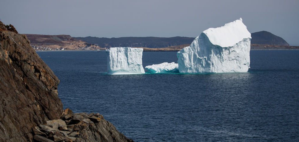
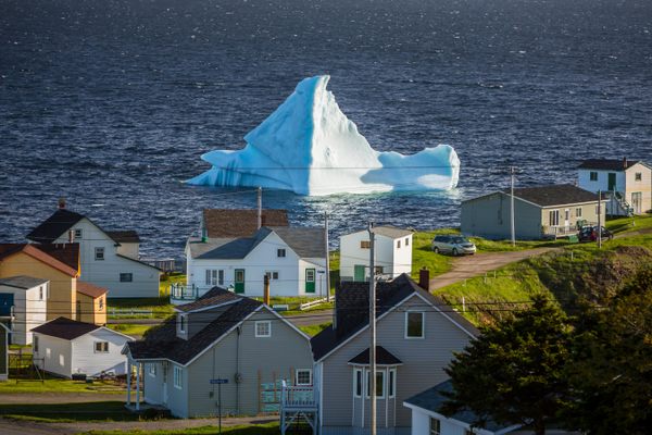
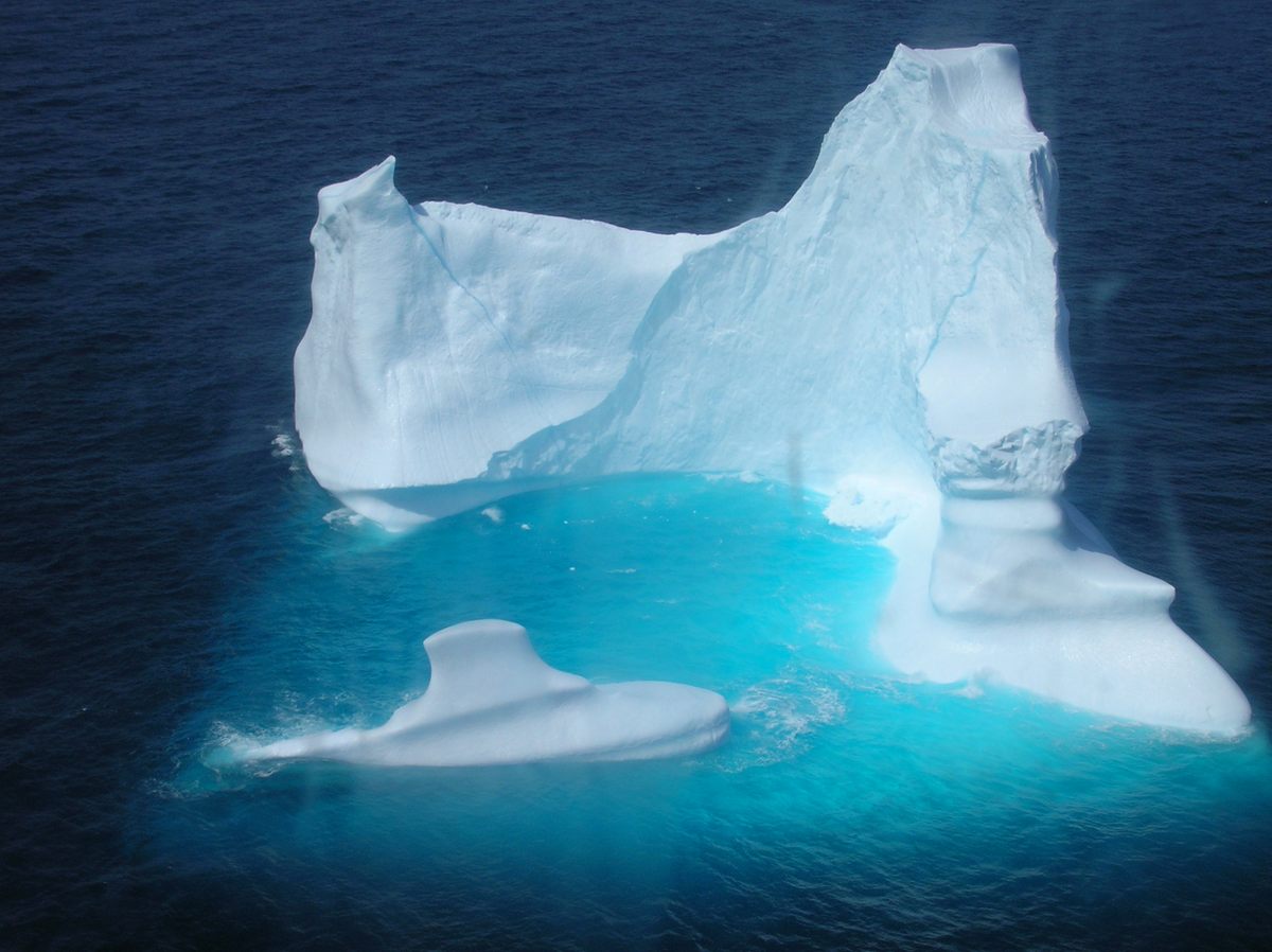
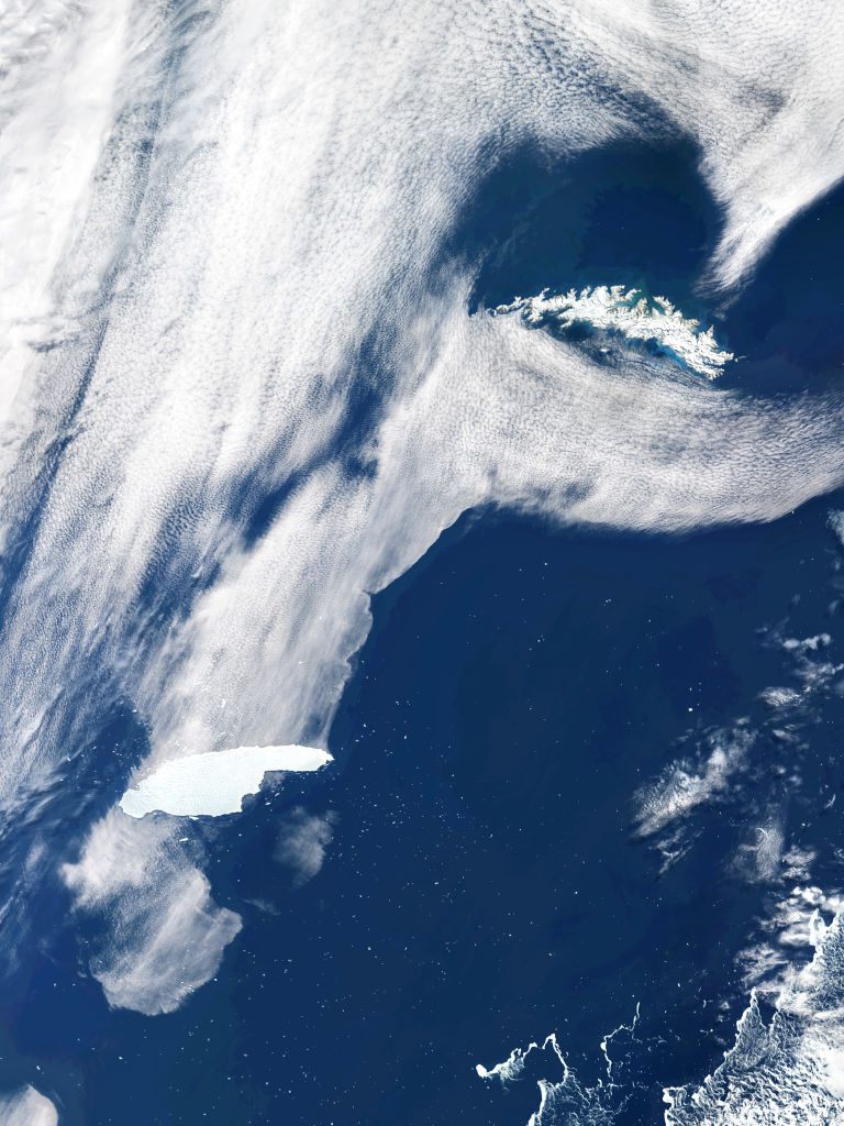
Unlike in Antarctica, where massive, flat, tabular bergs break off and often circle the continent, carried by deep ocean currents, or get lodged in one place, the Arctic tends to see smaller icebergs that still carry a hefty amount of ice underwater. The flotilla of frosty, bluish icebergs that parade down Iceberg Alley each year—dazzling onlookers on the east coast of Newfoundland from spring to early summer—shape-shift as they drift south from Greenland to warmer waters and melt. These can actually be more hazardous to ships than Antarctica’s behemoths.
“An iceberg the size of Manhattan you’re going to see on radar,” says Rudnickas. “It’s the little 15-meter iceberg that keeps me up at night.”
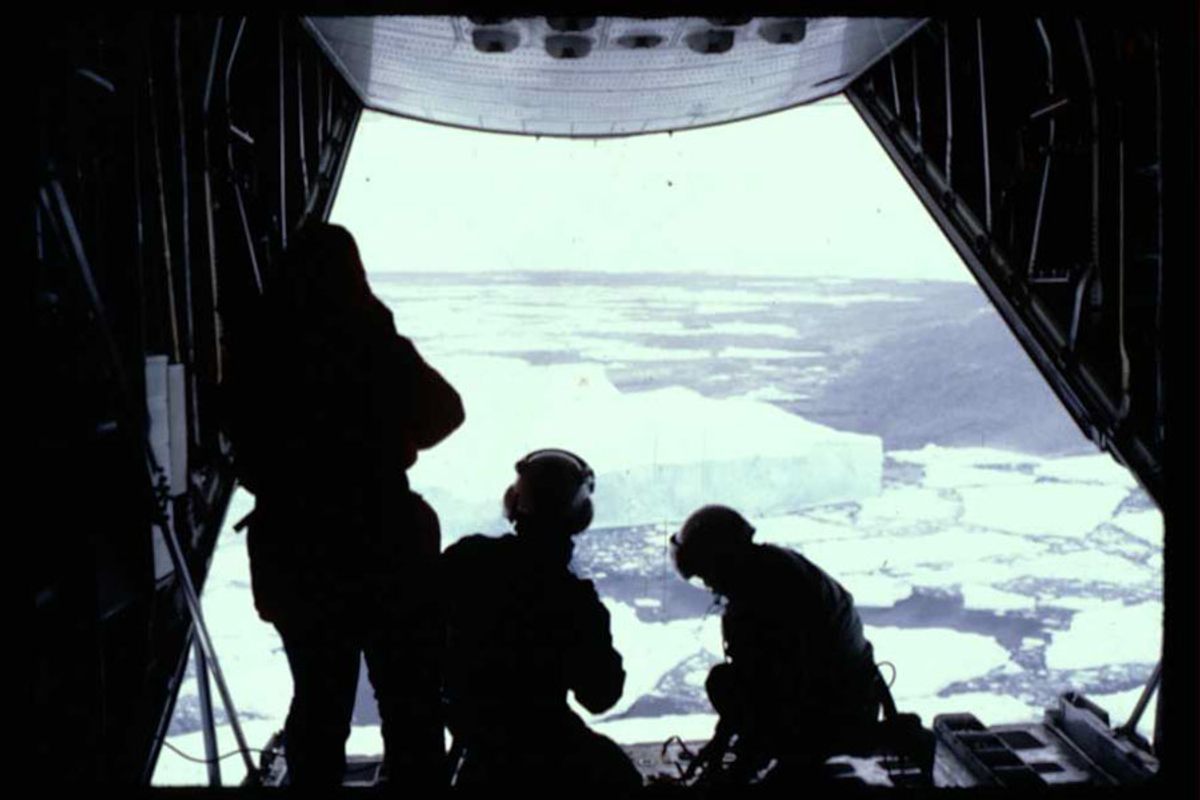
For the IIP—operated by the U.S. Coast Guard, though costs are shared by 19 member nations that use the area’s shipping lanes—what began before World War I as a single reconnaissance ship has evolved into aerial observations and high-tech data that are funneled into an oceanographic model that predicts iceberg movements. Each season, thousands of ships—cargo, fishing, military—pass through the maritime corridors around Iceberg Alley and the Grand Banks of Newfoundland. It is a tricky passage, where fog, wind, and waves can make detecting and avoiding icebergs particularly difficult.
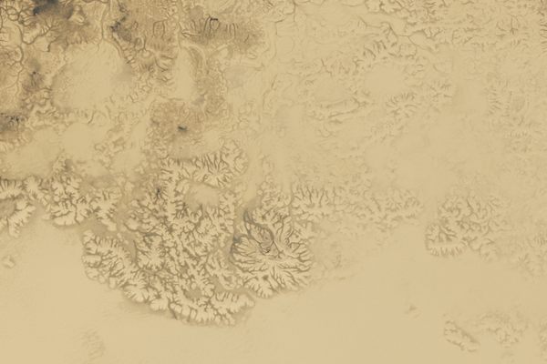
Canada, Finland, Russia, and other countries with Arctic backyards do their own ice monitoring, says Mike Lowe, senior ice analyst for the U.S. National Ice Center (NIC), which tracks and names icebergs of notable size. Originally a meteorologist and mathematician, Lowe keeps a watchful eye on the movements of Antarctic icebergs. In February, he was the first to spot a new fragment of A-68A, a colossus that was as big as Delaware when it calved from Antarctica in 2017. By the fall of 2020, A-68A was on a collision course with wildlife-rich South Georgia Island (also the resting place of polar explorer Ernest Shackleton), threatening to disrupt its ecosystem, before breaking up into smaller—though still sizable—pieces.
“It’s neat when you watch an iceberg break off, even if you don’t see it in person,” says Lowe, who identified the fresh shard, called A-68O, using satellite images. “There’s the spirit of discovery while sitting at your desk. It’s not quite the age of Antarctic exploration but it’s still cool.”
Icebergs must be either the approximate size of Manhattan or at least 10 nautical miles (11.5 miles) long to be named by the NIC, an operation of the U.S. Navy, Coast Guard, and National Oceanic and Atmospheric Administration. Though most of NIC’s monitoring is done by satellite, Lowe has deployed his scientific expertise in the Southern Ocean, aboard an icebreaker cutting the way for resupply ships headed to McMurdo Station.
NIC, along with the British Antarctic Survey, now has eyes on A-74, a massive berg nearly twice the size of New York City’s five boroughs that broke off Antarctica’s Brunt Ice Shelf near a British research station in late February 2021. Though these mammoths draw the most attention, NIC also monitors ice in less obvious places—the Great Lakes, the Potomac, Chesapeake Bay—where sea or lake ice might interfere with shipping activity. Safety is a common goal for the IIP and NIC, even as they concentrate on different parts of the world.
The coolest part of the job? “To be up alongside the icebergs on a vessel,” says Rudnickas. “You can hear the water splashing on them, you can see all the sea life that they protect and kind of nurture on their journey down the coast. And you can see the silt and the gravel that came off the coast of Greenland as the iceberg calved—all the different layers of pressurized ice. It’s quite amazing to see them up so close.”


Follow us on Twitter to get the latest on the world's hidden wonders.
Like us on Facebook to get the latest on the world's hidden wonders.
Follow us on Twitter Like us on Facebook