Meet the International Ice Patrol: Stopping Ships From Running into Icebergs Since 1913
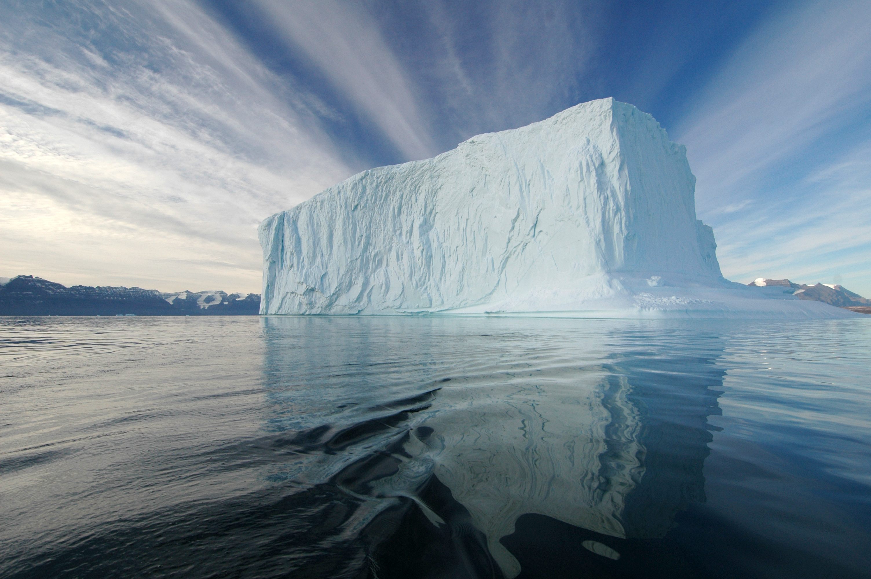
Definitely an iceberg (Photo: Rita Willaert/Wikimedia)
When the International Ice Patrol first started searching the North Atlantic for icebergs, after the Titanic sunk in 1912, a ship would make its way into the middle of the ocean, find the southernmost iceberg and babysit it for the rest of the season. When the iceberg moved, so would the ship. By reporting its position to boats trying to cross the ocean, it could keep them out of the way of all the other giant pieces of glacier floating through the water. As long as ships stayed south of that iceberg, they were most likely safe.
“We knew really well where that iceberg was,” says Michael Hicks, the chief science and oceanographer for the IIP. “But we had just a small glimpse of a very large area.”
In the 1940s, the patrol, which is part of the U.S. Coast Guard, vastly expanded its field of vision when the team started using planes to scout out icebergs across the ocean. But for decades the patrol has been thinking about how to surveil the sea from even further upwards, by using satellites.
As early as the 1960s, the International Ice Patrol recognized the potential of spying on icebergs from space; in the 1970s, it seemed clear that satellites would be key to the patrol’s future. “As satellite technology improves, all iceberg production and glacier retreat monitoring will be accomplished remotely and at comparatively little expense,” the patrol’s annual report on the season of 1974 predicted.
But actually incorporating satellite imagery into the daily operations of the organization is more complicated than it might sound. One of the only things keeping icebergs from sinking ships is the information the patrol sends out daily and weekly to mariners, and that information needs to be entirely reliable. Satellites, though, are not: right now, they still have a hard time telling an iceberg from a ship.
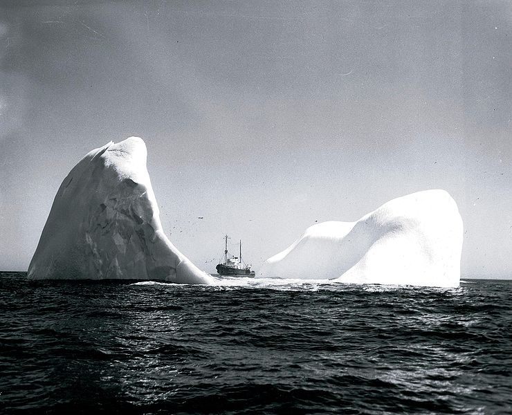
The International Ice Patrol in 1943 (Photo: USCGC/Wikimedia)
The International Ice Patrol itself is made up of just 16 people, and their home base these day is in Groton, Connecticut, even though the planes the team uses to patrol come from North Carolina and they run the actual patrols from Newfoundland, in Canada. During the active iceberg season, which runs from February to August, Coast Guard pilots will fly the planes from North Carolina to Connecticut, pick up the Ice Patrol team, and fly to St. John’s, a city on the tip of the Avalon Peninsula, which juts far east into the Atlantic Ocean.
The Ice Patrol team will stay up there for 7 to 10 days, and fly out over the ocean as much as they can. The patrol also track currents, winds and ice conditions, and Hicks uses that data to advise the patrol commander about where to target the flights. Even from the sky, there’s only so much area that the patrol can cover. And some days the mercurial weather is bad enough that planes can’t fly at all. A forecast might look good, but in the morning, the fog will be so thick that it’s impossible to see 100 feet.
These flights aren’t the Ice Patrol’s only source of information. Ships that happen to sight icebergs will send reports. Oil and gas companies that operate on the Grand Banks of Newfoundland have their own planes flying reconnaissance flights, and they share that information with the Ice Patrol, too. But most of the IIP’s reconnaissance work depends on the Coast Guard planes.
Those planes, though, aren’t only flying ice patrols. When they’re not in Newfoundland, they might be sent on search-and-rescue missions or to support the Coast Guard’s work to stop drug smuggling. “They’re in very high demand to fulfill other Coast Guard missions,” says Hicks. And that’s one reason why the Coast Guard wants to start using the satellites more.

Also definitely an iceberg (Photo: Drew Avery/Wikimedia)
Using satellites to identify ice was a early and obvious application of the technology: the IIP works with agencies like the Canadian Ice Service and the National Ice Center that have a long history of spying ice from above. The Canadian Ice Service is charged with understanding ice conditions in Canada’s navigable waters, which include parts of the Arctic Ocean, and the vast and remote nature of that region means that it’s almost impossible to survey with planes alone.
But there are different types of ice to spy on: sea ice—frozen ocean water—is relatively easy to distinguish from above. Icebergs are whole different story. “We’re looking for a tiny moving dot in the ocean,” says Hicks.
The first challenge of using satellite, for the IIP, is that the area in which they operate is covered with clouds 75 to 80 percent of the time. Satellites that collect visible or infrared images just deliver pictures of clouds—not exactly helpful for monitoring icebergs. The Ice Patrol didn’t start seriously experimenting with using satellite images until 1997, when a Canadian company, in partnership with the country’s space agency, launched Radarsat-1, a satellite equipped with a type of radar with a particularly high resolution.
The images that the radar delivers, looking down on the ocean from above, are just bright spots against a darker background. “It’s not a very clear picture of an iceberg,” says Hicks. That’s sometimes true for the radars that the Coast Guard’s planes use, too. But in a plane, when a spot isn’t clearly a berg or a boat, the patrol members can zoom the radar in to observe the mystery object in more detail or they can fly down lower towards the ocean to inspect it.
Satellite images, though, don’t have that flexibility. They’re first examined by a computer algorithm, which identifies possible icebergs; those are analyzed by a person who helps determine what the satellite has actually seen. Ships, says Hicks, tend to have standard shapes, and sometimes, a wake will appear behind a ship for miles. Icebergs are more irregularly shaped, and the radar technology on the satellite can sometimes observe that.
Still, though, as the IIP wrote in its 2011 report, “Distinguishing between icebergs and vessels is also a significant challenge.”

Icebergs as seen from a helicopter (Photo: Brocken Inaglory/Wikimedia)
At the moment, the IIP is working with its partners at other government agencies and in the private sector to teach the algorithms that read satellite data what an iceberg looks like and what a ship looks like. The patrol tries to coordinate their flights with the satellite passes: if they know that they saw an iceberg at a particular place, at a particular time, they can use that information to build a profile that will train the computer to distinguish a giant pile of ice from a giant pile of metal.
There is a certain trade-off between examining a wider area and detailed knowledge about the icebergs they’re monitoring. Back in the early days of the Ice Patrol, they knew a lot about that one southernmost iceberg. “You knew how big the iceberg was, and you knew exactly where it was,” says Hicks. But they only knew about that one (and a few other critical ‘bergs). Now, says Hicks, “we’re covering more area, but know less about the individual objects.”
Identifying bergs through satellite images doesn’t require the same level of intimacy that the Ice Patrol had with its targets back at the beginning. But the strategy does need to be able to reliably identify icebergs. Right now, iceberg spotting via satellite still misses significant numbers of the icebergs that the Ice Patrol finds: there’s only about a 50 percent overlap.
If the accuracy of the satellite reconnaissance improves, though, the patrol could have a much clearer view of the movements of icebergs over a much wider swath of ocean. Ship captains navigating treacherous stretches would better know what to expect when they spot frozen peaks on the horizon.


.jpg)
.jpg)
Follow us on Twitter to get the latest on the world's hidden wonders.
Like us on Facebook to get the latest on the world's hidden wonders.
Follow us on Twitter Like us on Facebook