How Far Can You Abstract a Map?
Morphology, an exploratory cartographic tool, turns the whole world into swoops and lines.
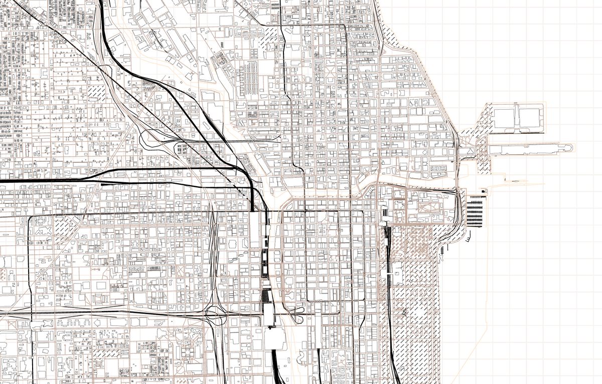
Can you guess which city is depicted above? If you look closely, there are plenty of clues: the big arterial river, the blocky buildings crowded onto the pier, the carefully plotted streets overlaid by the occasional loop of highway.
Do you have it? This is Chicago, Illinois, as viewed in Morphology, an exploratory cartographic tool on the Mapzen platform that eschews common communicative elements like color and symbols. Instead, it seeks to show the world, and all its constituent parts, as a series of carefully chosen lines.

Morphology is the brainchild of Geraldine Sarmiento, a cartographer at Mapzen. “I’ve always observed the forms of things,” Sarmiento says. “It could be a flower, a face, a teapot, the rings of Saturn—anything really.” When you look closely enough, she says, “patterns [and] rules repeat and change rhythm over time, just like you might hear in music or see in nature.”
All mapping involves abstraction. If we want to see the world laid out on a piece of paper, or scroll through a whole city by swiping on a phone screen, we first have to flatten and simplify it, making choices about what to show and how to show it.
Now that so many cartography tools are online, some of these decisions are built into the programs themselves. The Mapzen platform, for example, separates a given area into landscape and infrastructural elements, from parks and parking lots to roads and rivers.
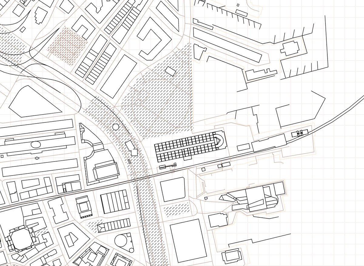
For Morphology, Sarmiento decided to take this logic of abstraction further, dissecting each of these elements into their own elements in turn. Using a rendering program called Tangram, she drew every feature in isolation, moving through the layer types alphabetically and deciding how best to represent each, using only lines at different lengths and thicknesses. “Lines are the most elemental and versatile material we can work with,” she explains in a blog post about the project.
Bridges and highway ramps, pared down to lines, looked like elegant tangles. Farms became big crosshatched patches. When drawing, “each feature deserves exquisite attention,” Sarmiento says. The goal was to reveal “the essence of the thing itself.”
As Sarmiento kept working, she found that zooming out a bit made other essences cohere as well. “The shapes of cities themselves reveal distinct cultures, the forces of nature that shape them, and the human interactions that take place on that shape,” she says.
Turn a sky view of Manhattan’s buildings into lines, and you see messy clumps of individuality (is that a courtyard?) squished into an orderly grid. Meanwhile, in Los Angeles, the shapes are regimented while the arrangement is haphazard, and in Paris, everything is puzzled around the central wheel of Place Charles de Gaulle.

Because Morphology creates an interactive map, the last set of choices is left to the viewer. The “Default” setting provides a particular subset of layers, including airports, roads, and water. But you can also choose to see each layer in isolation, learning what a chosen place would look like if everything but the bridges—or farms, or racetracks, or places of worship—was suddenly vacuumed away.
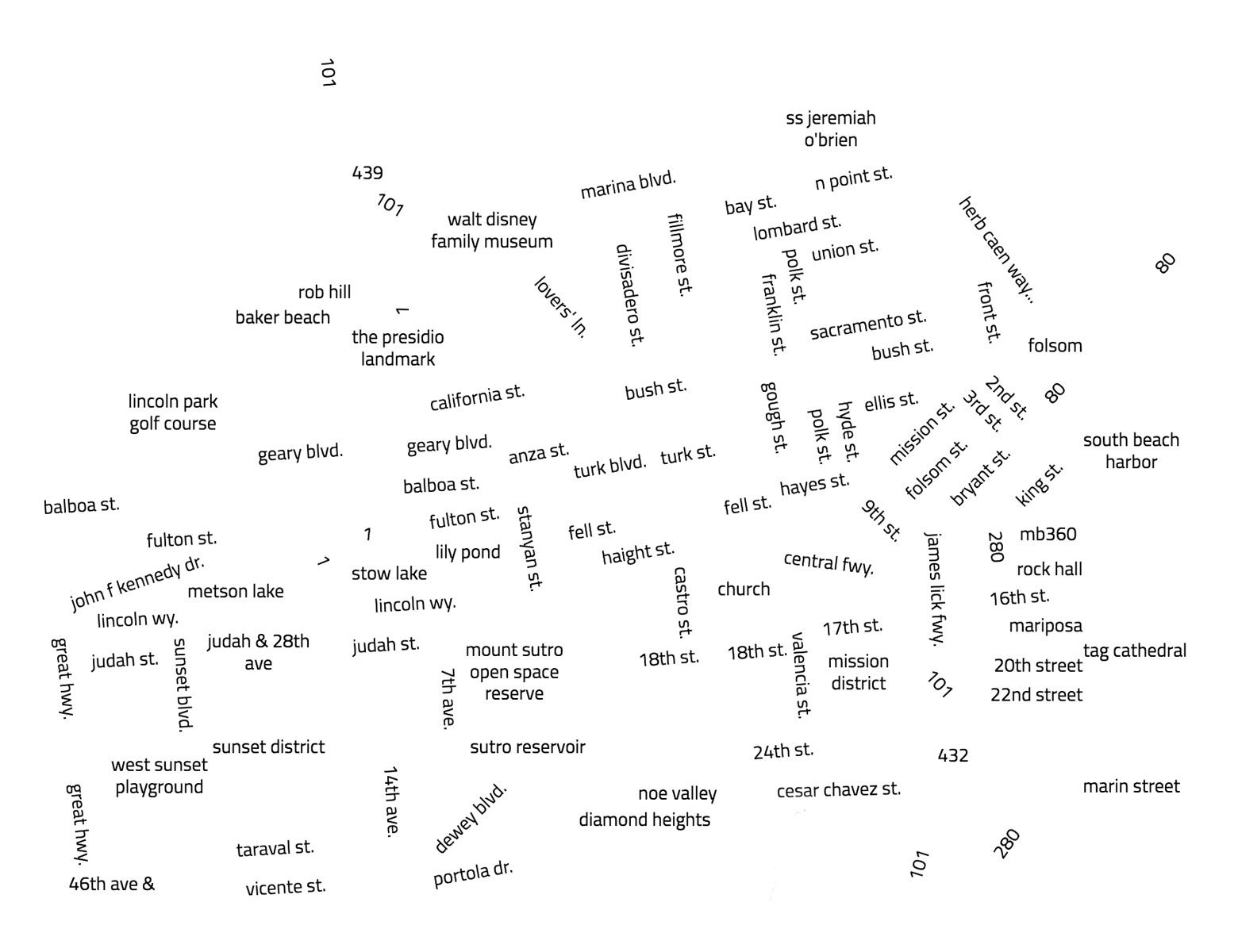
Bookmarks curated by Sarmiento lead to particularly interesting combinations, like the snaggle-toothed piers of Boston, or the tip of Florida made of just canals. One particularly disorienting layer consists entirely of labels: mouse over to, say, Avalon, California, and you’ll see dozens of street and landmark names worming through empty space. After all, “letters and words themselves are configurations and combinations of lines,” Sarmiento says.
Sarmiento describes Morphology as a work in progress, and says that as she continues to refine it, “more questions surface.” “It could go up and down at all scales,” she says. Will she keep zooming in, and see if yet more patterns emerge? Or go way out, and try to boil down the whole world into a dot?
It all depends on where the lines lead: “I’m still exploring,” she says. “I want to see what the forms can teach me.”
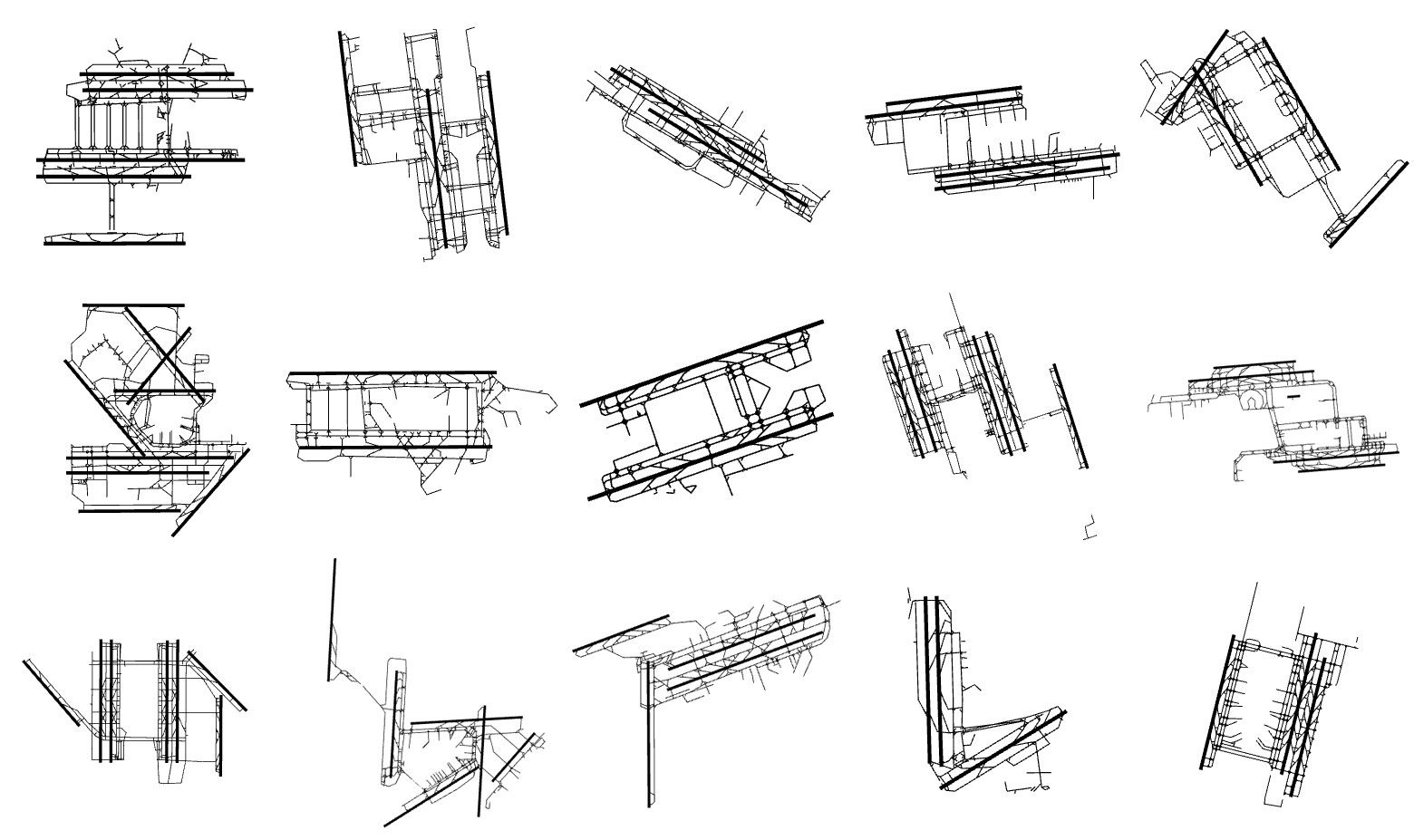
More views from Morphology are below—see if you can guess where and what they are.


Answers, from top to bottom: Coastlines of the Ganges Delta; railways of Antwerp; buildings of Brooklyn; bridges and water in Amsterdam, farms in Utah; labels in Tokyo; water in Port Charlotte, Florida.


Follow us on Twitter to get the latest on the world's hidden wonders.
Like us on Facebook to get the latest on the world's hidden wonders.
Follow us on Twitter Like us on Facebook