This Glacier Is Losing Ice Faster Than Any Other in Antarctica
Pine Island Glacier calved icebergs in 2013, 2015, 2017, and 2018—and now, another one is getting ready to break free.

Down in the notoriously vulnerable ice sheet of West Antarctica, Pine Island Glacier seems to be breaking up faster than ever, and it’s looking like 2019 might be another busy year. The ice shelf calved major icebergs in 2013, 2015, 2017, and 2018—and now, another one is getting ready to break free.
The instability of this glacier is not just bad for the southernmost continent. It is bad for the globe. This glacier is contributing more to sea level rise than any other in Antarctica. New research has shown that since 1979, Pine Island Glacier has lost 58 billion tons of ice per year, which makes it the biggest loser of the continent. Combined with its unstable neighbor, Thwaites Glacier, these glaciers are contributing one millimeter per decade to global sea level rise.
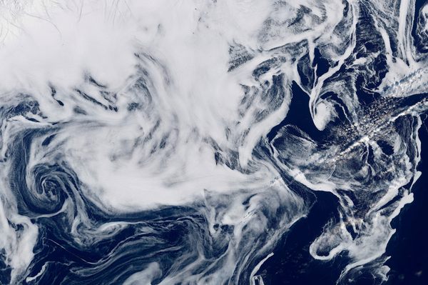
While large ice masses can appear solid, they are actually complicated, dynamically flowing systems. Miles-thick glaciers sit on the Antarctic continent as their ice slowly flows out to sea, creating a floating ice shelf that can calve icebergs. While this movement is a normal process, the frequent calving of icebergs and glacial landward retreat can indicate something out of the ordinary is happening. As the floating ice shelves retreat and shrink, the pressure on the land-based glacier gets relieved, allowing it to flow faster towards the ocean where it can then melt and cause sea level rise.
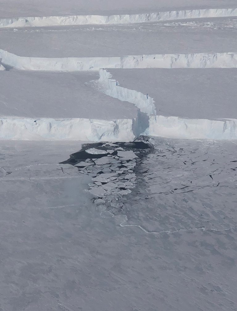
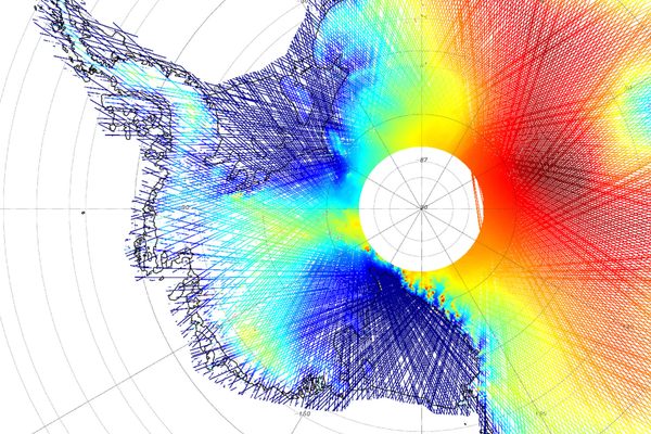
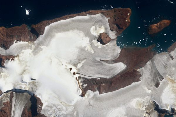
Thanks to satellite data from the European Space Agency’s Sentinel-1 satellite network, NASA’s Landsat satellite network, and NASA IceBridge reconnaissance flights, the acceleration of Pine Island Glacier has been monitored for decades from the sky. As far as the recent history of this glacier goes, in 2016, a rift started forming across the 22-mile-wide main trunk of the Pine Island ice shelf and eventually calved an iceberg called B-44 a year later in September 2017. Another rift appeared in September 2018, and only one month later, iceberg B-46 was calved from the glacier.
These icebergs may look small on the satellite images, but they are tens to hundreds of square miles in size. The most recent B-46 iceberg was over 70 square miles in area (by comparison, Manhattan is just over 22 square miles). This iceberg was seen by human eyes for the first time during a NASA IceBridge flight on November 7, 2018.
In December 2018, Robert Larter, a marine geophysicist from the British Antarctic Survey, pointed out on Twitter that the Sentinel-1 satellite clearly captured an actively forming rift only weeks after B-46 calved. “There is a fair chance we will see another calving event this year,” says Larter in early 2019. “You can see the fragments [in the satellite images] of the previous icebergs haven’t gone very far, so now there are a lot of icebergs stored up to come out of Pine Island Bay.”
Stef Lhermitte, an assistant professor of geoscience and remote sensing at Delft University of Technology, agrees: “We expect this new rift to result in a major calving event in weeks, months, or in maximum one-and-a-half years.”

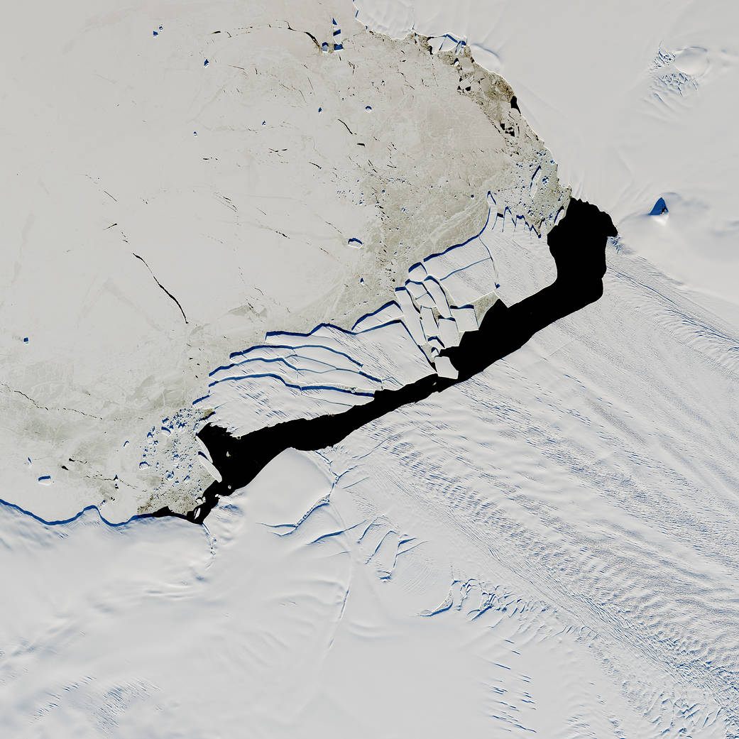
Before this marathon of iceberg calving since 2013, Pine Island only calved one iceberg every six years. This animation made by Lhermitte shows that the calving front, the line where the icebergs break off the ice shelf, has moved drastically landward. “In 2015, the calving event took the front 15 kilometers (9.3 miles) further back then it had ever been before,” notes Larter.
An ice shelf can be like a slow car in traffic, says Lhermitte, because all the cars (or ice) behind it get stuck and have to slow down, too. Once the slow car gets out of the way, the cars behind it can accelerate again. But in the case of a glacier flowing out to sea, moving slowly isn’t necessarily a bad thing.
“The ice shelf additionally slows down the ice movement because it is connected to the ocean floor,” Lhermitte explains. “In 2015, we saw that the ice shelf lost connection with one of these pinning points on the ocean floor.” The ice shelf had been losing contact with this pinning point for years, but it was completely lost after the 2015 calving event. Even though this seems alarming, the observational data need to be looked at as a whole, says Lhermitte: “An individual calving event does not mean anything, but over time we can see the front is receding. I don’t think we have any observational records of the ice front being that far back.”
Why all the sudden breakups? A 2016 study showed that the rifts from where these recent icebergs began to crack were relatively far inland, which is not a great sign, as it means the ice is being warmed by ocean water. In general, glacial ice gets thinner when more of the ice melts during the summer than gets replaced by snowfall in the winter. For decades, Pine Island Glacier has been thinning drastically, at some points up to 16 feet per year, because of warm water that resides deep in the Amundsen Sea near the glacier. This warm, salty water is part of the Circumpolar Deep Water, a water mass that brings heat, salt, and nutrients to the continental shelves of Antarctica. This water mass is flowing along the continental shelf and directly contacting the glacier.
The direct contact between this warm water mass and the glacier doesn’t occur in most places in Antarctica, Larter says, but he notes that something different is happening near Pine Island Glacier. “The warm water is flowing along the deep troughs that have been eroded out of the sea floor by glaciers themselves when the ice sheet used to extend out further,” he says. “It’s no surprise when you put warm water in contact with the base of an ice shelf you get melt.”
The dynamics of the glacier and ice mass loss are complex, Lhermitte says, and it is difficult to expressly attribute any specific event to climate change—but what is happening is exceptional for this area. “There is something going on in this area of Antarctica,” says Lhermitte. “This is the hotspot where Antarctica is losing most of its ice. The question that still remains is: How fast will it go and how much ice will it lose?”


Follow us on Twitter to get the latest on the world's hidden wonders.
Like us on Facebook to get the latest on the world's hidden wonders.
Follow us on Twitter Like us on Facebook