Abandoned Pacific Barrier Radar III
This abandoned radar site is slowly being taken back by the jungle, its mission cut short by the end of the Cold War.
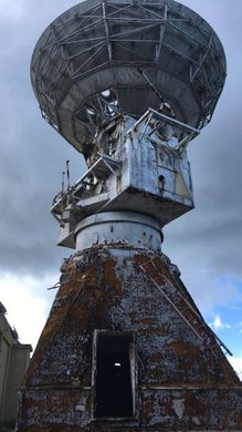
Travel up the lazy slope of Mt. Petosukura on the island of Saipan, and at the top is an abandoned radar tower, a last vestige of Cold War surveillance trying its best to fight back against the encroaching jungle.
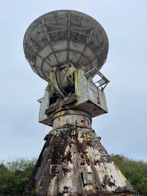
The facility dates to the late 1980s when the Air Force chose some high ground on the Northern Mariana Islands, a U.S. commonwealth in the western Pacific. They repurposed the site with some repurposed equipment, cutting out a patch of dense foliage and replanting it with a 40-foot radar tower. The installation on the island of Saipan was the third of the U.S. military’s Pacific Barrier Radar sites—or PACBAR III—and its mission was to detect and track Soviet satellites and missile launches.
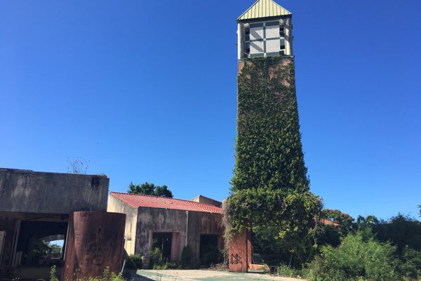
Decommissioned equipment was rescued from the USNS General H.H. Arnold, originally a World War 2 Navy transport ship that had been converted to a floating Air Force radar station. One of its salvaged towers was trudged up the jungle pass, where it was installed alongside some support buildings (and from the looks of old photos, ample parking!). It took two years to complete, and by 1989 it was ready to start doing some detect-o work, intended to provide coverage for a blind spot between two other radar stations—PACBAR I in the Marshall Islands, and PACBAR II in the Philippines.
PACBAR III’s mission was short-lived when the Cold War came to an end in the early 1990s. The military turned out the lights, and the site has since fallen into decay with several of the original buildings already engulfed by the jungle. What remains—the radar tower itself and a few outbuildings—are covered in over twenty years of rust and graffiti.
Know Before You Go
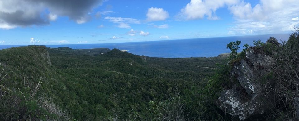
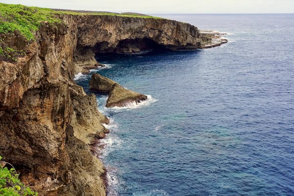
The Northern Mariana Islands are a U.S. commonwealth in the western Pacific, about 125 miles northeast of Guam. Saipan is the largest and northernmost island, and the capital of the commonwealth. To get to the site from Pau Pau Beach on the northwest coast, take Rte. 320 off of Rte. 30. Follow for about 2/3 of a mile and turn right to stay on Middle Road. It will twist and turn, and in about a mile and a quarter, there is a left turn-off, unmarked but paved, that will lead to PACBAR at the end. You’ll first pass a cell tower and newer looking building inside some fencing, but keep going just a little further. There is no gate to pass through or climbing required to get to the site but stay on the paved areas (the fence that once surrounded the facility is now gone). The right side of the road has a noticeable trail that leads to a lookout off a cliff, overlooking the Marpi jungle and the deep blue Pacific Ocean.










Follow us on Twitter to get the latest on the world's hidden wonders.
Like us on Facebook to get the latest on the world's hidden wonders.
Follow us on Twitter Like us on Facebook