Trips Places Foods Stories Newsletters
Loading...
Loading...
Loading...
Loading...

No search results found for
“”

Make sure words are spelled correctly.

Try searching for a travel destination.

Places near me Random place

Popular Destinations

  • Paris
  • London
  • New York
  • Berlin
  • Rome
  • Los Angeles
Trips Places Foods Stories Newsletters
Sign In Join
Places near me Random place
All the United States Nevada Manhattan Belmont

Belmont

The second seat of Nye County, still mostly a ghost town, has become a magnet for those looking to live "away from it all."

Manhattan, Nevada

Added By
slgwv
Email
Been Here
Want to go
Added to list
CAPTION
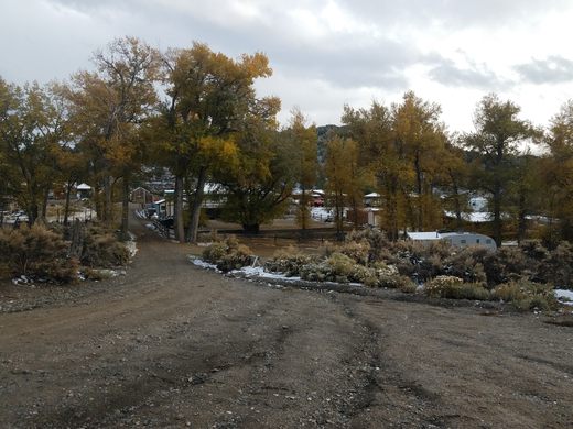
View of Belmont coming in from the south. Note the red brick chimney of the Monitor-Belmont mill to the left.   slgwv / Atlas Obscura User
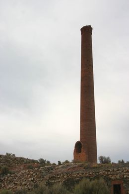
Red brick chimney south of Belmont, all that’s left of the Monitor-Belmont mill.   slgwv / Atlas Obscura User
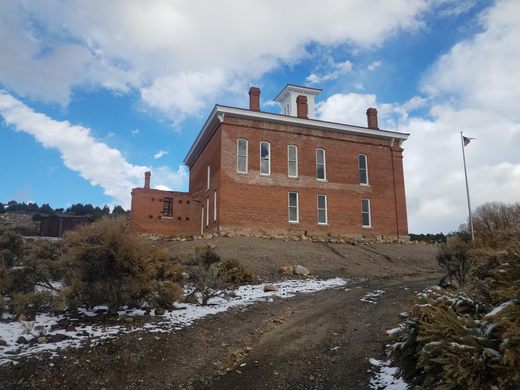
Looking east toward Belmont from near the courthouse.   slgwv / Atlas Obscura User
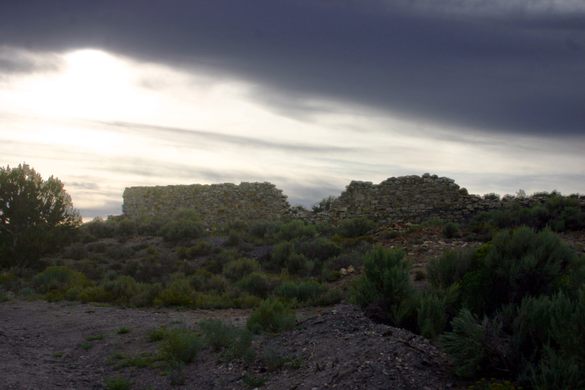
Ruin at north edge of Belmont.   slgwv / Atlas Obscura User
The Consolidated Mill chimney as it appeared in 2009.   slgwv / Atlas Obscura User
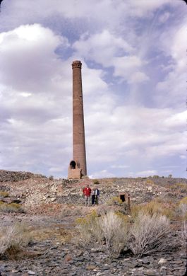
The Consolidated Mill chimney in 1965. Figures give scale.   slgwv / Atlas Obscura User
View of Belmont looking south.   slgwv / Atlas Obscura User
Looking back toward the courthouse (visible beyond the street to the left).   slgwv / Atlas Obscura User
New fire station in Belmont, with contemporary buildings (and some ruins) around.   slgwv / Atlas Obscura User
Belmont main street. The blue flag with the U.S. flag is the Nevada state flag.   slgwv / Atlas Obscura User
Belmont main street.   slgwv / Atlas Obscura User
Ruin near the courthouse.   slgwv / Atlas Obscura User
Back of the Belmont Courthouse, showing the old jail.   slgwv / Atlas Obscura User
Belmont Courthouse with the steel jail that was moved from Gabbs.   slgwv / Atlas Obscura User
Belmont Courthouse from the west, showing the ruins of the old jail.   slgwv / Atlas Obscura User
Old jail on the back of the Belmont Courthouse, from the north.   slgwv / Atlas Obscura User
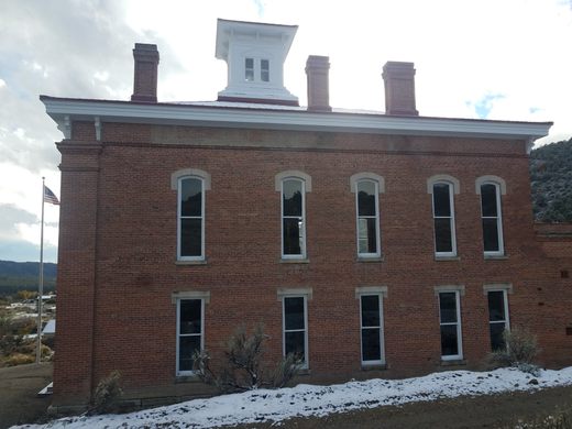
North side of the Belmont Courthouse.   slgwv / Atlas Obscura User
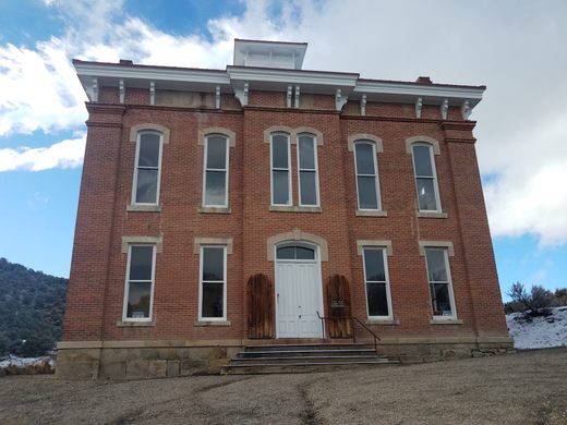
The Belmont Courthouse, seen from the front.   slgwv / Atlas Obscura User
The Belmont Courthouse, seen from the south.   slgwv / Atlas Obscura User
Interpretive sign in context.   slgwv / Atlas Obscura User
Interpretive sign at courthouse, courtesy of E Clampus Vitus.   slgwv / Atlas Obscura User
Ruin south of the courthouse, with new construction beyond.   slgwv / Atlas Obscura User
Looking east along street into courthouse (which is behind the camera).   slgwv / Atlas Obscura User
Been Here
Want to go
Added to list

About

Silver was discovered in this area in late 1865, and Belmont was established soon thereafter. It became the county seat of Nye County in 1867, replacing Ione, and reached a peak population of maybe a few thousand by 1870. The camp had faded by the 1880s, with only 36 voters recorded in 1903. The county seat was moved to Tonopah in 1905, where it remains today.

There were some intermittent revivals thereafter, during World War I in particular, but the post office closed for the second time in 1922.

The town was never completely abandoned, though. In fact, since the late 20th century there has been a mini-boom in new residents for those who really want to get away from it all. This is shown by incongruous new construction scattered among the ruins.

Many ruins remain, however. Coming into town from the south, visitors may notice a lone brick chimney off to the west; this is all that remains of the Monitor-Belmont Mill, built in 1867 and revived briefly during the World War I boom. On the north side of town, an even taller brick smokestack is the surviving remnant of the Combination Mill, built in 1868. The damage to the top of the chimney is said to have come from Air Force pilots using it as a target while training.

The most interesting structure is undoubtedly the Belmont Courthouse, easily the most imposing building left in Belmont. It is prominent a couple of blocks west of the downtown. The courthouse is currently a historic site and there are plans to refurbish it, but at present (2023) it is closed.

Related Tags

History & Culture Ruins Ghost Towns

Know Before You Go

Belmont is accessible on a paved road. Some 5.5 miles east of Tonopah on US-6 turn north onto Nevada State Route 376 and follow it 13 miles to a right turn onto old Nevada 82, the Belmont Road. It is now 26.5 miles to Belmont. The pavement ends at the north end of town.

There are currently (2022) no services in Belmont except a bar. The nearest full services on a paved road are in Tonopah, some 45 miles away (retrace the directions above).

There are also full services in Big Smoky Valley, the next large valley to the west, off Nevada SR-376. They are a bit closer but require traversing a stretch on graded road. Go back south on NV-82 8.2 miles to a signed turn for Manhattan. Turn right here, onto US Forest Service Road 014. It is graded, turning into paved Nevada SR-377 at the city limit of Manhattan. The graded stretch should be passable to ordinary passenger cars in dry weather but is likely to be completely impassible in winter. It is about 7.2 miles from Manhattan to the junction with SR-376; it is 15.5 miles overall from the intersection with Nevada-82.

Now proceed 8.1 miles north on SR-376 to a left turn onto Pablo Canyon Road, proceed 1 mile, then take a shallow right onto Electrum Road. There is an obviously small commercial district about 0.6 miles ahead in the village of Hadley.

Alternatively, instead of turning into Hadley, you can continue another 16 miles on SR-376 to Carvers, where there are service stations right on the main highway.

Belmont and the mills therein should not be confused with the Belmont Mill, which is a different site near Hamilton, Nevada some 85 miles to the northeast.

Community Contributors

Added By

slgwv

Published

January 18, 2023

Edit this listing

Make an Edit
Add Photos
Belmont
1 Main St
Manhattan, Nevada, 89022
United States
38.596749, -116.874962
Visit Website
Get Directions

Nearby Places

Tybo

Nye County, Nevada

miles away

Ophir

Millett, Nevada

miles away

Diana's Punch Bowl

Round Mountain, Nevada

miles away

Explore the Destination Guide

Photo of Nevada

Nevada

United States

Places 265
Stories 24

Nearby Places

Tybo

Nye County, Nevada

miles away

Ophir

Millett, Nevada

miles away

Diana's Punch Bowl

Round Mountain, Nevada

miles away

Explore the Destination Guide

Photo of Nevada

Nevada

United States

Places 265
Stories 24

Related Places

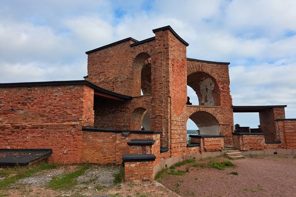
  • Hancock wide shot.

    Nathrop, Colorado

    Hancock Ghost Town

    All that remains of this once-booming mining town are the ruins of a saloon.

  • Wormsloe Historic Site tree canopy.

    Savannah, Georgia

    Wormsloe State Historic Site

    The tabby ruin is Savannah’s oldest surviving structure.

    Sponsored by Visit Savannah
  • Royal Palace of King Maha Parakramabahu.

    Polonnaruwa, Sri Lanka

    Ancient City of Polonnaruwa

    This site was once the religious, cultural, and trade center of Sri Lanka.

  • St Ninian’s Chapel

    Isle of Whithorn, Scotland

    St Ninian’s Chapel

    This medieval pilgrimage site was a key part of the early Christian missionary work in Scotland.

  • Ruins of the church in Dvorine from above.

    Banja, Serbia

    Dvorine

    The remains of a luxurious 14th-century church built by the last despot of Serbia.

  • Dhamnihawa Stupas

    Kapilvastu, Nepal

    Dhamnihawa Stupas

    A pair of stupas that archaeologists believe were built to honor the parents of Siddhartha Gautama (aka Lord Buddha).

  • Birkenhead Priory

    Birkenhead, England

    Birkenhead Priory

    The oldest standing building on Merseyside is special for its rich history as a Benedictine monastery and its unique connection to the origins of the Mersey Ferry.

  • Pentidattilo was named for the hand-shaped rock on which it sits.

    Pentidattilo, Italy

    Pentidattilo

    A ghost town on the slopes of a hand-shaped rock is haunted by the story of a 17th-century murder.

Aerial image of Vietnam, displaying the picturesque rice terraces, characterized by their layered, verdant fields.
Atlas Obscura Membership

Become an Atlas Obscura Member


Join our community of curious explorers.

Become a Member

Get Our Email Newsletter

Follow Us

Facebook YouTube TikTok Instagram Pinterest RSS Feed

Get the app

Download the App
Download on the Apple App Store Get it on Google Play
  • All Places
  • Latest Places
  • Most Popular
  • Places to Eat
  • Random
  • Nearby
  • Add a Place
  • Stories
  • Food & Drink
  • Itineraries
  • Lists
  • Video
  • Podcast
  • Newsletters
  • All Trips
  • Family Trip
  • Food & Drink
  • History & Culture
  • Wildlife & Nature
  • FAQ
  • Membership
  • Feedback & Ideas
  • Community Guidelines
  • Product Blog
  • Unique Gifts
  • Work With Us
  • About
  • FAQ
  • Advertise With Us
  • Advertising Guidelines
  • Privacy Policy
  • Cookie Policy
  • Terms of Use
Atlas Obscura

© 2025 Atlas Obscura. All Rights Reserved.